
Sometimes, a scenic detour isn’t one you make by choice. That was the case in 2013, when a “geological event” caused a section of U.S. Route 89 south of Page to buckle. Until the road was repaired two years later, motorists had to use more circuitous routes to travel to and from Page, Lake Powell and Glen Canyon Dam. One of those was State Route 98 — and, as you’ll see on this drive, the scenery along this 66.3-mile road proves that not everything about a detour is a hardship.
From U.S. 89 just south of Page’s city limits, head east on SR 98, a paved, well-maintained route also known as the Naat’tsis’aan (Navajo Mountain) Scenic Byway. Early on, the road offers excellent views of its namesake peak, which is the highest point (10,329 feet) on the Navajo Nation and one of the tribe’s most sacred landmarks. Closer to the road, on the left, you’ll see Tower Butte and some of the other features in and around Lake Powell.
Next, the road passes turnoffs for Upper Antelope Canyon and the decommissioned Navajo Generating Station before crossing over the tracks for the electrified railroad that once delivered coal to the power plant. Straight ahead is LeChee Rock, a wide, layered sandstone butte that climbs some 900 feet above the surrounding prairie.
Some smaller buttes are visible on the roadside as the route curves to the south and traverses a rolling expanse of high-desert vegetation. Around Mile 25, you’ll reach an area dotted with junipers and start seeing small, textured rock features on both sides of the road. On the left, keep an eye out for Sitting Lizard Rock — which, true to its name, resembles one of the area’s reptiles getting a little sun.
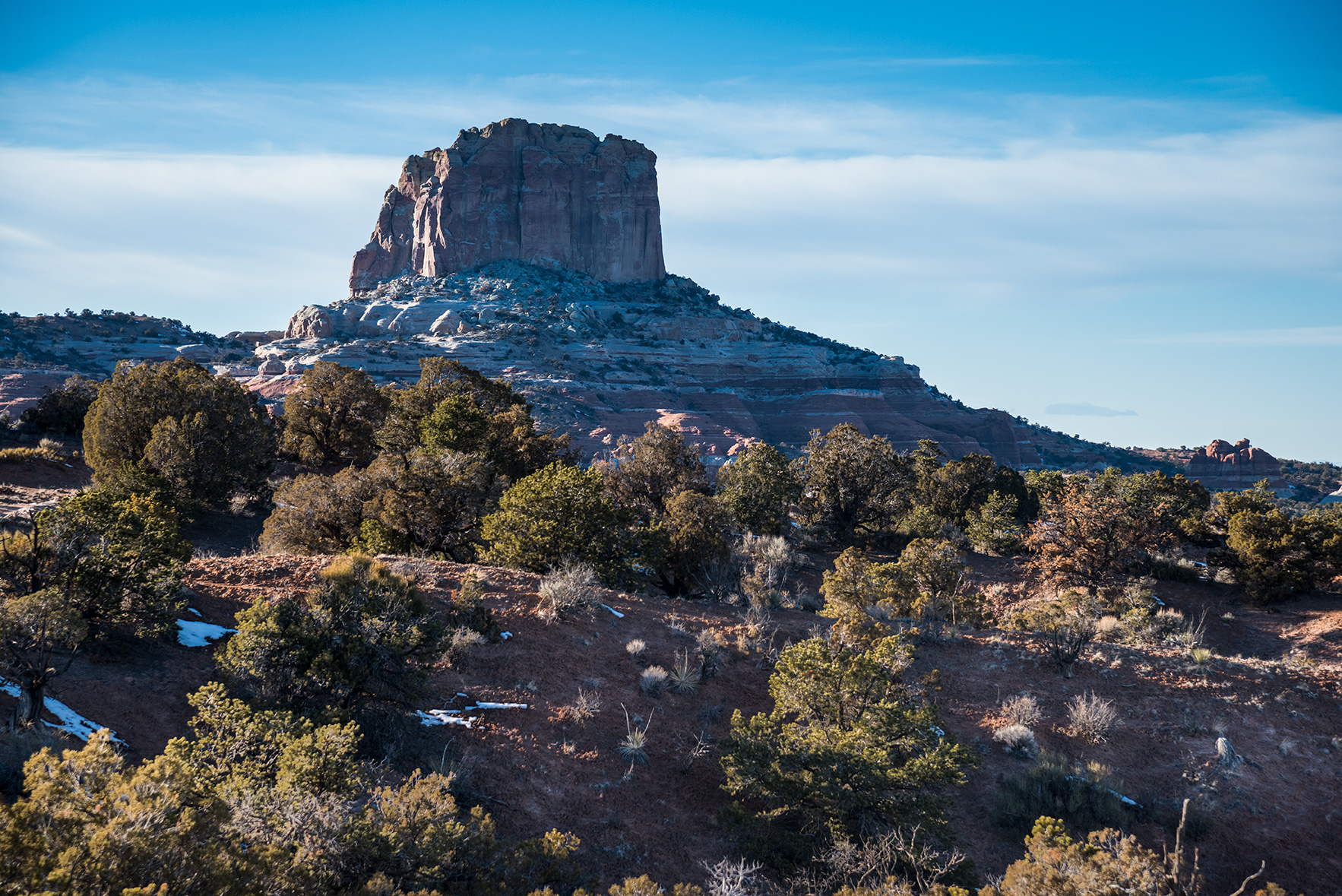
As you crest a hill at Mile 34, you’ll get a nice panorama of White Mesa, a sprawling landform near the small town of Kaibeto. For the next 10 miles, you’ll be treated to views of the buttes that dot the north side of the mesa. The last major one of these, Square Butte, marks the northeast corner of the landform, and you’ll curve around it at Mile 44 and climb into a slightly more forested area. Four miles past the butte, on the left, is a pullout that offers an excellent look at that butte and Navajo Mountain to the distant north.
The road reaches its literal high point (6,687 feet) at Mile 50, then gradually descends past scattered homesteads before turning south for its final stretch. As you pass through the Kletha Valley, you’ll see the northwestern edge of Black Mesa ahead of you; this mesa is known for its coal beds and for its sedimentary strata, geological evidence of a sea that existed there during the Cretaceous period. You’ll get a close look at the mesa before SR 98 reaches its eastern terminus at U.S. Route 160.
From this intersection, turning left will take you to Navajo National Monument and Monument Valley, while going right leads past the Elephant Feet, an often-photographed roadside landmark, en route back to U.S. 89. If you’re headed back to Page, the repaired Echo Cliffs section of that highway is plenty scenic itself. If you aren’t headed that way, it’s worth a detour. Just like a lot of roads around there.
Tour Guide
Note: Mileages are approximate.
Length: 66.3 miles one way (from U.S. Route 89)
Directions: From U.S. Route 89 near Page, go east on State Route 98 for 66.3 miles to U.S. Route 160.
Vehicle requirements: None
Special considerations: A permit is not required to travel the road, but some other Navajo Nation recreation activities, such as hiking and camping, do require a permit. Contact the tribe for more information. Additionally, please respect all Navajo regulations, including COVID-19 measures. At press time, the tribe required all visitors and residents to wear a face mask when in public.
Information: Navajo Nation Parks and Recreation, 928-871-6647 or navajonationparks.org
Travelers in Arizona can visit az511.gov or dial 511 to get information on road closures, construction, delays, weather and more.
Additional Reading:
For more adventure, pick up a copy of our book Arizona Highways Scenic Drives, which features 40 of the state’s most beautiful back roads. To order, visit shoparizonahighways.com/scenicdrives.