
Before there were wilderness areas, there were primitive areas, which, in the words of Aldo Leopold, were defined as “a continuous stretch of country preserved in its natural state ... big enough to absorb a two weeks’ pack trip.” In 1935, Sycamore Canyon was given that protection and designated a primitive area, the state’s first. In 1972, it was designated a wilderness area, and in 1984, it was expanded by 9,000 acres. Today, the Sycamore Canyon Wilderness protects 58,448 acres in and around the canyon, from its forested rim near Williams to its riparian mouth in the Verde Valley.
In all, it winds for more than 20 miles along Sycamore Creek, and at its widest point, it extends 7 miles from rim to rim. In addition to its namesake trees, the wilderness is home to cottonwoods, hackberries, piñon pines, ponderosa pines, black bears, badgers, mountain lions, mule deer and ringtails. There are hiking trails, too, many of which take you into the rugged and remote canyon. The Sycamore Rim Trail, as the name suggests, offers a look from up above.
Unlike its sister trails down below, this one is relatively young. It was proposed in 1975 to protect a unique environment of ponds, streams, cliffs and deep canyons. People liked the idea, and the route was finally cleared and marked in 1979. Since then, the Sycamore Rim Trail has become an easy way to get a good look at Arizona’s second-largest canyon.
From the trailhead, the dirt path crosses a small meadow and enters the forest. The trail, which isn’t identified as such, is a loop. You’ll be going clockwise toward Dow Spring and an old sawmill site. The remains of the mill serve as a reminder that you’re in timber country. Although this particular sawmill ceased operation in 1920, logging continues in the forest. Just beyond the mill, you’ll get some terrific views of the San Francisco Peaks to the northeast. Then, after about 45 minutes, you’ll see the first of many small pools, which are fed, in part, by L.O. Spring.
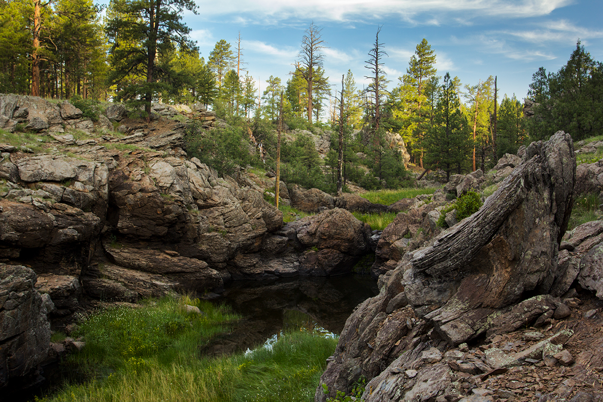
Reminiscent of something you might come across in Maine or Minnesota, the pools are crowded with lily pads and cattails, and surrounded by lush green grass. No doubt these are prime locations for spotting wildlife — mule deer and elk in particular. After about an hour, the trail intersects an old logging road. It’s a little confusing, but you’ll want to stay right and look for a giant cairn. Eventually, the trail goes left and reaches the rim of Sycamore Canyon and the border of the Sycamore Canyon Wilderness. Looking in, you might notice signs of the Rafael Fire, which was caused by lightning and burned nearly 80,000 acres in the summer of 2021.
Technically, the trail never enters the wilderness area, but the views for the next hour or so, about 3 miles in all, are nothing but wilderness. It’s a beautiful canyon, one that grows from a small ditch to a big wow! It gets bigger and better all the way to Vista Point, which is the halfway mark of the trail. The views, as the name suggests, are worth stopping for. From there, it’s back into the woods and on to the normally dry Sycamore Falls. It’s an impressive landmark in any weather, but when it’s flowing, it’s Mother Nature’s moving aria on the joys of being in the backcountry.
From the falls, the trail winds past the Pomeroy Tanks — perennial pools that support a population of small fish and quench the thirst of area ungulates — and arrives at an intersection with the Overland Trail. At the junction, you’ll see a field, at least as big as Lambeau, of jagged volcanic rocks. On the other side, you’ll begin a 500-foot ascent of KA Hill, which sits at an elevation of 7,287 feet.
From the top, the trail winds for another 20 minutes back to the trailhead, but don’t be in a rush to leave. KA Hill is the highest point of the hike, and the 360-degree views from the summit include Garland Prairie and the Mogollon Rim in the distance. And closer in, the unique and beautiful environment that inspired this trail back in the 1970s.
ADDITIONAL READING: If you’re looking to hit the trail this summer, pick up our new Summer Hiking Guide, which features 50 of our favorite trails and is written for hikers of all skill levels. To order a copy, visit shoparizonahighways.com
/summerhikes.
Trail guide
Length: 11-mile loop
Difficulty: Easy
Elevation: 6,721 to 7,287 feet
Trailhead GPS: N 35˚09.623', W 112˚00.034'
Directions: From Flagstaff, go west on Interstate 40 for approximately 25 miles to Garland Prairie Road (Exit 167). Turn left (south) onto Garland Prairie Road, which turns into Forest Road 141, and continue 12 miles to Forest Road 56. Turn right onto FR 56 and continue 1.5 miles to the trailhead parking area, on the left.
Vehicle Requirements: None
Dogs Allowed: Yes (on a leash)
Horses Allowed: Yes
USGS Maps: Bill Williams Mountain, Garland Prairie, Sycamore Point
Information: Williams Ranger District, 928-635-5600 or fs.usda.gov/kaibab