
One thousand, nine hundred and thirteen. That’s how many miles separate Flagstaff, Arizona, and Washington, D.C. With that kind of distance, and all of the other priorities of the resident, few people would have expected Barack Obama to make time for the Arizona Trail. Nevertheless, on March 30, 2009, he signed HR 146, which, among other things, added the 800-mile trail to the exclusive list of National Scenic Trails.
Beyond the prestige, the designation is significant because it provides a new level of protection for the trail. That said, the prestige is nice, too. Prior to the president’s signature, there were only eight National Scenic Trails in the country. Now, the Arizona Trail is among an elite group that includes the Appalachian Trail, the Pacific Crest Trail, the North Country Trail, the Ice Age Trail, the Potomac Heritage Trail, the Natchez Trace Trail, the Florida Trail, the Continental Divide Trail, the New England Trail and the Pacific Northwest Trail.
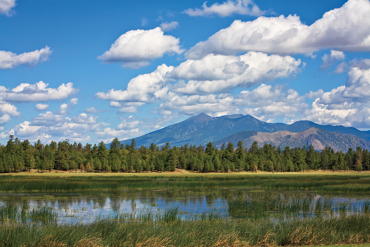
One of the easiest and most accessible sections of the AZT, which runs north and south from Utah to Mexico, is the route from Marshall Lake to Fisher Point, just south of Flagstaff — officially, it’s part of Passage 31. Named for the gentleman who incorporated the first bank in Flagstaff, Marshall Lake is more marsh than lake. Still, it’s a vital wetland that provides habitat for an array of birds, including ospreys and bald eagles. In fact, it’s so important that it’s managed in partnership by Ducks Unlimited and the Arizona Game and Fish Department. Most years, the lake has enough water in it to be stocked with trout by Game and Fish. In dry years, though, the lake might temporarily disappear. Either way, it’s where this hike begins.
From the lake, the easy-to-follow trail (think cow path) cuts across Anderson Mesa, a broad, grassy upland dotted with trees. After about 20 minutes, the trail drops into a ponderosa forest. Although you’ll be surrounded by trees, it’s nothing compared to the Appalachian Trail, which, according to Bill Bryson, is a good thing. As he wrote in A Walk in the Woods, his superb book about hiking that National Scenic Trail: “Woods are not like other spaces. Their trees surround you, loom over you, press in from all sides. Woods choke off views and leave you muddled and without bearings.”
The route from Marshall Lake is nothing like that. It’s more open, which means there’s a good chance you’ll see some wildlife — keep your eyes peeled for elk, mule deer, turkeys and coyotes. Continuing downhill for another 10 or
15 minutes, you’ll come to a small meadow, which gives way to more trees and a brief uphill climb. The trail continues like this for about an hour, after which you’ll come to the ridgeline of Walnut Canyon. Whether you’re ready or not, you’ll want to take a break here. The views of the San Francisco Peaks are spectacular — maybe as good as you’ll get anywhere in Northern Arizona.
Moving on, the trail switchbacks to the bottom of the canyon (the same canyon that’s home to Walnut Canyon National Monument) and passes some beautiful red-rock cliffs reminiscent of Sedona, but with a hint of pink as well. (Technically, they’re petrified Permian Period sand dunes.) Right around there, you’ll also come to an intersection with the Sandys Canyon Trail, which winds back up to the top of Walnut Canyon, a scenic wonder that took Mother Nature 6 million years to make.
From the intersection, continue north and you’ll eventually come to a large open meadow with a couple of trails going in different directions. Follow the signs to Fisher Point. You could turn around here, but the extra 1.1 miles (one way) to the point are worth the effort. From the top, you can see distant horizons and the meadow you crossed below. And like any apex, it’s a perfect place to reflect on the first half of the hike. It’s also a good opportunity to look east and whisper, “Thank you.” After all, if you like hiking, you should be grateful for HR 146.
trail guide
Length: 13.6 miles round-trip
Difficulty: Moderate
Elevation: 7,133 to 7,708 feet
Trailhead GPS: N 35˚06.675', W 111˚32.484'
Directions: From Flagstaff, go southeast on Forest Highway 3 (Lake Mary Road) for 9.5 miles to Forest Road 128. Turn left on FR 128 and continue 1.2 miles to a fork in the road. Turn left at the fork and continue a half-mile to an intersection with an unmarked dirt road. Turn left and continue a quarter-mile to the trailhead.
Vehicle Requirements: None
Dogs Allowed: Yes (on a leash)
Horses Allowed: Yes
USGS Maps: Marshall Lake, Flagstaff East
Information: Flagstaff Ranger District, 928-526-0866 or fs.usda.gov/coconino