
Like so many small-town businessmen in the Wild West, the founding fathers of Prescott figured the road to success was a railroad. The first was the Prescott and Arizona Central, which opened in 1887 and went bankrupt five years later. The next year, in 1893, the Santa Fe, Prescott and Phoenix Railway began a 91-year run as a line colloquially known as “the Peavine” — the name came from its wandering route and many serpentine trestles. The line was discontinued in 1984, but its legacy lives on as the Prescott Peavine National Recreation Trail, one of 2,390 rails-to-trails in the United States.
The hike begins at the Watson Woods Riparian Preserve, which is nourished by Granite Creek and protects 126 acres of creekside vegetation, including some massive Frémont cottonwoods. Arroyo willows and red willows are in there, too. At one time, the riparian area stretched for a thousand acres, but grazing and gravel pits took a toll. Nevertheless, the preserve makes a beautiful starting point for an easy trail that slices through one of the most scenic landscapes in Central Arizona.
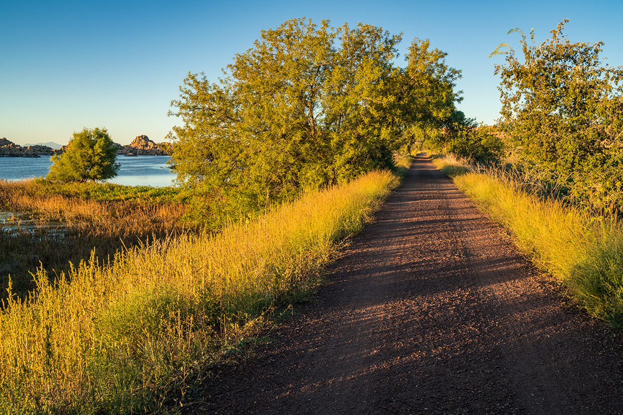
For the first 10 minutes, the wide path parallels the preserve to the west and a police training area to the east. The civilization disappears quickly, though, replaced by a first glimpse of Watson Lake, which was created by the damming of the creek in 1916. “One of the greatest sports for Prescott and its visitors from now on will certainly be boating on Lake Watson,” Yavapai Magazine proclaimed at the time. “The surroundings are incomparably romantic.” The adjacent Willow Lake was created about 20 years later.
In addition to recreation, the lakes provide vital habitat for resident and migrating birds. As a result, the ecosystem is part of Audubon’s Important Bird Area program, a global effort dedicated to the protection of bird habitat. Wood ducks, northern shovelers, killdeer … those are a few of the species that call this place home.
Continuing on, you’ll start seeing some of the giant boulders that are collectively known as the Granite Dells. Geologists estimate the rocks to be about 1.4 billion years old. Those on Granite Mountain, which rises in the distance, are even older. It’s along this stretch that the views of the lake disappear. But the rugged terrain ahead isn’t a consolation. It’s a scene from an old Tom Mix movie. You won’t need the imagination of Peter Pan to envision outlaws on horses galloping alongside a steam locomotive as it powers through gaps in the rock.
The trains are gone, but horses remain. In addition, you’ll almost certainly see mountain bikes. The Peavine is a connecting route for bikers headed to the intersecting storm trails, rugged single tracks with names like Blaster, Black Hole and Yabba Dabba View. The Lakeshore Trail, which runs along the Peavine, is another popular single track — it’s a nice alternative for hikers on their return.
About a half-hour in, the trail begins a slight ascent and arrives at a bridge that crosses Boulder Creek. You can still smell the creosote. To the left is an intersection with the Watson Loop Trail, a short connector that leads to the dam that makes the lake possible. From there, the route passes some private land to
the west, where lucky ducks get to enjoy the Dells from their kitchen windows. The trail then crosses a dirt road and passes a site known as Point of Rocks, a place where a cluster of railroad buildings used to be located.
A few minutes later, the Peavine arrives at P&E Junction. Also known as Entro, the junction is where the Prescott and Eastern Railroad branched off toward Humboldt and Mayer. Today, it’s where the Iron King Trail begins a 4-mile run to Prescott Valley. It’s also the turnaround point for this listing. If you have the time, the Peavine continues for a couple miles to an intersection with State Route 89. A better option, though, is to head back toward the trailhead and explore some of the side routes along the way. The train is gone, but its legacy is something the founding fathers of Prescott could be proud of. Even if it’s nothing they could have imagined.
trail guide
Length: 6 miles round-trip
Difficulty: Easy
Elevation: 5,197 to 5,144 feet
Trailhead GPS: N 34˚34.529', W 112˚25.645'
Directions: From Intestate 17 (Exit 262), go northwest on State Route 69 for 31.8 miles to Prescott Lakes Parkway. Turn right onto Prescott Lakes Parkway and continue 1.8 miles to Sundog Ranch Road. Turn right
onto Sundog Ranch Road and look for the parking lot on the left.
Special Consideration: A $3 parking pass is required.
Vehicle Requirements: None
Dogs Allowed: Yes (on a leash)
Horses Allowed: Yes
USGS Map: Prescott
Information: City of Prescott, 928-777-1552 or prescott-az.gov/recreation; Rails-to-Trails Conservancy, railstotrails.org