
Hiking isn’t usually something that’s done on the spur of the moment. Gear, maps, vehicle requirements, trailhead directions, physical conditioning ... there’s a lot to consider before hitting the trail. The Woods Canyon Lake Loop is one of the very rare exceptions.
Naturally, a little planning is necessary, but for the most part, you could wake up on a Saturday morning, expecting to lounge around watching reruns of This Old House, and then think to yourself: I’ve gotta get off the couch and do something. With about as much effort as it would take to walk around the block, you could head to Woods Canyon Lake. The drive is simple, and the trail is easy, requiring nothing more than a good pair of tennies, some sunscreen and a big bottle of water. That’s about it.
The trail begins at the Spillway Campground. It’s one of the best in Arizona if you can commandeer a site. Adjacent to the campground is a small parking area, which is one option for day hikers, but the space there is limited. A better option is to drive all the way to the lake and park in the lot at the general store — it’s the same lot that serves the boat landing. Parking spaces are limited at this lot, too, but you should be OK, unless it’s a holiday weekend.
From the pavement, head east and follow the signs toward the amphitheater. Beyond the small structure are some random trails — there’s no main trail at the outset — that wind for a few minutes to the campground. Once you get there, veer left toward the lake and look for the Spillway Dam, which is a long, narrow mound of dirt with red rocks on the lake side and green grass on the opposite slope. You’ll know it when you see it.
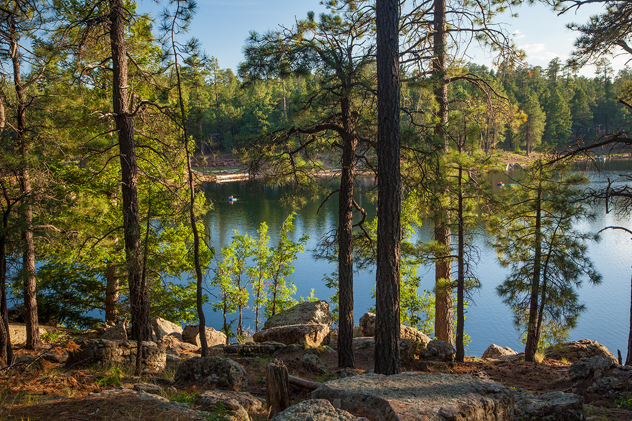
Hop on the dirt path that crosses the dam, say hello to the many fishermen and women who will be angling from the rocks, and head for the woods, which is home to ponderosa pines, Douglas-firs, Gambel oaks, bracken ferns, wild roses and this spectacular trail, which is one of the easiest and best on the Mogollon Rim.
Within minutes of entering the forest, you’ll start seeing plastic blue diamonds tacked to the trees. Although it’s virtually impossible to get lost on this trail, which parallels the shoreline for its entire length, the markers come in handy for those hikers who are directionally challenged and need some reassurance.
In addition to the blue diamonds, the forest brings an unexpected measure of solitude. Woods Canyon Lake was built for recreation, and it can feel congested at times, but the noise disappears quickly beyond the dam, and after about 10 minutes, you’ll come to a short side trail that leads to the water. Just beyond that junction is a tall ponderosa that’s used as a nesting site by great blue herons — look for heron chicks in June.
The trail continues in a counterclockwise direction with some gentle ups and downs, but the most you’ll ever climb at a time is the equivalent of three flights of stairs. This is an easy trail that conjures up images of Walden Pond. It’s not as serene as what Thoreau would have experienced, but by modern standards, it’s pretty peaceful.
About 45 minutes into the hike, the trail winds to the end of a slough where you’ll see a small creek that feeds the lake. The area around the creek is green, grassy and gorgeous, and it might be the most beautiful place on the trail.
From there, the trail climbs a series of railroad ties toward a bald eagle protection zone. Because eagles like to nest along this shoreline, the trail is detoured around the area from March 1 through August 31. The alternate route is equally scenic, and as you make your way uphill, look up in the sky — in the summer, there’s a good chance of seeing the national bird.
The rest of the route continues around the lake, past the Rocky Point Trailhead and back to the boat landing. It’s not a long hike, and you won’t have worked up much of a sweat, but you’ll be glad you rolled off the couch. Nothing against This Old House, but the scenery at Woods Canyon Lake is much more interesting than watching somebody install a floor joist. See for yourself.
trail guide
Length: 5 miles round-trip
Difficulty: Easy
Elevation: 7,500 to 7,534 feet
Trailhead GPS: N 34˚20.001', W 110˚56.646'
Directions: From Payson, go east on State Route 260 past Kohls Ranch to Forest Road 300, where the road tops out on the Mogollon Rim. Turn left onto FR 300 and continue 5 miles to Woods Canyon Lake. Park in the lot adjacent to the boat landing.
Vehicle Requirements: None
Dogs Allowed: Yes (on a leash)
Horses Allowed: Yes
USGS Map: Woods Canyon
Information: Black Mesa Ranger District, 928-535-7300 or fs.usda.gov/asnf