
There are two ways to hike this trail. You can start at the bottom and work your way up, or you can do it the other way around — there are two-wheel-drive trailheads on both ends. Whichever route you choose, at some point, you’ll have to climb more than 1,700 feet up the face of the Mogollon Rim. It just depends on whether you want to tackle the ascent somewhere in the middle of the march, or postpone it until the end. This description is written for those who would rather not procrastinate.
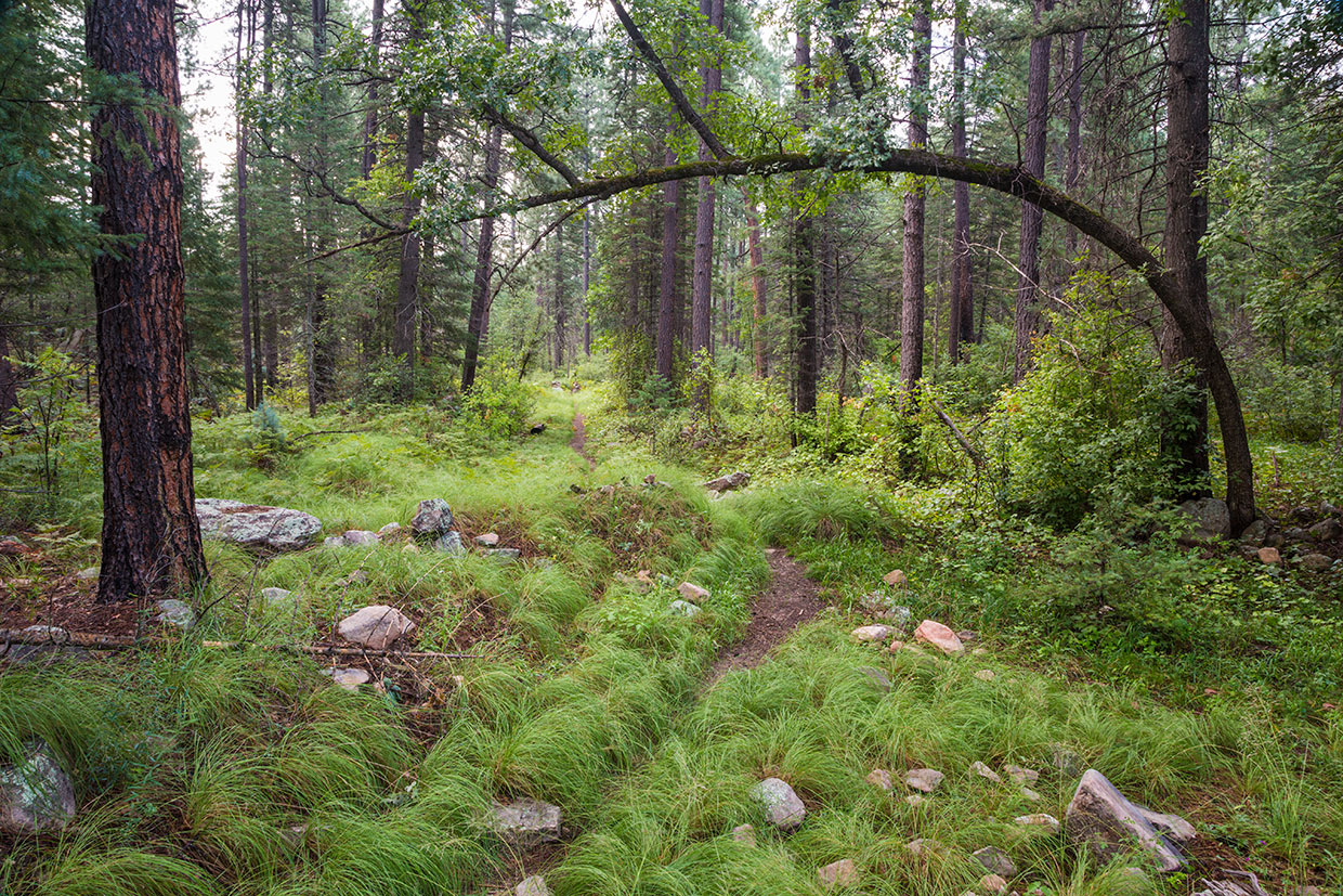
From the lower trailhead near Christopher Creek (the village), the trail quickly crosses Christopher Creek (the waterway) and heads into the woods. The path at the outset is rocky dirt surrounded by lush grasses, ferns and a lot of undergrowth. The trees you’ll see are mostly ponderosas. Big, old yellow bellies. Within a few minutes, before you’ve even had your first handful of trail mix, you’ll arrive at a small meadow and a large alligator juniper. Ten minutes later, the trail intersects a short spur that leads to See Spring, the source of life for so much of what makes this trail great. Veer left and enjoy the surroundings.
Once you make the turn, the trail dips into a small wash. If you’re used to the drier ponderosa pine forests around Flagstaff, this stretch will seem like a rainforest, especially in the spring and during the summer monsoon. With the moisture comes a wave of deciduous trees — maples, among others — and another leap over the creek. To the right, you’ll see signs of the Promontory Fire, which was started by a careless human being on May 13, 2007, and eventually burned more than 4,000 acres. Unlike parts of the White Mountains, where new trees shoot up quickly after a fire, the transition here is slower. That said, the charred remains are minimal compared to what you’ll see up the road, where the Rodeo-Chediski Fire burned 462,600 acres in 2002.
Back in See Canyon, the climb continues. To this point, the uphill has been gradual. The real work is still ahead. In the meantime, you’ll cross the creek again, pass a wonderful campsite and stand in awe of an enormous ponderosa. It’s dead — it’s been dead awhile — but with a circumference of at least 15 feet, it’s still impressive and noteworthy.
Moving on, you’ll start seeing more maples and ponderosas, gnarly oaks and a handful of aspens. Mint, ferns and grasses grow along the creek. It’s a beautiful hike, and the best views show up about 45 minutes in. For a few hundred yards, the trail skirts the southern ridge of the canyon, and then it drops down. Beware of flash floods at the bottom, especially in July and August.
If the weather’s clear, cross the wash and start scrambling up the opposite bank. This heading marks the beginning of the primary ascent. After 10 minutes of huffing and puffing, you’ll scramble over a field of boulders, and 15 minutes after that, you’ll switchback through a steep area with loose rocks — it’s even trickier on the return. Another creek crossing and another series of switchbacks will get your attention as you approach the final stretch. Although it’s the toughest part of the hike, the last 15 to 20 minutes go by quickly, despite a few “false summits,” including a broad plateau that’s sure to fool you.
The actual summit is just beyond that last impostor. You’ll know you’re there when you see the upper trailhead. It’s clearly marked, but it’s nondescript. Because the apex of the trail is located along Forest Road 300 in the middle of the Apache-Sitgreaves National Forests, it doesn’t take your breath away. Not like Humphreys Peak or other mountaintops. Still, it’s idyllic. When describing the area in the late 1800s, U.S. Army Captain George M. Wheeler wrote: “Mountain, forest, valley and streams are blended in one harmonious whole. Few worldwide travelers in a lifetime could be treated to a more perfect landscape, a true virgin solitude, undefined by the presence of man.”
Enjoy the harmony, and be grateful that the hard part of the hike is behind you. It’s all downhill from there.
trail guide
Length: 7 miles round-trip
Difficulty: Moderate
Elevation: 6,183 to 7,856 feet
Trailhead GPS: N 34˚20.170', W 111˚00.842'
Directions: From Payson, go east on State Route 260 for 20.2 miles to the Christopher Creek Loop exit. Turn left onto the loop and continue 1 mile to Forest Road 284. Turn left onto FR 284 and continue 1.5 miles to the trailhead.
Vehicle Requirements: None
Dogs Allowed: Yes (on a leash)
Horses Allowed: Yes
USGS Map: Promontory Butte
Information: Black Mesa Ranger District, 928-535-7300 or fs.usda.gov/asnf