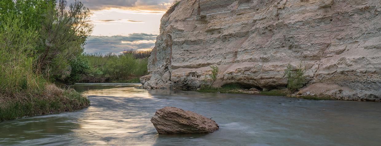
Like the White Cliffs of Dover, the white cliffs of the Verde Valley are rooted in a history that goes back millions of years. Our local cliffs, which are modest compared to those in England, contain the fossilized remains — and in some places the ancient footprints — of primitive horses, turtles, camels, saber-toothed tigers, mammoths and stegomastodons.
Today, the cliffs are a milky backdrop for the Verde River, which was designated a National Wild and Scenic River in 1984. Forty years later, a small section of vital land surrounding that beautiful river was opened up as Arizona’s newest state park.
Located at the southern end of the Verde River Greenway State Natural Area, near the confluence of West Clear Creek and the Verde River, Rockin’ River Ranch State Park comprises 209 acres that range from a high-desert grassland to a mature mesquite bosque to a lush riparian area along the water. Although it’s still in development, the infant park features six trails that offer a thorough introduction to the area. They’re all short and easy. The longest is the White Cliffs Trail, a 1.7-mile loop that leads straight to the river.
Like all loops, the White Cliffs Trail can be done in either direction. To hike it clockwise, head east from the spacious parking lot and cross the narrow park road. Within a few minutes, you’ll arrive at the high end of the riverbank, where a massive Frémont cottonwood and an equally impressive Arizona sycamore form an entryway into one of the state’s most pronounced riparian areas — it will be even more alluring in November, when the leaves slip into their autumn hues.
Because this hike is more of a nature walk than a notch-in-your-belt adventure, it’s accessible to almost everyone. And in that spirit, the loop is dotted with several park benches that allow for contemplation and appreciation. The first is at the riverbank. From there, the trail drops down to the water, where the sound of the birds and the rushing water is an antidote to whatever the stress of the day might be. In addition to the cottonwoods and sycamores, the vegetation on the shoreline includes Arizona ash trees, cattails and Goodding’s willows. You might see otters and beavers down there as well.
After a few minutes, the trail veers away from the river and climbs slightly to a point where you’ll get your first good look at the white cliffs through a gathering of giant cottonwoods. The trail then heads back to the river and under the canopy of trees. There you’ll see the scattered remains of the old ranch that for many years occupied the site. At one point, the property was operated as a guest ranch, with horseback riding and boarding facilities. In 2008, The Nature Conservancy purchased the ranch and subsequently sold it to Arizona State Parks.
The ranchers, of course, weren’t the first to live there. Around A.D. 650, the Southern Sinagua people entered the region. Like other prehistoric settlers in the Southwest, they used the natural resources around them for sustenance and trade. For shelter, they built what are known as pit houses, which used the earth’s natural insulation for coolness in the summer and warmth in the winter — a good example of a pit house can be seen at Montezuma Well, about 20 miles to the north.
Continuing the loop, you’ll come to an intersection with the Miano Trail, a short route that veers right and leads back to the park road. Keep left to stay on the White Cliffs Trail, which parallels the river for another 10 minutes before it shifts away from the water and comes to another intersection — this time with the Buckaroo Trail, a half-mile hike that cuts through the heart of the park’s beautiful mesquite bosque. Canotia trees and catclaw acacias also dot the landscape.
From there, the loop hits the homestretch and follows a fencerow that separates the park from private land. You’ll see horses and greenhouses beyond the barrier. In the park, keep your eyes peeled for gray foxes, coyotes, jackrabbits, cottontails, javelinas and Coues white-tailed deer. There are rattlesnakes, too, which can be dangerous. But nothing like a saber-toothed tiger.
Trail guide
Length: 1.7-mile loop
Difficulty: Easy
Elevation: 3,007 to 2,989 feet
Trailhead GPS: N 34˚29.972', W 111˚49.335'
Directions: From Interstate 17 in Camp Verde (Exit 287), go east on State Route 260 for 1.6 miles to Oasis Road. Turn right onto Oasis Road and continue 0.4 miles to South Salt Mine Road. Turn right onto South Salt Mine Road and continue 4.9 miles to Rockin’ River Ranch Road. Turn left onto Rockin’ River Ranch Road and continue 1 mile (past the entrance station for Rockin’ River Ranch State Park) to the trailhead parking area, on the right.
Special Considerations: The park is open from 9 a.m. to 5 p.m. Fridays through Sundays, except Christmas Day, when applicable. Arizona State Parks and Trails fees ($7 per vehicle) apply.
Vehicle Requirements: None
Dogs Allowed: Yes (on a leash)
Horses Allowed: Yes
USGS Map: Camp Verde
Information: Rockin’ River Ranch State Park, 928-284-7912 or azstateparks.com/rockin-river

