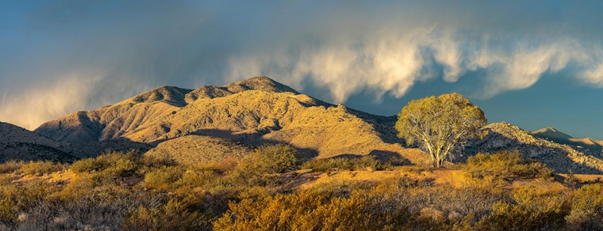
Dos Cabezas and Chiricahua Mountains, Bowie
There’s no shortage of history at Apache Pass, the route between the Chiricahua and Dos Cabezas mountains of Southeastern Arizona. A freshwater spring — one of the only reliable water sources in the area — made the pass a gathering place for Indigenous people, sparked a battle during the Civil War and led to the creation of a U.S. Army fort. History is the centerpiece of this easy 21-mile drive that traverses the pass, but just as alluring are the dramatic views and opportunities to explore two of the state’s less-visited mountain ranges.
From Bowie, a tiny town along Interstate 10, head southeast on Apache Pass Road, which is paved for its first 12 miles but suitable for passenger cars beyond that. You’ll pass through a residential area and under the interstate, then drive past several pistachio groves. Straight ahead are the Chiricahuas, best known for the rhyolite hoodoos of Chiricahua National Monument farther south. To the right are the Dos Cabezas (“two heads”) — named for their prominent twin peaks, which were made famous by a Rex Allen Jr. song.
To get a closer look at the latter range, turn right at Mile 4.5, onto Happy Camp Canyon Road, and take this washboarded dirt road 4 miles to Indian Bread Rocks Recreation Area. This site, like the wilderness area it abuts, is maintained by the Bureau of Land Management, and it offers campsites, picnic tables and hiking opportunities amid the striking granite outcroppings at the base of the Dos Cabezas’ steep northern slopes.
Back on Apache Pass Road, continue southeast through a flat landscape of yuccas and scrub vegetation. The road soon turns due south, offering a view of broad, imposing Bowie Mountain (6,883 feet) and, to its right, Helens Dome (6,365 feet). As you begin to climb into the mountains, the pavement ends and a landscape of ocotillos and prickly pear cactuses takes over. Then, at Mile 13, you’ll reach the trailhead for Fort Bowie National Historic Site.
Established in 1862 after the Battle of Apache Pass, in which Union soldiers were ambushed by Chiricahua Apaches led by Cochise, Fort Bowie — named for Colonel George Washington Bowie — served as a key Army outpost until it was abandoned in 1894. An easy 1.5-mile hiking trail leads from the road to the eroding stone and adobe walls of Fort Bowie’s buildings, passing the Apache Pass Stage Station (a stop on the Butterfield Overland Mail route), the fort’s cemetery, Apache Spring and other historic sites along the way. If you can spare a few hours and a few hundred calories, this National Park Service site is a must-visit. If you can’t, at least check out the overlook a half-mile past the trailhead parking area.
As you continue, you’ll pass numerous stately agaves and sotols before beginning your descent out of the mountains. Once the road curves back to the south at Mile 16, you’ll get an excellent view of the Chiricahuas to the southeast and the Swisshelm Mountains, named for a prospector who explored the range in the 1800s, straight ahead. Finally, Apache Pass Road, now a wide dirt path, turns to the west just before it ends at State Route 186.
For a bit more natural wonder, head southeast from here to explore the hoodoos of the Chiricahuas; for a little more history, go northwest to the old mining town of Dos Cabezas, then on to Willcox and I-10.
Note: Mileages are approximate.
Length: 21 miles one way (from Bowie)
Directions: From Willcox, go east on Interstate 10 for 23 miles to Bowie (Exit 362). Merge onto the I-10 business loop and continue 1.5 miles to Apache Pass Road. Turn right onto Apache Pass Road and continue 21 miles to State Route 186.
Vehicle requirements: None in good weather.
Warning: Back-road travel can be hazardous, so be aware of weather and road conditions. Carry plenty of water. Don’t travel alone, and let someone know where you are going and when you plan to return.
Information: Fort Bowie National Historic Site, 520-847-2500 or nps.gov/fobo; Safford Field Office, 928-348-4400 or blm.gov/arizona

