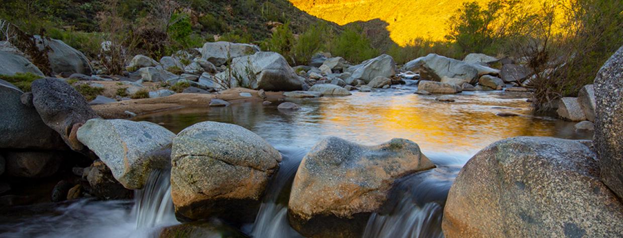
There are a couple of things you should know about the Badger Springs Trail. 1) Badgers aren’t among the mammals you’re likely to see — your chances of seeing the trail’s namesake are about as good as they are at our world headquarters. 2) Agua Fria, which is Spanish for “cold water,” is the name of the river you’ll be following, but the river is usually just a riverbed, and it’s almost never cold. Here’s another thing: If you’re a little squeamish about rattlesnakes, you might want to sit this one out — the desert sun stirs up Mohave greens and other rattlers as early as February. (Note to reader: This is our January issue, so it’s not too early to start keeping an eye out.)
Disclaimers notwithstanding, the Badger Springs Trail is a great way to explore the Sonoran Desert, especially in the spring. Archaeology, ecology, history, spectacular scenery, and peace and quiet are the selling points of this hike, which winds through the heart of Agua Fria National Monument, a 71,000-acre parcel of high-mesa grassland 40 miles north of downtown Phoenix.
Unlike other federal parklands, this one offers some solitude — if the South Rim of the Grand Canyon is Grand Central, Agua Fria is a bus stop on a deserted stretch of Historic Route 66.
Indeed, very few people have ever been to the monument. Millions, however, drive by it every year. The trailhead, which is within shouting distance of the Sunset Point Rest Area, is located just off of Interstate 17 at the Badger Springs Road exit. From the freeway, it’s a short drive — less than a mile — down a forest road to the trailhead. That brings up another thing. The Badger Springs Trail isn’t really a trail. It’s more of a route. From the “trailhead,” you’ll follow a traditional path for a few hundred yards down Badger Springs Wash, which leads to the river. After that, the trail is whatever route you choose to take along the Agua Fria.
In the winter and spring, the river will be more substantial. Other times, it’ll be nothing but a series of pools. Either way, what you’ll quickly realize is that this hike is slow-going. That’s because you’ll be bushwhacking through a combination of soft sand (imagine walking on the beach) and an endless stream of boulders, ranging in size from large pumpkins to Volkswagen Beetles. There’s a lot of up and down and around and around on this hike, which makes it hard to gauge distance. Although the river runs for several miles to Black Canyon City, it’s best to hike for an hour or two, then retrace your steps.
Along the way, you’ll experience one of Arizona’s many beautiful riparian corridors. This one is home to cottonwoods, sycamores, willows, coyotes, bobcats, pronghorns, native fish and 177 bird species. The list goes on, but the monument wasn’t established because of Mother Nature. It was created to protect more than 400 archaeological sites. From A.D. 1250 to 1450, people known as the Perry Mesa Tradition inhabited this Precambrian canyon, and they left behind one of the most significant systems of prehistoric sites in the Southwest.
As you make your way downstream, keep your eyes peeled for their cliff dwellings and petroglyphs, as well as the old pipeline left over from the Richinbar Mine — interestingly, the rusted steel feels more like a museum piece than an eyesore. Of course, more than anything, you’ll want to keep your eyes peeled for snakes. It’s that time of year.
Length: Varies, depending on how far downstream you go.
Difficulty: Moderate
Elevation: 3,133 (along the river) to 4,600 feet (in the monument’s northern hills)
Trailhead GPS: N 34˚13.878', W 112˚05.878'
Directions: From Phoenix, go north on Interstate 17 for approximately 40 miles to Badger Springs Road (Exit 256). Turn right onto Badger Springs Road, cross the gravel parking lot and continue 0.8 miles to the trailhead.
Vehicle Requirements: None
Dogs Allowed: Yes (on a leash)
Horses Allowed: Yes
USGS Map: Joe’s Hill
Information: Aqua Fria National Monument, 623-580-5500 or blm.gov/arizona

