Pusch Ridge Wilderness, Tucson
When you’re hiking out of Pima Canyon, the hikers hiking in tend to ask the same question: “Did you see any sheep?” The large herbivores are a payoff in a place that doesn’t really need one — Pima Canyon, like Sabino Canyon, is a lush desert portal into the alluring Santa Catalina Mountains. If you do see a sheep, consider yourself lucky. But don’t expect to. As Charles Bowden used to say, desert bighorns are like phantoms. “Animals that can survive intense heat in places of little water, move through hard country, stare out with eyes of massive power, weigh up to 225 pounds and yet remain all but invisible to the rest of us.” Nevertheless, they’re out there, and this popular hike is one of the few ways to catch a glimpse.
The trek begins at the Iris Dewhirst Pima Canyon Trailhead on the northern edge of Tucson, where suburban adobes press against the Catalinas’ front range. From the small parking lot, the route immediately passes under a bridge and into a parklike setting of Sonoran Desert. The first 1,700 feet of the trail are on a sliver of public land sandwiched between private homes. It then crosses into the Pusch Ridge Wilderness, which was designated in 1978 and protects nearly 60,000 acres of rugged backcountry. Because of the bighorns, dogs are not allowed on this trail.
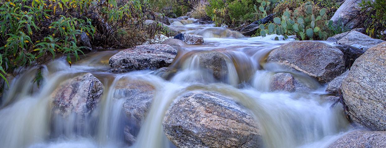
About 10 minutes into the wilderness, the route veers north and the homes fade away. For a while, though, the Old Pueblo can be seen in the distance to the south. But even that view quickly disappears as the trail ascends a “V”-shaped incision into the south face of Pusch Ridge. The track, which is easy to follow along this stretch, dips in and out of a craggy wash. Like most desert washes, Pima Creek is usually dry. But not always. Be smart, especially during the rainy season.
Whether or not there’s running water, you will start to see thickets of riparian vegetation, including an old cottonwood that marks the transition from one ecosystem to another. An even bigger cottonwood, a few hundred feet farther on, shows off the possibilities of a healthy riparian area. Mixed in with the big trees are some impressive saguaros, along with a grove of beautiful ocotillos and some gnarly oaks. What’s more, this lovely stretch of riparian habitat is framed on either side by towering cliffs — Rosewood Point is to the south.
Continuing up, the trail bounces back and forth from the north bank to the south bank of Pima Creek. After 90 minutes of overall hiking, it arrives at a platform of flat rock, which is dotted with what appear to be ancient metates — stone “bowls” used for grinding corn. Just beyond the indentations is an unmarked spur that leads to a landmark known as the “first dam,” which was built in the 1960s by the Arizona Game and Fish Department. Its purpose was to provide a water source for bighorn sheep, javelinas and other wildlife. But unless you’re looking for it, you won’t find it. The dam is set against the rock wall on the north side and is naturally camouflaged by tall reeds and clumps of grass. Poke around, though. The old stone structure is a relic worth seeing. It also makes a good turnaround point if you’re looking for a moderate day hike.
However, if you have the time, the Pima Canyon Trail continues for another 5.5 miles to an intersection with the Finger Rock Trail. You’ll need a good set of lungs to get there. And a good sense of direction. From the dam, the trail gets increasingly difficult to follow — and much steeper — as it ascends to the upper slopes of Mount Kimball. The reward is a panorama that includes Window Rock and Cathedral Rock. Better yet, if you happen to be in the right place at the right time, you might even catch a glimpse of a desert bighorn sheep. The sure-footed phantoms are out there. Somewhere.
Length: 6 miles round-trip (to the “first dam”)
Difficulty: Moderate
Elevation: 2,916 to 3,931 feet (at the “first dam”)
Trailhead GPS: N 32˚21.202', W 110˚56.881'
Directions: From Interstate 10 north of Tucson, go east on Cortaro Farms Road, which becomes Magee Road, for 8.8 miles to the trailhead on the right.
Vehicle Requirements: None
Dogs Allowed: No
Horses Allowed: Not suitable for horses.
USGS Maps: Tucson North, Oro Valley
Information: Santa Catalina Ranger District, 520-749-8700 or fs.usda.gov/coronado

