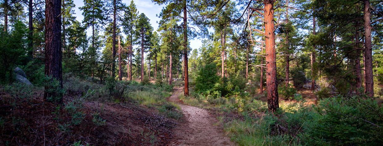
Prescott National Forest, Prescott
At first glance, it doesn’t make any sense: Why aren’t there more people out here? It’s only 15 minutes from Whiskey Row. But if you look at a map, you’ll see that it’s not about disinterest. It’s about gluttony — there’s an embarrassment of riches on the Prescott National Forest, especially in the Groom Creek area. On the long list are several campgrounds, the Spruce Mountain Picnic Site, the Groom Creek bouldering area, a group picnic site at the historic Groom Creek Schoolhouse (built in 1902), a horse camp and more than 15 established hiking trails. It’s no wonder the Wolf Creek Loop gets lost in the mix. But consider that a dollop of gravy. The lack of foot traffic only makes this beautiful trail more enjoyable.
The hike begins at a primitive forest road that’s easy to get to. There’s not a formal trailhead, but the route (Trail 384) is well marked at the small parking area. Like all loops, this one can be done in either direction. Heading clockwise, the trail immediately crosses the dirt road you’ll have come in on and dips down to the Wolf Creek drainage. It’s unlikely you’ll see any water, but you will see some old, half-exposed water pipes. And the first of so many trees — most of the forest is made up of ponderosa pines, woodland oaks, alligator junipers, piñon pines and Arizona walnuts.
As you climb out of the drainage on a wide track of rock and sand, you’ll catch a glimpse of the South Spruce Ridge. Boulders dot the surrounding landscape, as they do most everywhere on the Prescott National Forest. Then, about 10 minutes in, the manzanitas show up and the oaks start to congregate. Even in early November, there’s a good chance the hardwoods along this route will be displaying some autumn color. And the forest will definitely smell like fall — that ironic redolence of decomposition. Perhaps the most impressive oak is off to the right as you hit the half-hour mark.
Continuing south, the trail crosses a forest road that leads to Lower Wolf Creek Campground, which was built by the Civilian Conservation Corps in the late 1930s. About a half-mile later, the trail veers right and begins a gradual ascent to an intersection with Forest Road 74. This is the closest you’ll come to the Hassayampa River, which begins at a spring at the base of nearby Mount Davis and runs for nearly 100 miles to its confluence with the Gila River west of Phoenix. Much of the river flows underground, but pools of water can often be seen in this area, along with lush, ever-present riparian vegetation. All of which is set against a backdrop of Mount Tritle to the south and Maverick Mountain to the southwest. Make the short detour on the forest road. It’s beautiful down by the river.
Back on the trail, the route overlaps FR 74 for about 20 minutes before veering off to the left. As you make your way along this stretch — and along the loop as a whole — keep your ears peeled for dirt bikes and other OHVs. Many of the trails in the Groom Creek Area are multipurpose. That includes horses, too.
After the split, the trail eventually winds onto a south-facing slope, where the tall trees take a brief hiatus, before arriving at Wolf Creek Road, a mile or so west of where you parked. For a hike that’s extremely well marked, there’s no marker at this important intersection. However, if you go left on the dirt road for about 25 yards, you’ll see a sign on the right that points the way.
From there, the trail climbs back into the woods and passes an intersection with an unmarked forest road. Keep right toward the barbed-wire fence and continue on to yet another forest road — FR 9406L. Turn right to complete the loop. Like the rest of the route, you probably won’t see anybody on the homestretch. But the solitude only makes it more enjoyable. It’s that dollop of gravy, which tastes even better in November.
Length: 5 miles round-trip
Difficulty: Easy
Elevation: 6,203 feet to 5,666 feet
Trailhead GPS: N 34˚27.328', W 112˚26.988'
Directions: From downtown Prescott, go south on Mount Vernon Avenue, which becomes the Senator Highway, for 7 miles to where the pavement ends. At that point, turn right onto the unmarked dirt road (County Road 101/Wolf Creek Road) and continue 0.4 miles to Forest Road 707. Turn right onto FR 707 and park in the open space immediately to the left. If the limited space is full, there are additional parking options ahead on FR 707.
Vehicle Requirements: None
Dogs Allowed: Yes
Horses Allowed: Yes
USGS Map: Groom Creek
Information: Bradshaw Ranger District, 928-443-8000 or fs.usda.gov/prescott

