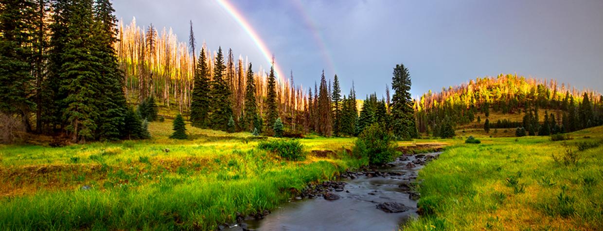
White Mountains, Apache-Sitgreaves National Forests
In most cases, the combination of black and white makes gray. In Eastern Arizona, it’s different. When you combine the Black River with the White Mountains, you get green. So many shades of green. And when football weather rolls around, you’ll see some gold in the palette as well. Green and gold. Like the Packers, but the tickets are easier to come by. And they’re free. All you have to do is hit the road, which is a National Scenic Byway, park the car and lace up your boots.
The route begins at a small trailhead that can squeeze in five or six vehicles. The river is in plain sight. The trail is not. To get to it, you’ll have to walk about a hundred yards to the west, and then drop down the bank on the south side of the dirt road. The rest of the route, which begins as a two-track, is easy to follow. And if you do lose sight, just find your way back to the water — the Thompson Trail parallels the Black River all the way to the end.
From the outset, you’ll see signs of the Wallow Fire, which burned 538,049 acres in the White Mountains in 2011. Some of those acres were on the sleep slopes that bracket the river. But looking up is not like looking at old black-and-whites of London after the Blitz. The worst of the scarring is obscured by a carpet of thick grasses and clusters of young aspens — adolescents intent on taking over the natural world.
About 10 minutes in, you’ll come to the upper end of an “Apache Trout Fish Barrier.” The man-made blockade functions as a waterfall, preventing non-native fish from moving into the Apache trout’s habitat. The fish is one of only two trout species that are native to Arizona — the other is the Gila trout. Both are listed as threatened under the Endangered Species Act, and barriers such as these have helped restore the 10-inch-long fish to its historical habitat. For obvious reasons, this portion of the Black River is closed to fishing.
Just beyond the barrier you’ll see a gate, but the trail veers left before you get to it. At this point, the two-track pares down to a single track and nudges up against the river. Five hundred yards later, you’ll come to the lower end of the enclosure, which is marked by an impressive waterfall. It, too, is man-made. Still, it makes for a great photo. However, if you’re a purist, and limit your exposures to Mother Nature, there’s plenty to choose from as the trail moves from a grove of evergreens into one of the White Mountains’ many cienegas.
“Cienega” is a Spanish word that means “wet, marshy area.” In any language, these meadows are great places to see elk and mule deer, especially around dawn or dusk. Other wildlife in the area include black bears, coyotes, turkeys, mountain lions and Mexican gray wolves. Keep your eyes peeled. At the same time, watch your step in the cienegas. Sometimes, what appears to be solid ground is in fact a boggy pothole. Expect to get muddy.
After a half-hour of hiking, the trail moves back into the woods — an alpine forest of white pines, Engelmann spruce, Colorado blue spruce and Douglas firs. There are ferns, too. In the summer, they add another shade of green. This time of year, they’ll look like the coming of winter.
As you make your way through the ferns and trees, the trail veers away from the river. But only slightly. You’ll still hear the recurring waterfalls. And you’ll see a series of hearty cairns, presumably built in the wake of the fire, when everything was a mess. Eventually, after about an hour on the trail, those cairns will drop you off at an intersection with the West Fork Black River Trail, which is the turnaround point for this route. If you have time, explore that trail, too. Or just sit down and look around. The river gives life to a montane riparian zone that’s reminiscent of something you’d see in Washington or Maine. Arguably, it’s one of the most lush and beautiful places in Arizona. And it’s certainly the last thing you’d expect from a combination of black and white.
Length: 5 miles round-trip
Difficulty: Moderate
Elevation: 8,818 to 8,553 feet
Trailhead GPS: N 33˚53.083', W 109˚28.192'
Directions: From Hon-Dah, go east on State Route 260 for 19.7 miles to State Route 273. Turn right onto SR 273 and continue south for 14.1 miles to Forest Road 116. Turn right onto FR 116 and continue 4 miles to the trailhead.
Vehicle Requirements: None
Dogs Allowed: Yes
Horses Allowed: No
USGS Maps: Big Lake North, Big Lake South
Information: Springerville Ranger District, 928-333-6200 or fs.usda.gov/asnf

