
Catalina State Park
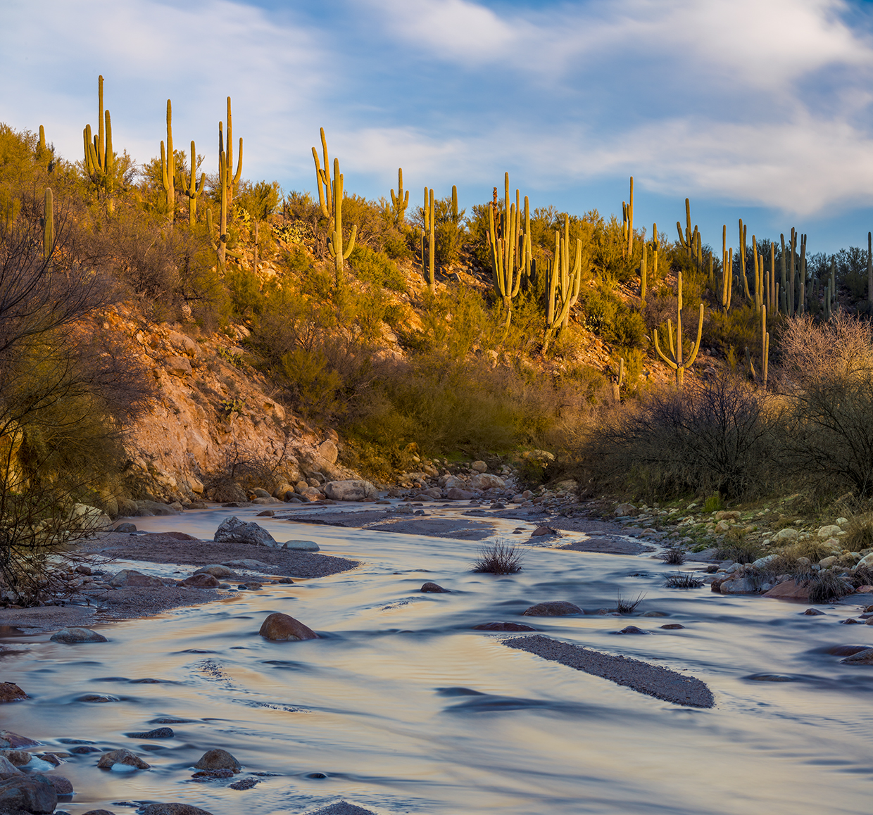
A river runs through the northwest corner of Catalina State Park. Like most desert rivers, Cañada del Oro works only part time, when the snow melts or the rains come. The rest of the time, it’s a dry wash just waiting to nurture a riparian habitat that’s struggling in a protracted drought. The “canyon of gold,” as the name translates, attracted nugget-thirsty prospectors in the 1800s, but none of them got rich. Not in the sense of dollars and cents. Enrichment, however, comes in many forms. And going to work every day in such a beautiful place must have counted for something. You’d think.
Today, that beautiful place attracts a different kind of prospector: nature lovers. Within the park’s 5,500 acres are 5,000 saguaros, 150 species of birds and several mammal species, including coyotes, javelinas, mule deer, Coues white-tailed deer, raccoons and white-nosed coatis. And this time of year, there should be wildflowers — brittlebush, marsh asters, chuparosas, Coulter’s lupines, California poppies. To see those things, or even some of those things, there are several trails in the park. One of the most popular is the Canyon Loop Trail.
Like most loops, you can hike this route in either direction. The locals suggest counterclockwise. It’s good advice. The best scenery is on the left side of the clock, between 12 and 6. And that’s how this piece is written.
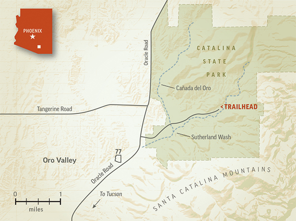
From the trailhead, walk south across the park road and onto a wide, sandy path. Within a minute, you’ll come to Sutherland Wash, which is named for William Henry Sutherland, a rancher from the 1920s who also served as the general superintendent and part-owner of the Arizona Stage Co. Like Cañada del Oro, this wash is usually dry. But in March, it might be otherwise. Beware.
On the other side, you’ll see an intersection with the Birding Trail, a short route that leads to Montrose Canyon. Veer left to stay on the Canyon Loop, which climbs to a grassy plateau dotted with saguaros and mesquite trees. The views of the Santa Catalina Mountains to the south will hold your gaze as you come to yet another intersection, this time with the Romero Canyon Trail.
The canyon is named for Francisco Romero, the earliest known rancher in the Cañada del Oro area. Mr. Romero was the grandson of a Spanish soldier who arrived in Tucson in the 1770s. “Francisco and his wife, Victoria, had three children, one of whom became a rancher,” Charles R. Eatherly wrote in a history of the area. “His name was Fabian, born in 1864, and he is credited as the founder of Rancho Romero. His ranch is reported to have been 4,800 acres.”
The Romero Canyon Trail, which crosses into the Pusch Ridge Wilderness, is the most difficult trail in the park. And one of the best. It’s something to keep in mind for another time. Meanwhile, veer left to stay on the Canyon Loop, which shifts north and arrives at a beautiful lookout area with a memorial bench. From there, the trail descends — via several dozen steps made of railroad ties — back down to Sutherland Wash. Horses use an alternate trail to get to the bottom.
This is the homestretch. And it’s the best part of the trail, especially if there’s running water in the wash. But even if there’s not, the riparian ecosystem spotlights the diversity of the Sonoran Desert and how beautiful it can be. Cottonwood and ash are the primary hardwoods. And the north bank is lined with clusters of massive saguaros, like dozens of NBA players standing side by side during the national anthem.
As you head west, the narrow trail crosses the wash a couple of times and passes a few more memorial benches, including one dedicated to Sophia “Sue” Kent, who was born the year after this magazine premiered and died in 2009. Presumably, she came to the park for the same reason so many other modern prospectors do. For the enrichment that comes from communing with Mother Nature.
Trail Guide
Length: 2.3 miles round-trip
Difficulty: Moderate
Elevation: 2,723 to 2,901 feet
Trailhead GPS: N 32˚25.540', W 110˚54.481'
Directions: From Tucson, go north on Oracle Road (State Route 77), past Oro Valley, to the entrance for Catalina State Park. Turn right onto the park road and continue 1.8 miles to the Canyon Loop Trailhead, at the east end of the road.
Special Consideration: An entrance fee, ranging from $5 to $20, is required.
Vehicle Requirements: None
Dogs Allowed: Yes (on a leash)
Horses Allowed: Yes
USGS Map: Oro Valley
Information: Catalina State Park, 520-628-5798 or azstateparks.com/catalina