
Belgium has the Battle of the Bulge, one of the most significant conflicts in Europe during World War II. You’ve probably heard of it. Arizona has the Battle of the Bulls, which might have been the least significant conflict of the Mexican-American War. If you somehow haven’t heard of that one, it’s probably because you haven’t been down Charleston Road, which connects the communities of Tombstone and Sierra Vista. That unusual footnote in Arizona lore is just part of the history along this easy desert meander.
Just west of the O.K. Corral in Tombstone, go south on Sumner Street, which soon bends to the southwest and becomes Charleston Road, a paved two-lane route. Mesquites and ocotillos crowd the roadsides as you descend through the conical buttes of the Tombstone Hills, where a thick vein of silver once fueled the town’s mining boom. And around Mile 2, you’ll crest a small hill and get a good look at the distant Huachuca Mountains, near this drive’s destination.
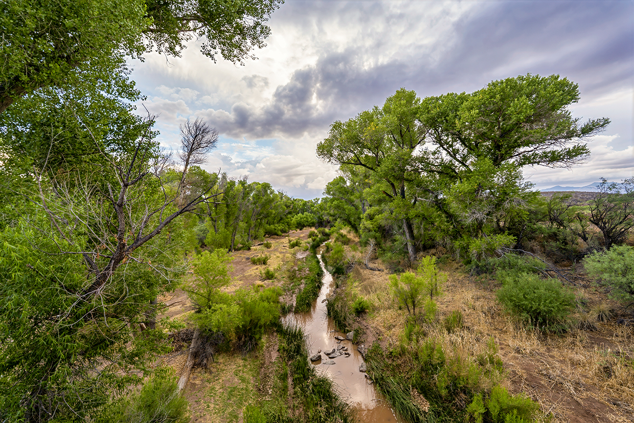
A few tall yuccas join the vegetation as the road approaches the greenery of the San Pedro River, visible miles in advance. At Mile 7.6, you’ll enter San Pedro Riparian National Conservation Area, which protects 57,000 acres and a 40-mile stretch of one of the only undammed major rivers in the Southwest. Much of the history along Charleston Road is clustered near the river, starting with a pullout on the right at Mile 8.5.
From here, an easy footpath leads to an overlook of the ruins of the Corbin Mill, once the centerpiece of the 1880s mining town of Millville. As an interpretive sign explains, two stamp mills in the town processed silver ore from Tombstone’s mines 24 hours per day. The mill workers lived on the other side of the river in Charleston, which boasted blacksmiths, a post office and a school, among other establishments.
Today, a few ruins can be found in Charleston, but there’s no trail to that townsite, and the Bureau of Land Management, which manages the conservation area, doesn’t encourage visitation. The Millville site, though, is relatively easy to visit via a trail network that starts at the overlook. One trail also offers a look at some much more distant history: a series of petroglyph panels along the San Pedro. In all, it’s a 2.5-mile (round-trip) hike to see Millville and the petroglyphs.
Back on Charleston Road, it’s a quarter-mile farther to the river crossing and a monument to the 1846 Battle of the Bulls, which involved the Mormon Battalion. As the battalion approached the San Pedro, a group of wild bulls — descended, it seems, from cattle left by Mexican ranchers run off by Apaches — charged the outfit, wounding a few men and killing three mules. The soldiers killed several bulls and drove the rest off, then regrouped and continued their march to San Diego.
After you’ve explored the area via an old bridge now used for foot traffic, continue across the San Pedro on the newer road bridge. You’ll get a view of 4,459-foot Brunckow Hill, named for an early prospector in the area, on the left at Mile 9.5, as you climb away from the river. It’s just a few miles from there to the outskirts of Sierra Vista, and a few more miles farther to the road’s conclusion at State Route 90 — and these days, you’re unlikely to see any wild bulls roaming the city streets.
Tour Guide
Note: Mileages are approximate.
Length: 16.3 miles one way (from Tombstone)
Directions: From the intersection of Allen and Sumner streets in Tombstone, go south on Sumner Street, which turns southwest and becomes Charleston Road, for 16.3 miles to State Route 90
in Sierra Vista.
Vehicle Requirements: None
Warning: Back-road travel can be hazardous, so be aware of weather and road conditions. Carry plenty of water. Don’t travel alone, and let someone know where you are going and when you plan to return.
Information: San Pedro Riparian National Conservation Area, 520-439-6400 or blm.gov/arizona
Travelers in Arizona can visit www.az511.gov or dial 511 to get information on road closures, construction, delays, weather and more.