
Las Cienegas National Conservation Area
It’s hard to believe that Las Cienegas National Conservation Area was, at one time, at risk of becoming a master-planned community and golf course. Instead, the locals rallied, and in 1986, the area came under the protection of the Bureau of Land Management. In 1988, it became part of the National Landscape Conservation System. Today, it’s accessed by a 24-mile drive that’s best described as spectacular.
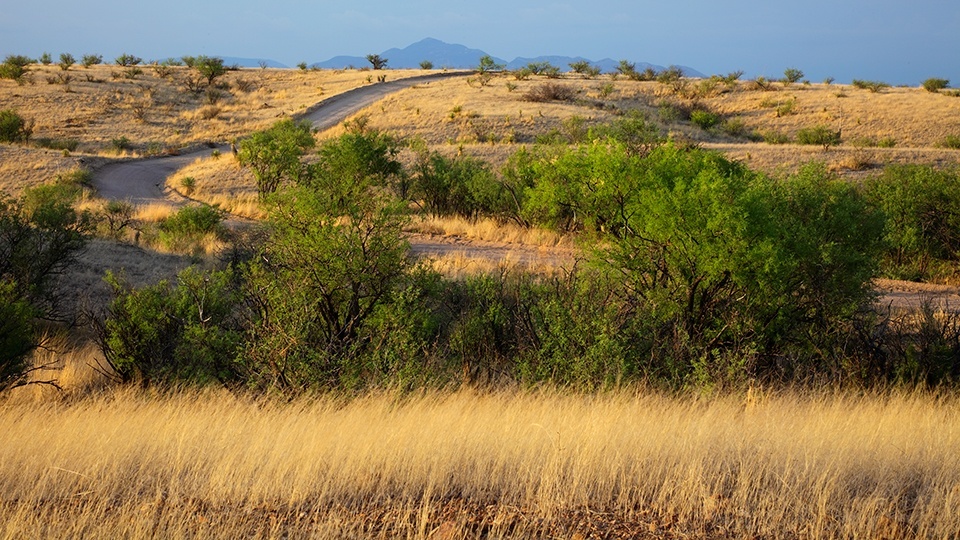
But before you head out, be warned: Although the landscape, with its rolling grasslands and verdant riparian area, is magnificent, the road itself isn’t. It’s challenging at times and might require four-wheel-drive in places.
To begin, turn left off of State Route 83 onto the gravel road marked “Historic Empire Ranch” and continue for 3 miles to a “T” junction. There, turn left onto Bureau of Land Management Road 6901 and follow the sign to Oak Tree Canyon. Some area maps list the route as Bureau of Land Management Road 901, but the agency updated its signage to include a numerical prefix that indicates road condition. In this case, the “6” means “off road.” Moving along, you’ll quickly come to the riparian area around Empire Gulch. At about Mile 4, the cottonwood trees and mesquite bosque lining the road give way to vast open grasslands. Just beyond the rolling hills, you’ll enter another riparian area, where you’ll cross Cienega Creek. As you pass over a bridge, a small sea of cattails hides any sign of water, but the reeds are beautiful and unexpected. Around Mile 8, the road turns left, then abruptly right. At that point, you’ll be on Bureau of Land Management Road 6914.
This is where you can expect a few challenging conditions. That’s because the road is maintained on an as-needed basis. Besides a few bumps in the road, you’ll also cross several sandy washes (don’t even think about attempting them in inclement weather). In addition, the conservation area hosts a working ranch, so you might encounter a few cows. Thus, it’s important to leave gates as you find them. Pronghorns, mule deer and bobcats are also prevalent in the area, as are black-tailed prairie dogs, which the Arizona Game and Fish Department reintroduced to the area in 2008 and 2009.
Near Mile 11, you’ll begin a serious climb, but the payoff is a spectacular view of the Whetstone Mountains on your left. As soon as you reach the top, the road drops, and for the next mile or so, it becomes increasingly difficult to navigate. Take your time. If you can safely transition into four-wheel-drive, do so, because the narrow road twists and turns sharply.
As the road begins to level out, you’ll face another potential obstacle: a fork in the road, where there are no clear markers to indicate which road is BLM 6914. Continue in the direction you were already headed — southwest. At Mile 13.9, you’ll cross another sandy wash, and in less than 1.5 miles, the road connects with Bureau of Land Management Road 6900. This marks the final stages of the drive, and by Mile 24, you should be back where you started.
Note: Mileages are approximate.
Length: 24 miles round-trip (from State Route 83)
Directions: From Tucson, go east on Interstate 10 for 23 miles to State Route 83. Turn right onto SR 83 and continue 19 miles to Historic Empire Ranch Road (Bureau of Land Management Road 6900). Turn left onto Historic Empire Ranch Road and continue 3 miles to Bureau of Land Management Road 6901. Turn left onto BLM 6901 and continue 8.4 miles to Bureau of Land Management Road 6914. Turn right onto BLM 6914 and continue 7 miles to BLM 6900. Turn right onto BLM 6900 and continue 5.6 miles until you arrive at the starting point of the drive.
Vehicle requirements: A high-clearance, four-wheel-drive vehicle is required.
Information: Las Cienegas National Conservation Area, 520-439-6400 or www.blm.gov/arizona