
Tonto National Forest, near Phoenix
Every now and then — particularly in the dead of a brutal Arizona summer — a person can grow tired of the desert. But come autumn, when the air is crisper and the leaves on the scrub oaks have gone golden and the Earth is ripe for rain, that person can grow to love the desert again. It happens in winter, too. And in spring.
These are the seasons to drive Four Peaks Road (Forest Road 143) from State Route 87 (the Beeline Highway) to Theodore Roosevelt Lake. When you do, you’ll cruise through a hit parade of desert beauty.
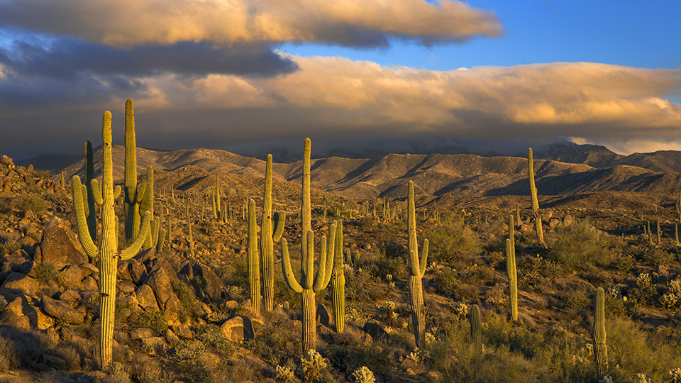
The route begins 26 miles north of Mesa, off SR 87. The right turn is well marked, and the road turns to dirt — and washboard — immediately. The road’s namesake Four Peaks are visible to the left, and the desert is awash with paloverde and mesquite trees; cholla and prickly pear cactuses; and broad, beefy yuccas.
After about a mile, you’ll see a target-shooting area to the right. Throughout the drive, you’ll encounter off-highway-vehicle paths. Follow the wide main road to avoid getting lost in the tangle of trails. This is particularly important at Mile 2.2, when you’ll come to an intersection. Stay straight to stay on Four Peaks Road. When it crests a little more than a half-mile later, you’ll feel as though you’re being swallowed by broad, beautiful desert.
Boulders and saguaros begin to punctuate the landscape, as do century plants and manzanitas. Just a mile past the intersection, look left to see a saguaro peeking from behind a boulder. Thanks to two perfectly placed wren holes, the cactus seems almost human, with two big eyes scanning for visitors.
After a cattle guard, you’ll be chasing the peaks — Browns Peak, the highest point in Maricopa County, and its three unnamed counterparts — as the road curves right and curls like a ribbon across the desert. From here, the boulders seem taller and more closely clustered, and at Mile 4.8, a giant rock pile off to the right resembles a hand breaking through the surface of the Earth.
At Mile 11.6, a massive flat-topped rock to the right looks like a bald man’s broad head and serves as the marker for what will become a downhill roller coaster through tiny riparian areas fed by seasonal rains and dotted with fledgling sycamore trees. Soon, though, the road climbs again, this time to a junction at Mile 18.1.
Go straight to stay on the route, or detour just a few miles to the Pigeon and Lone Pine trailheads. Soon after the junction, you’ll come to a sign warning of an 8 percent downhill grade thereafter. You’ve reached the high point of the journey: an elevation just shy of 5,800 feet.
Past an American Tower Corp. radio tower, Theodore Roosevelt Lake materializes, its long fingers spreading across the desert. At Mile 23.2, an optional loop circles a massive rock formation. Take it. The scenery is no different, but what’s life without a little adventure?
Less than 5 miles after the detour, you’ll hit the blacktop of State Route 188. Turn left to travel by pavement about 20 miles back to SR 87. Or retrace your route. The desert, after all, is magic this time of year.
Note: Mileages are approximate.
Length: 28 miles one way (from State Route 87)
Directions: From the northern intersection of state routes 202 and 87 in Mesa, go northeast on SR 87 for 26 miles to Forest Road 143 (Four Peaks Road). Turn right (east) onto FR 143 and continue 28 miles to State Route 188 near Theodore Roosevelt Lake.
Vehicle requirements: A high-clearance vehicle is required. Don’t attempt the drive after recent rain or if rain is in the forecast.
Warning: Back-road travel can be hazardous, so be aware of weather and road conditions. Carry plenty of water. Don’t travel alone, and let someone know where you are going and when you plan to return.
Information: Mesa Ranger District, 480-610-3300 or www.fs.usda.gov/tonto