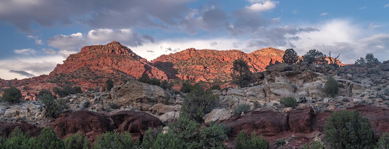
Vermilion Cliffs National Monument, Arizona Strip
If you’ve driven to the Grand Canyon’s North Rim, you’ve seen the house. Just before you climb onto the Kaibab Plateau and head for Jacob Lake, there it is — a turquoise and white rock house on the north side of U.S. Route 89A. It’s isolated and unexpected, and it’s also a signal that, after a long drive, you’re almost there. But have you ever wondered where the dirt road that starts at the house might take you?
You should. Because House Rock Valley Road features a national monument, sweeping vistas and a chance of spotting one of Arizona’s rarest birds. And even though the 29.5-mile route is rugged in spots, you can drive it and be back on blacktop in 90 minutes or so.
From the house, head north on House Rock Valley Road (Bureau of Land Management Road 1065). To the east are the namesakes of Vermilion Cliffs National Monument, and the cliffs’ deep red contrasts with the green of piñon pines and junipers on the valley’s floor. After 2.7 miles, you’ll reach a site for observing endangered California condors, which are released from atop the Vermilion Cliffs every September.
Five miles past the observation site, you’ll crest a hill and get your first view, to the north, of the jagged Coyote Buttes. This section of the monument is part of the Paria Canyon-Vermilion Cliffs Wilderness, and access to its wonders, including the swirling layers of Navajo sandstone known as “The Wave,” requires a permit from the BLM. But there’s no permit needed to enjoy the view from the road, which reaches an unmarked “Y” intersection at Mile 9.3. Bear left to stay on House Rock Valley Road.
The trees get bigger and closer to the road as you continue north. And the road gets rougher, so take it easy on the accelerator and enjoy the multicolored sandstone formations at the base of the Coyote Buttes — there’s a good view of them at Mile 17 or so. About 2.5 miles later, you’ll reach the state line and cross into Utah. Until recently, this area was part of Grand Staircase-Escalante National Monument, but the monument’s boundary was moved farther north in 2017.
North of the state line, the road winds between sandstone buttes that loom over the roadway. The Buckskin Gulch Trailhead, at Mile 25, is ideal for stretching your legs and viewing the nearby rock formations. From here, it’s less than 5 miles to the road’s end at U.S. Route 89.
Near the highway, an interpretive sign explains the nearby East Kaibab Monocline, a formation known locally as the Cockscomb. It’s a wrinkle in the Earth’s crust, created by plate tectonics between 40 million and 80 million years ago. You can travel through the Cockscomb by turning right onto U.S. 89 and heading toward Page and Lake Powell. Or you can turn around and head back the way you came. As usual, when you see the house, you’ll know you’re almost there.
Note: Mileages are approximate.
Length: 29.5 miles one way (from U.S. Route 89A)
Directions: From Navajo Bridge, go west on U.S. Route 89A for 27.5 miles to House Rock Valley Road (Bureau of Land Management Road 1065). Turn right (north) onto BLM 1065 and continue 29.5 miles to U.S. Route 89 in Utah.
Vehicle requirements: A high-clearance, four-wheel-drive vehicle is required. Don’t attempt the drive after recent rain or if rain is in the forecast.
Warning: Back-road travel can be hazardous, so be aware of weather and road conditions. Carry plenty of water. Don’t travel alone, and let someone know where you are going and when you plan to return.
Information: Arizona Strip Field Office, 435-688-3200 or www.blm.gov/arizona

