
Kannally Ranch isn’t as familiar as Phantom Ranch. Or the Babacomari. But it’s on the National Register of Historic Places, and the state park that protects it is home to more than a dozen interconnected hiking trails. Most are short and easy. However, if you’d like to rack up some extra mileage, the network lends itself to an array of combinations, including the Arizona Trail Loop.
Like everything else at Oracle State Park, the loop begins near the old ranch house, which was built into a hillside between 1929 and 1932. The 2,622-square-foot white stucco home with turquoise wooden shutters features four levels, two terraces and no bedrooms. The lack of sleeping quarters is odd, but the history of the property is pretty typical. The original 160-acre ranch was purchased by Neil and Lee Kannally in 1903. The two brothers were later joined by sisters Lucile and Mary and brother Vincent, and the ranch grew to almost 50,000 acres.
They ranched those acres for decades, and then, in 1952, they sold all but 4,000 acres. After Lucile’s death in 1976, the rest of the ranch was willed to Defenders of Wildlife, a nonprofit that later deeded the ranch to the Arizona State Parks Board. Oracle State Park was officially dedicated on October 1, 2001, and today it’s a 4,000-acre wildlife refuge that offers hikers a chance to see white-tailed deer, mountain lions and Gila monsters. But birds are the dominant species. You’ll see so many birds on the Arizona Trail Loop.
From the east end of the parking lot, the loop begins with the Nature Trail — it’s one of four trails that make up the circuit. About five minutes in, the Nature Trail intersects the Wildlife Corridor Trail. Like all loops, this one can be hiked in either direction. This description runs clockwise, so, veer right to stay on the Nature Trail as it cuts through a riparian area for about 50 yards. At that point, the trail turns left onto a single track and ascends to a wildlife viewing area that includes an open-air structure.
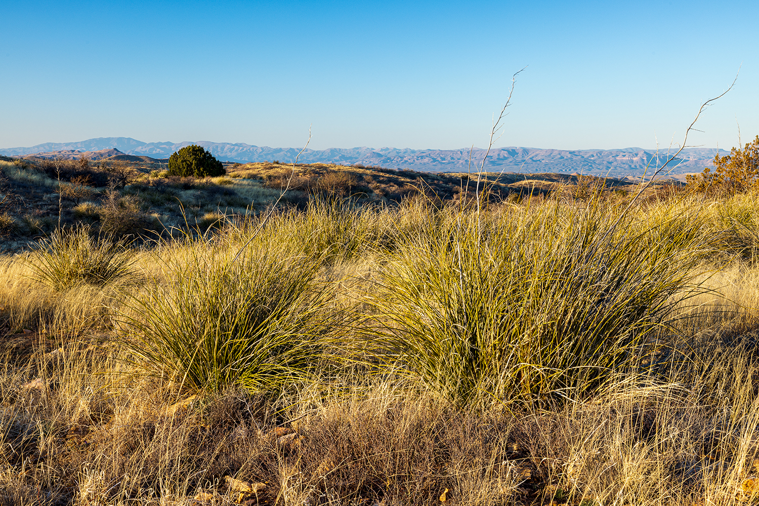
Just before the building, the loop turns right, makes a gradual ascent to the southwest and arrives at the Manzanita Trail — the second of the four trails. Veer left as the well-marked path dips down, crosses a wash and climbs to a commemorative park bench at an elevation of 4,420 feet, the high point of the hike. The bench faces east, toward the Galiuro Mountains. And in between are the rolling grasslands that define this park, which sits in a transitional zone, with an oak woodland at the higher elevations and desert grasslands farther down.
At the turn of the previous century, the grasslands attracted cattle ranchers. Now that they’re gone from the park, a variety of native grasses have flourished. And they’re punctuated by Emory oaks, white oaks and junipers. There are soaptree yuccas, too, and ocotillos and hedgehog cactuses, which bloom in the spring. There’s also a single saguaro. Literally. There’s just one in the entire park. It’s an intrepid survivor that’s found a niche at the extreme upper end of its habitat.
From the bench, the trail descends through the grassland, which is interrupted in places by small clusters of rock. Like sandcastles on a beach, they rise above the otherwise uniform landscape. In addition to the rocks, you’ll likely see birds on this stretch. Flocks in the hundreds are not unusual.
Continuing on, about 50 minutes in, the Manzanita Trail arrives at the Arizona Trail, which heads south to Mexico and north to Utah. You’ll head north, which is a left turn, and make some gradual ups and downs until to you come to Cottonwood Wash — the low point of the loop (4,046 feet). Just beyond that junction is the connecting point with the Wildlife Corridor Trail, which is the anchor leg of the loop.
The homestretch offers more of the same. The only difference is the position of the sun and a small cluster of ocotillos along the way. This isn’t a hike with a grandiose payoff, but that’s not a demerit. The allure of this loop is the ecosystem that’s grown from Ms. Kannally’s benevolence. It’s the opportunity to walk back in time, into an Arizona landscape that existed before the Herefords came marching in. That’s the payoff.
Trail Guide
Length: 6.07 miles round-trip
Difficulty: Moderate
Elevation: 4,420 to 4,046 feet
Trailhead GPS: N 32˚36.619', W 110˚43.994'
Directions: From Interstate 10 near Marana, go east on Tangerine Road (Exit 240) for 13.2 miles to Oracle Road (State Route 77). Turn left onto Oracle Road and continue 17.7 miles to American Avenue. Turn right onto American Avenue and continue 2.2 miles to the Mount Lemmon Highway. Turn right onto the Mount Lemmon Highway and continue 1.1 miles to Oracle State Park. From the entrance, continue 1 mile to the parking area.
Special Consideration: A $7 entry fee is required.
Vehicle Requirements: None
Dogs Allowed: Yes (on a leash)
Horses Allowed: Yes
USGS Map: Oracle
Information: Oracle State Park, 520-896-2425 or azstateparks.com/oracle
ADDITIONAL READING:
For more hikes, pick up a copy of Arizona Highways Hiking Guide, which features 52 of the state’s best trails — one for each weekend of the year, sorted by seasons. To order a copy, visit shoparizonahighways.com/hikingguide.