
The first thing that’ll come to mind when you catch your first glimpse of Mount Wrightson is: Holy moly! Or something more graphic. Your second thought will be: There’s no way! It’s only
5.4 miles away on foot, but it’s waaaaaaaay up there. And it looks even farther than that.
At 9,453 feet, Mount Wrightson — the locals call it “Mount Baldy” — is the highest point in the Santa Rita Mountains, and it’s a visible landmark from Tucson and Patagonia and most places in Southeastern Arizona. There are two trails to the top: the Super Trail (16.2 miles round-trip) and the Old Baldy Trail (10.8 miles round-trip). As you might expect by the overall distance, the latter, which is not to be confused with the West Baldy Trail in the White Mountains, is more challenging. It’s also more scenic. In particular, there are more interesting plant communities on the north face of the mountain, which is the direction Old Baldy takes.
The trail begins at the far end of Madera Canyon, a riparian woodland along an intermittent stream bordered by mesquite trees, junipers, oaks, and various pines and evergreens. Even if you’re not a birder, you have to appreciate the unique nature of this avian wonderland. Madera Canyon is home to more than 250 species of birds, including elegant trogons, yellow-billed cuckoos, red-faced warblers and broad-tailed hummingbirds — 15 different hummingbird species frequent this canyon. Birders come from all over the globe to check their boxes. Hikers come for the rocks and the trees and the challenge of conquering the summit.
From the trailhead, you’ll start feeling the incline immediately, and it won’t let up until you’re on your way down. Within about 10 minutes, the grove of trees changes from sycamores to ponderosas. This is also where that first view of Mount Wrightson comes in. As you continue climbing, the forest gets thicker — shaggy, almost — and after an hour or so, you’ll come to a spectacular slope covered with ferns. There’s something about ferns that seems out of place in Arizona, but there they are.
Beyond the ferns, the ponderosas start getting taller, and they’re mixed with silverleaf oaks and Apache pines. They’re beautiful. Equally impressive is the Josephine Saddle, which sits at 7,080 feet, 2.2 miles from the trailhead. There are some great views off to the east, but what will really catch your attention is a wooden memorial. On November 15, 1958, three young Boy Scouts, ages 12 to 16, died at this spot when they were caught in a sudden snowstorm. It’s a good reminder that whenever you’re hiking in Arizona, you need to check the forecast before you leave the house. Flash flooding in the deserts and lightning and snow in the mountains can be deadly. Be smart.
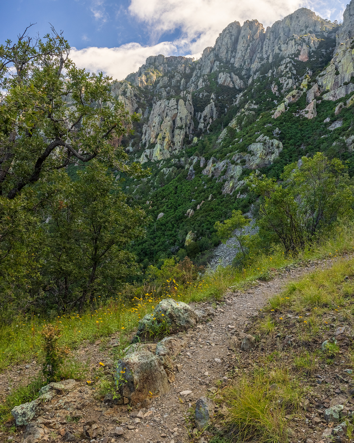
From the saddle, the trail gets noticeably steeper and includes some challenging switchbacks. It’s beautiful every step of the way, with brilliant green everywhere, but your legs and your lungs won’t really appreciate it. If you’re not breathing too hard, keep your eyes peeled for white-tailed deer, black bears and some very fat squirrels, especially around Bellows Spring, which you’ll pass along the way.
After about three hours, you’ll finally arrive at Baldy Saddle, an almost treeless place that’s used as a campsite by backpackers. The summit is still about a mile away, and in places, the trail is better suited for mountain goats than for day hikers. It’s steep and rocky, and one misstep could ruin an otherwise perfect day. At the top of the mountain are the remains of a fire tower built in 1921. It was small but had a work area, a kitchen and a sleeping area. A ladder led to a cupola, where an instrument called a Firefinder was located. The historic structure remained in use until the 1950s.
Today, all that’s left of the tower is a section of its foundation, but the views are still the same. On a clear day you can see the Sierra San José in Sonora, Mexico, as well as several surrounding mountain ranges, including the Rincons, the Galiuros and the Chiricahuas. Also, to the west, you’ll see the Smithsonian Institution’s Whipple Observatory, which looks like a misplaced igloo at the top of Mount Hopkins. To some observers, the telescope is an eyesore. To others, it’s a scientific marvel. To the hikers who make it to the top of Mount Wrightson, it’s just one more thing to look down on as they think to themselves: Holy moly! I made it to the top.
trail guide
Length: 10.8 miles round-trip
Difficulty: Strenuous
Elevation: 5,458 to 9,453 feet
Trailhead GPS: N 31˚42.758', W 110˚52.427'
Directions: From Tucson, go south on Interstate 19 for 24 miles to Continental Road (Exit 63). Turn left onto Continental Road and continue 1.1 miles to Whitehouse Canyon Road. Turn right onto Whitehouse Canyon Road, which merges into Madera Canyon Road, and follow the signs for 5.6 miles to the Madera Canyon Recreation Area. The trailhead is at the far end of the recreation area, near the Mount Wrightson Picnic Area.
Special Consideration: An $8 parking pass is required.
Vehicle Requirements: None
Dogs Allowed: Yes (on a leash)
Horses Allowed: No
USGS Map: Mount Wrightson
Information: Nogales Ranger District, 520-281-2296 or fs.usda.gov/coronado
ADDITIONAL READING:
For more hikes, pick up a copy of Arizona Highways Hiking Guide, which features 52 of the state’s best trails — one for each weekend of the year, sorted by seasons. To order a copy, visit shoparizonahighways.com
/hikingguide.