
“The Rim,” Raymond Carlson wrote in the April 1966 issue of Arizona Highways, “is scenery, history, virgin wilderness, so rough only small portions are accessible by conventional auto, the rest a challenge to the jeep-driver or the sturdy mountain goat.” He used the words “unimaginable beauty” to describe the vistas. Although time has brought more roads — and more people — the unimaginable beauty remains the same. For that reason, it’s a summer playground for all kinds of nature lovers.
Its lakes attract serious anglers and kids with cane poles. Its network of forest roads draws mountain bikers and four-wheelers. And its trails call to hikers of all fitness levels. For an easy stroll, there’s Woods Canyon Lake. For something more strenuous, there’s See Canyon. And somewhere in between is the Horton Creek Trail.
The trail, which is named for the creek that’s named for settler L.J. Horton, begins at the foot of the Mogollon Rim, about 150 feet from the Upper Tonto Creek Campground and just below the Tonto Creek Fish Hatchery, which has been in operation since 1937. In 1990, it was damaged by the Dude Fire — the same fire that took out Zane Grey’s cabin, about 3 miles to the east. One of the hatchery buildings crumbled, and the watershed sustained damage, but the facility was saved, and every year it produces rainbow trout, brook trout and Apache trout (Arizona’s state fish) to stock the state’s waterways.
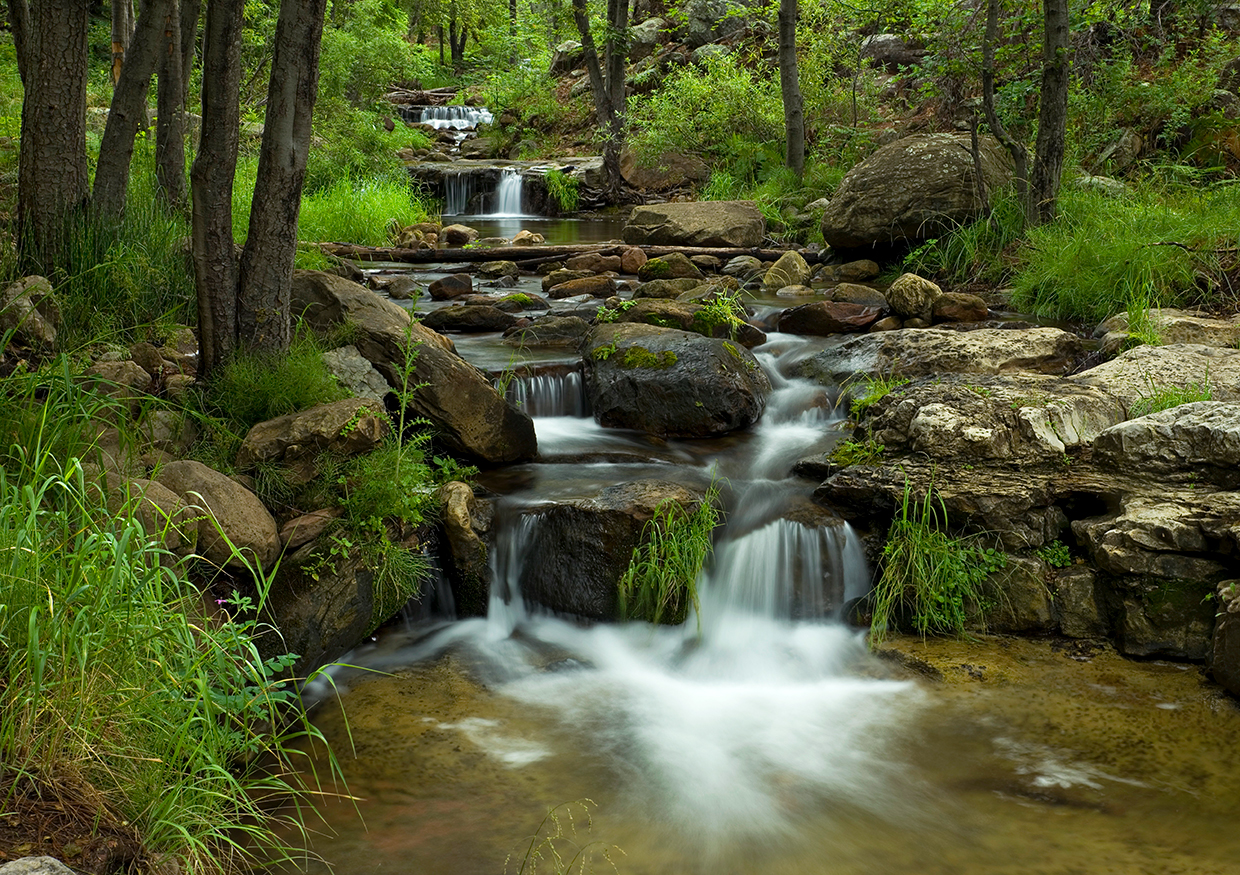
From the trailhead, the route follows an old logging road that parallels the stream. The first quarter-mile or so is an easy, pine-needle-covered path that cuts through a grove of ponderosa pines and aspens. To this point, you won’t hear any running water, but once you pass the U.S. Forest Service gate, you’ll start hearing it.
For most of the hike, you’ll be within a few hundred yards of the water. By all means, hop off the trail and get your feet wet. There are several creek crossings — made up of big rocks and small boulders, which are slippery when wet — and they’re worth the side trip. You’ll also notice some idyllic campsites, which you’ll want to keep in mind for another day when you’re equipped with a tent and a sleeping bag.
Continuing uphill, past the lush colonies of roses, wild grapes, ferns and strawberries, you might start feeling a slight burn in your quads. It’s not poison ivy, although that three-leafed menace does grow in abundance in the area. The burn is from the incline, which is unexpected — this hike is deceptively steep and gains more than 1,000 feet in elevation. Another challenge, as you get farther up, is a bed of rocks that were dumped by an ancient rockslide. The trail winds over the rocks, which drool at the thought of twisting unsuspecting ankles. It’s like walking inside a giant gumball machine. Be careful.
Beyond the rocks, and at the 1.5-mile mark, you’ll see a monstrous alligator juniper to your left — this tree is to junipers what the General Sherman is to giant sequoias. The surrounding maples and Douglas-firs are impressive as well. Everywhere you look, the views dispel the stereotype that Arizona is nothing but snakes, scorpions and sand dunes.
The nature of the trail stays about the same until it nears the top, where a series of switchbacks leads away from the creek. Don’t be fooled by that. At the 4-mile mark, the Horton Creek Trail intersects the Highline Trail, which was established in 1870 and used by homesteaders. Zane Grey and Babe Haught used it, too, on hunting expeditions. In all, it’s a 40-mile marathon for those lucky hikers who don’t have to be at work on Monday morning.
Just beyond that intersection is Horton Spring, which pours out of the rocks about 30 feet above the stream and nurtures the lush surroundings made up of horsetails, mosses and grasses. These are the headwaters of the creek, and if ever there were a place to relax and get lost in your imagination, this would be it. But in the interest of full disclosure, you might not be alone. Of all the trails that wind through the “unimaginable beauty” of the Mogollon Rim, the Horton Creek Trail is the busiest. Take your chances, though. It’s worth sharing.
trail guide
Length: 6.4 miles round-trip
Difficulty: Moderate
Elevation: 5,487 to 6,695 feet
Trailhead GPS: N 34˚20.394', W 111˚05.732'
Directions: From Payson, go east on State Route 260 for 17 miles to Tonto Creek Road (Forest Road 289) near Kohls Ranch. Turn left onto Tonto Creek Road and continue 1 mile to the Upper Tonto Creek Campground. The trailhead is at the campground.
Vehicle Requirements: None
Dogs Allowed: Yes (on a leash)
Horses Allowed: Yes
USGS Map: Promontory Butte
Information: Payson Ranger District, 928-474-7900 or fs.usda.gov/tonto