

Kaibab National Forest
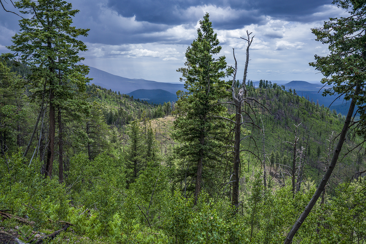
On May 24, 2000, Mother Nature tossed a bolt of lightning at a ponderosa pine on the southwest side of Kendrick Peak. That was the first tree to go in the Pumpkin Fire, which ultimately burned 14,760 acres on and around the mountain. The north side was hit the hardest, but the east and west sides got it, too. On the south side, where the Kendrick Trail climbs to the mountain’s summit, the fire burned in a gentler mosaic pattern, leaving patches of burned and unburned woodland.
The trail begins as a wide dirt path surrounded by ponderosas. With your first step you’ll start the long climb (2,702 vertical feet in all), and within a few minutes you’ll come to a small grove of young ponderosas — about 15 to 20 feet tall. They’ve taken root in the wake of the fire, and they’re inching up, but it will be decades before they re-establish a canopy. Meanwhile, the holes in the ceiling are allowing for new growth — ferns, flowers and grasses — that attracts elk and mule deer, as well as big cats and black bears.
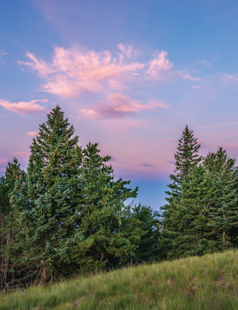
On the horizon, above and beyond the young ponderosas, you’ll catch a glimpse of the Kendrick Lookout Tower — it’s so far away, it looks like it’s sitting on a peak in another county. Moving on, about 15 minutes in, you’ll pass a large wall of volcanic rock, cross a wash and arrive at the Kendrick Mountain Wilderness, a 6,510-acre sanctuary that’s managed by Mother Nature. Just inside the boundary, the trail climbs to a place that escaped the fire. Five minutes later, however, it moves back into the recovery zone. That’s the pattern of a mosaic fire.
At the half-hour mark, the San Francisco Peaks make an appearance to the east. It’s a nice photo op that’s followed by the trail’s first Engelmann spruce. From there, the hike begins a series of long but gradual switchbacks. Between the first zig and subsequent zag, you’ll come to the most impressive tree of the day. It’s a stumpy old ponderosa that survived the Pumpkin Fire, along with many other hardships over the past century.
Continuing up, the trail arrives at a level spot. It lasts for only about 30 yards, but the respite helps. As soon as you start climbing again, you’ll see the growing collection of wind turbines on the plateau to the west, and then a big aspen, which serves as gatekeeper for a grove of old trees that dodged the fire. Beyond the survivors, the switchbacks enter a brief thicket — rare on this trail — and cross a rocky slope. Ferns are the dominant plant species along this stretch.
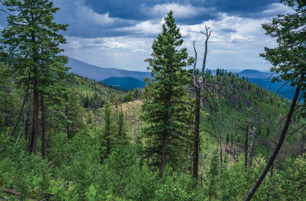
A few switchbacks later, the trail moves into a subalpine forest of Douglas- firs, white firs, Engelmann spruce and aspens. Although the aspens are filling in some of the gaps, their growth rate on this mountain is much slower than it would be in the White Mountains or on the North Rim. The trail passes through several groves of new aspens as it ascends to the upper saddle, a wind-blown place that’s home to the Kendrick Lookout Cabin. The cabin was built in 1912, making it the second-oldest in the Southwest. In 1988, it was listed on the National Register of Historic Places, and during the Pumpkin Fire, it was protected with a fire blanket — imagine a backyard storage shed wrapped in aluminum foil.
The rest of the route is a short series of switchbacks that lead to the lookout tower, which was built in 1964 — it replaced a wood tower built by the Civilian Conservation Corps in the 1930s. Six decades later, the future of the tower is up in the air. One option is to add it to the Forest Service’s “Rooms With a View” cabin rental program. It would certainly measure up. Through the windows you can see the San Francisco Peaks to the east, Oak Creek Canyon to the south and the North Rim of the Grand Canyon to the north. You can also see the worst effects of the Pumpkin Fire. What you can’t see is the ponderosa pine that was struck by lightning on May 24, 2000. Nevertheless, you can rest assured that Mother Nature is working on a worthy replacement.
ADDITIONAL READING: For more hikes, pick up a copy of Arizona Highways Hiking Guide, which features 52 of the state's best trails — one for each weekend of the year, sorted by seasons. To order a copy, visit www.shoparizonahighways.com/hikingguide
Trail Guide
Length: 9 miles round-trip
Difficulty: Strenuous
Elevation: 7,715 to 10,417 feet
Trailhead GPS: N 35˚23.214', W 111˚52.056'
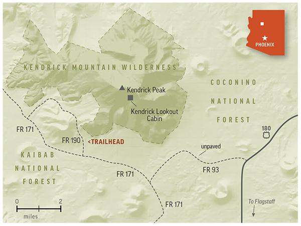
Directions: From Flagstaff, go northwest on U.S. Route 180 for 17.2 miles to Forest Road 193. Turn left onto FR 193 and continue 3.1 miles to Forest Road 171. Turn right onto FR 171 and continue 2 miles to Forest Road 190. Turn right onto FR 190 and continue 0.3 miles to the trailhead.
Vehicle Requirements: None
Dogs Allowed: Yes (on a leash)
Horses Allowed: Yes
USGS Maps: Kendrick Peak, Moritz Ridge
Information: Williams Ranger District, 928-635-5600 or www.fs.usda.gov/kaibab
LEAVE-NO-TRACE PRINCIPLES:
• Plan ahead and be prepared.
• Travel and camp on durable surfaces.
• Dispose of waste properly and pack out all of your trash.
• Leave what you find.
• Respect wildlife.
• Minimize campfire impact.
• Be considerate of others.