
In the 1890s, miners returning from Canada's Klondike Gold Rush set up shop in and around remote Aravaipa Canyon. They founded a town there and called it Klondyke — an alternate spelling whose explanation, if there is one, has been lost to history. Today, the near-ghost town of Klondyke is just one of the things you'll see during an easy meander down Klondyke Road.
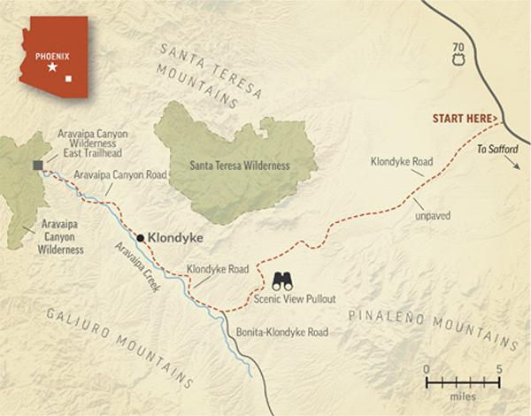
The road begins at U.S. Route 70 northwest of Safford. Early on, you'll see the imposing Pinaleño Mountains on the left and the smaller Santa Teresa Mountains on the right. Within a mile, the pavement gives way to a wide, smooth dirt road that, for most of this route, is navigable in most vehicles.
Low, sparsely vegetated buttes populate the flatlands close to the road, and you'll also see scattered barrel cactuses, ocotillos and yuccas. After a few gentle ups and downs, you'll get a closer look at the Santa Teresas, on the right, starting at Mile 13. These rugged peaks belong in part to the San Carlos Apache Tribe; the other sections of the range feature a pair of federal wilderness areas that protect the mountains' diverse plant and animal life, along with a geological landmark sacred to the Apaches.
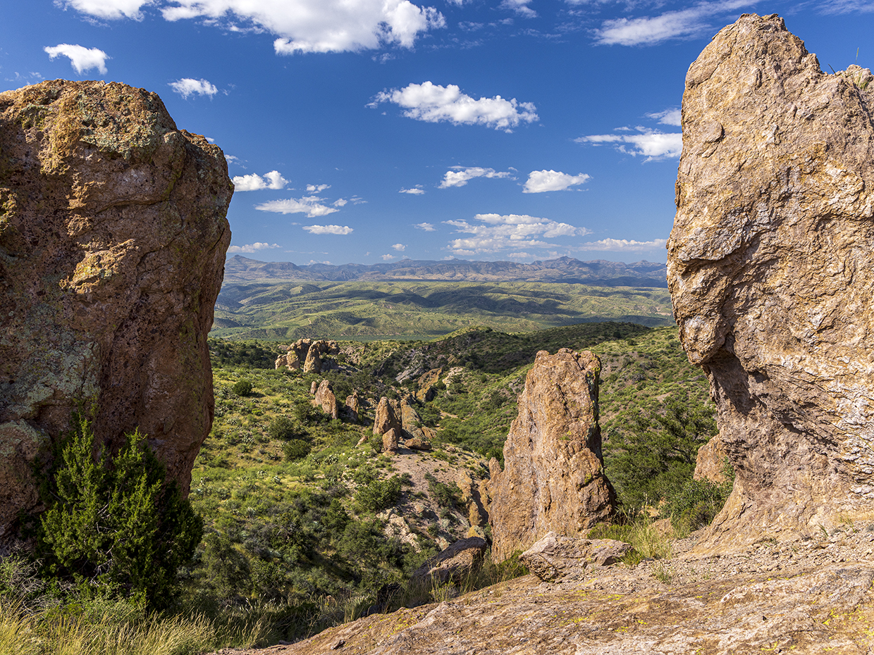
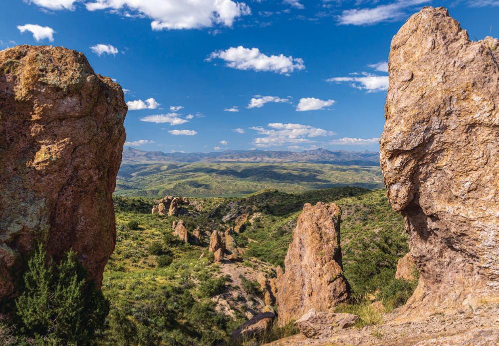
Just past a less important landmark — an odd jumble of volcanic boulders at Mile 18.7 — the road begins its descent toward Aravaipa Canyon. The vegetation changes accordingly, with taller trees replacing the desert scrub. Soon, the Galiuro Mountains, which form the southwest side of the canyon, appear straight ahead, and at Mile 22.5, a pullout on the right offers a panorama that includes those distant peaks and the canyon far below.
As your descent continues, you'll pass countless mesquites and yuccas before reaching a “Y” intersection at Mile 24.8. Rather than going left, onto Bonita-Klondyke Road, bear right to stay on Klondyke Road, which remains wide and easy to navigate. Over the next few miles, the vegetation gets even thicker, and in spots, tall cottonwoods and sycamores form a fleeting canopy over the road.
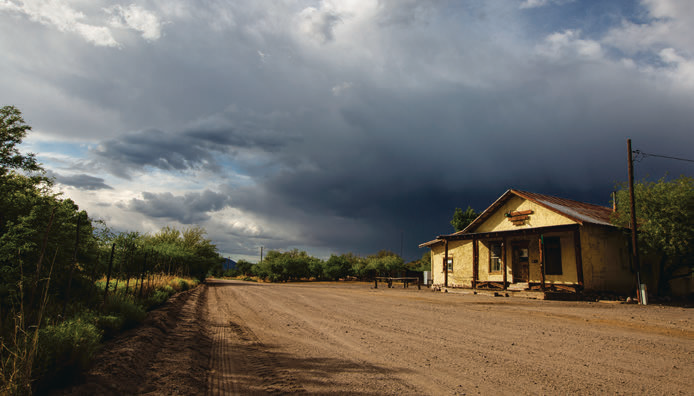
Klondyke itself is next, at Mile 32.5. Its historic adobe store, which was closed for years, was open again as of mid-2026; other structures include a schoolhouse that dates to 1907 and was recently rehabilitated, along with a handful of occupied residences. On a hill to the southeast is the cemetery, which is on private property; buried there are members of the Power family, including Jeff Power, who was killed in an infamous shootout in the Galiuros in 1918.
If you're continuing past Klondyke, you'll want a high-clearance vehicle, as Klondyke Road gets rougher and more rutted from there. At another “Y” intersection, at Mile 36, bear left to stay on the main route, now Aravaipa Canyon Road. You'll now descend even farther, into a grove of massive cottonwoods and sycamores shaded by steep canyon walls.
After a series of shallow Aravaipa Creek crossings, you'll come to the Salazar Family Church, which dates to the early 1900s and was built by one of the first families to settle the canyon. From there, it's less than a mile to the trailhead for the Aravaipa Canyon Wilderness, which marks the end of this route. Access to the wilderness area is extremely limited, and you'll need to reserve a permit in advance if you intend to hike in. If not, there's plenty more to see on the return trip up Klondyke Road — no matter how you spell it.
ADDITIONAL READING: For more adventure, pick up a copy of our book Arizona Highways Scenic Drives, which features 40 of the state's most beautiful back roads. To order, visit www.shoparizonahighways.com/100scenicdrives .
Tour Guide
Note: Mileages are approximate.
Length: 40.6 miles one way (from U.S. Route 70)
Directions: From U.S. Route 70 about 15 miles northwest of Safford, go southwest on Klondyke Road, which later becomes Aravaipa Canyon Road, for 40.6 miles to the Aravaipa Canyon Wilderness East Trailhead.
Vehicle Requirements: None in good weather for the drive to Klondyke. Continuing past Klondyke requires a high-clearance vehicle, such as an SUV or truck. Four-wheel-drive is not necessary in good weather.
Warning: Back-road travel can be hazardous, so be aware of weather and road conditions. Carry plenty of water. Don't travel alone, and let someone know where you are going and when you plan to return.
Information: Safford Field Office, 928-348-4400 or www.blm.gov/az (general Aravaipa Canyon Wilderness information); recreation.gov (hiking permits)
Travelers in Arizona can visit www.az511.gov or dial 511 to get information on road closures, construction, delays, weather and more.