Douglas Ranger District, Coronado National Forest
There are mountains. There are hills. And then there are the Dragoons.
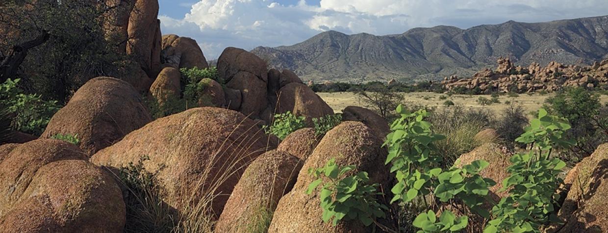
Officially a mountain range, the fiercely rugged and deliciously enticing Dragoon Mountains defy categorization. Some mountains soar, but the Dragoons seem to roll over the landscape. A collection of sharp-slanted cliffs and tumbled boulders rises abruptly from shaggy grasslands and slices north to south across Cochise County. For 30 miles, the Dragoons — surging, falling, cresting and curling — appear as if a pounding surf had somehow turned to stone during high tide.
One of the best ways to access this haunting terrain, once the stronghold of Cochise and the Chiricahua Apaches, is to make the drive to Council Rocks. Along the way, you’ll cross a golden savannah dotted with mesquites, yuccas and agaves. Sprawling oaks with piously bowed limbs gather at the stony flanks of the Dragoons. It was at Council Rocks that Cochise signed the Broken Arrow Peace Treaty in 1872.
The drive begins on Middlemarch Road, which once served as a supply and patrol route between Fort Bowie and Fort Huachuca. Follow Middlemarch, a wide gravel road, for 10 miles and turn north onto Forest Road 687.
As you parallel the mountains on this rutted dirt track, you’ll see what made the Dragoons such perfect shelter for the Apaches. The slopes jut upward in a snarl of rocky chaos. Granite spires, sheer cliffs and slashing chasms create both a maze and a fortress.
The mountains provided Cochise with food and medicine and year-round water. And from the high vantage point, the Apaches had excellent views of the valleys on either side of the mountains. They could literally see Army troops coming two days before they arrived. The angular peaks and labyrinth of canyons were ideally suited for the guerrilla tactics used by the Apaches. It’s no wonder that after 11 years of bloody warfare on the Arizona frontier, the government was eager to make peace.
Turn east onto Forest Road 687K, which leads to the Council Rocks parking area. A short but steep trail clambers into a cluster of house-sized boulders and shallow caves. Ancient footholds carved into the rocks offer assistance today, just as they did decades ago. Evidence of fire pits and metates, where corn was ground, can be found.
Dozens of pictographs adorn boulders and overhangs. Archaeologists believe the original pictographs were created by the Mogollon people nearly 1,000 years ago and were later augmented by the Apaches.
Little has been changed by the passage of time. Views are still endless, stretching for miles across the deep-grass valley. A soothing quiet settles, and it’s easy to drift between eras. This is still the West, still the frontier. Standing watch amid the granite bones, don’t be surprised to find yourself staying alert and vigilant, scanning the horizon for dust clouds. After all, it could be the cavalry.
Note: Mileages are approximate.
Length: 16.8 miles one way
Directions: From Tucson, go east on Interstate 10 for 45 miles to Benson. In Benson, go south on State Route 80 for 22 miles to Middlemarch Road, which begins about a mile north of Tombstone. Turn left onto Middlemarch Road and continue 10 miles to Forest Road 687. Continue on FR 687 for 6.5 miles to Forest Road 687K, turn right, and continue 0.25 miles to the small parking lot.
Vehicle Requirements: A high-clearance vehicle is recommended. Forest Road 687 can become rough and rutted following a heavy rain.
Warning: Back-road travel can be hazardous, so be aware of weather and road conditions. Carry plenty of water. Don’t travel alone, and let someone know where you are going and when you plan to return.
Information: Douglas Ranger District, 520-364-3468 or www.fs.usda.gov/coronado

