Bureau of Land Management, Kingman Field Office
There are times when the roads that lead to a scenic drive are anything but scenic. And some roads seem endless, even boring. “Are we there yet?” becomes the mantra of those stuck in the car. Yet you drive on because the payoff — endless vistas of stunning Arizona wilderness — is worth it. The drive to Six Mile Crossing has a definite payoff, but the scenery along the way is impressive, too. This trip is all about beautiful landscapes, from start to finish.
To reach Burro Creek Crossing Road, which is the link to Six Mile Crossing, travel north from Wickenburg on U.S. Route 93. It isn’t far into the drive before the landscape is suddenly covered in Joshua trees.
Designated the Joshua Tree Parkway of Arizona, this 54-mile stretch of U.S. 93 is spectacular, and because the road winds and climbs, you’re guaranteed several excellent views of these beautiful, bizarre-looking plants. If Mother Nature is kind and the right amount of rain falls at the right time of year, clusters of white-green blossoms sprout from the tips of the Yucca brevifolia in the spring.
As the signs for Burro Creek begin to appear, start paying attention to the milepost numbers. The turnoff to Burro Creek Crossing Road is around Milepost 132. Keep in mind there isn’t a turning lane, so you’ll want to slow down as you approach, and make sure you use your turn signal to give the folks behind you a heads-up. Once you make the turn, you’ll see a sign that reads: “Primitive Road. Caution. Use at Your Own Risk.” In spite of the warning, Burro Creek Crossing Road is a well-maintained, graded dirt road that can be navigated with a sedan, weather permitting.
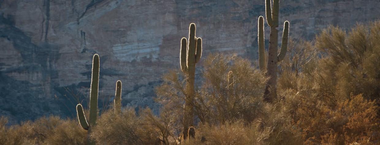
Heading east, saguaros, chollas and ocotillos replace the Joshua trees, and it isn’t long before you’re treated to some very nice views of Arizona’s backcountry. Although you’ll be less than a mile from the heavily traveled U.S. 93, you’ll feel a world away — other than the piles of scat, a few cattle crossings and tire tracks, it’s just you and Mother Nature. That said, take it slow and be mindful of the occasional oncoming vehicle. For the next 7.5 miles, the road narrows as you climb the hillside. And then, at Mile 5.3, the road becomes rough, but it’s temporary. A flash-flood sign serves as a reminder to skip this drive during inclement weather.
Around Mile 8, you’ll see the tailings dam from the Freeport-McMoRan Copper & Gold Mine. It’s an unexpected and unnatural scar on Mother Nature’s otherwise pristine canvas. As the road begins to descend in a series of switchbacks, the scenery shifts once again as cottonwood trees erupt from the ground, their leaves providing shade as you bump along toward Burro Creek.
The creek is a lush, life-giving stream for the javelinas, toads, mosquitofish and raptors that inhabit the area. It’s also the payoff of this scenic drive. Beauty certainly abounds en route, but it’s here, as you walk along the banks of the creek, that you’ll want to thank Mother Nature for her impressive handiwork.
Note: Mileages are approximate.
Length: 14.5 miles one way
Directions: From Wickenburg, go north on U.S. Route 93 for 65 miles to Burro Creek Crossing Road (Milepost 132). Turn right onto Burro Creek Crossing Road and continue 14.5 miles to Six Mile Crossing. Retrace your route to return to U.S. 93.
Vehicle requirements: A high-clearance vehicle is suggested. Do not cross Burro Creek unless you have a four-wheel-drive vehicle.
Information: Bureau of Land Management, Kingman Field Office, 928-718-3700 or www.blm.gov/arizona
Travelers in Arizona can visit www.az511.gov or dial 511 to get information on road closures, construction, delays, weather and more.

