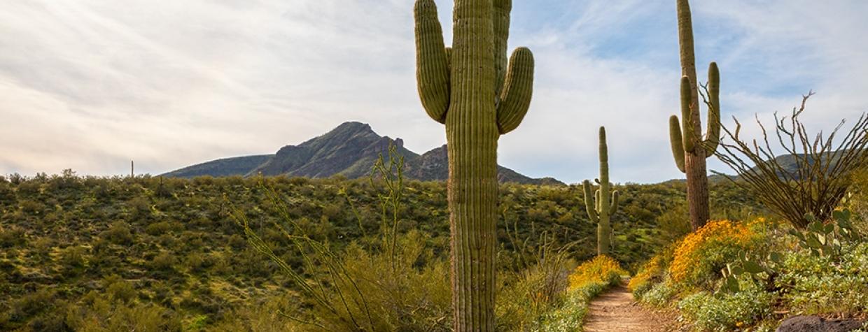
Spur Cross Ranch Conservation Area, Cave Creek
It’s pretty quiet on the Spur Cross Ranch. That wasn’t always the case. Just south of what’s now protected as a conservation area was a thriving gold mine and an old townsite. There’s no sign of the town now, but in 1890, it had a school, a post office, a general store and several saloons. Thirty years later, after the mine played out, some of the old timber from the site was used to build the Spur Cross Dude Ranch, which could accommodate up to 24 guests in rustic wooden cabins. Warren and Billie Beaubien operated the ranch from 1945 until 1953. Sadly, Mr. Beaubien died in ’53 as a result of injuries sustained in a plane crash on the ranch’s small airstrip. After that, the ranch was sold to investors, who demolished the buildings to save money on property taxes.
A half-century later, on January 9, 2001, the 2,154-acre ranch became one of the crown jewels of Maricopa County’s regional park system. And today, it’s a multi-use area (hiking, biking, horseback riding) that includes eight trails and a segment of the 315-mile Maricopa Trail. Some of the trails in the park connect to routes in the neighboring Tonto National Forest, and several can be combined to form loops suited to your schedule and stamina. One of the best is the Spur Cross-Dragonfly Loop.
The route begins at a good-sized parking lot just beyond Spur Cross Stables. The trailhead is another 200 feet to the north. That’s where park volunteers collect a $3 day-use fee. A few steps farther is a sign for the Spur Cross Trail, which runs east and west. The route to the right leads into the national forest. There’s a lot to see up there, including some primitive backcountry. For this loop, though, you’ll want to go left.
About 10 minutes in, the rocky trail drops down to Cave Creek, which is one of the last remaining year-round spring-fed streams in the area. The creek won’t always have running water, but it’s important to be prepared. Especially during the summer monsoon, when flash floods can rush through without warning. Because of the water, which nourishes a riparian habitat of mesquites, cottonwoods and willows, the corridor along the creek has been designated an Important Bird Area by Audubon Arizona — more than 80 species of birds have been cataloged by the nonprofit. Javelinas, mule deer and coyotes are among the other wildlife you might see.
Once you cross the creek, you’ll come to an intersection with the Metate Trail, which veers right and leads to what’s left of the old dude ranch. It’s one of the few signs of human occupancy in a landscape dominated by saguaros — there’s a density here that would impress even the saguaro aficionados down in Tucson.
From the intersection, the trail begins a gentle ascent that accounts for most of the 300 feet you’ll climb on this moderate route. In the distance, to the northwest, you’ll see Sugarloaf Mountain, which is one of several peaks in the area that top out at almost 4,000 feet in elevation. To the west is Elephant Mountain. After another 10 minutes, the Spur Cross Trail passes a junction with the Tortuga Trail and arrives at the highest point of the loop (2,490 feet). From there, it makes a gradual descent to an intersection with the Dragonfly Trail.
The downhill continues on the Dragonfly as the trail switches into the Boca Grande Wash. The track gets a little rocky at the bottom, but it quickly transitions to sand, which allows you to enjoy the giant cottonwoods that shade the trail. As you work your way through the trees, you’ll pass a sign for the Jewel of the Creek Preserve — another protected area south of Spur Cross Ranch. Stay right to continue on the loop, which leads to a small footbridge and past the old mine site. After a brief climb and subsequent descent to the creek, the loop makes its way to Spur Cross Road near the stable. The rest of the route follows the road for a quarter-mile back to the trailhead. It’s not as quiet as the trail itself, but the surrounding landscape of saguaros is just as impressive.
Length: 3.85 miles round-trip
Difficulty: Moderate
Elevation: 2,205 to 2,490 feet
Trailhead GPS: N 33˚53.171', W 111˚57.098'
Directions: From Cave Creek, go north on Spur Cross Road for 4.1 miles to the trailhead on the right.
Special Consideration: A $3 day-use pass is required.
Vehicle Requirements: None
Dogs Allowed: Yes (on a leash)
Horses Allowed: Yes (on Spur Cross, but not on Dragonfly)
USGS Map: Cave Creek
Information: Spur Cross Ranch Conservation Area, 602-506-2930 or maricopacountyparks.net

