
Apache-Sitgreaves National Forests, Alpine
When you head out on a wildlife-watching trip, you expect to see wildlife. If you don’t, it’s disappointing. That’s why it’s a good idea to plan a trip that’s a winner even when the deer and the antelope are playing elsewhere. The drive to Wildcat Crossing, near Alpine in the Apache-Sitgreaves National Forests, is that kind of journey. You’ll want to pack your binoculars and your birding guide, but even if the animals don’t cooperate, this unpaved 41.8-mile drive past ponderosa pines, verdant riparian areas and steep canyon walls makes a stellar way to spend an afternoon. And in good weather, you can tackle it in just about any vehicle.
From Alpine, head south on U.S. Route 191, then west on Forest Road 26. Almost immediately, you’ll see a sign warning of unstable trees and other fallout from the 2011 Wallow Fire, which scorched a half-million acres in Arizona and New Mexico. You’ll see scattered evidence of Wallow on this drive, but most of the route escaped significant damage. For its first several miles, FR 26 winds past tall ponderosa pines, scattered houses and campsites; then, it passes a series of large meadows, which come alive with yellow and white wildflowers in summer. Mule deer, elk and pronghorns are frequent visitors here, and among the ponderosas, you might spot an Abert’s squirrel or a flock of Merriam’s turkeys.
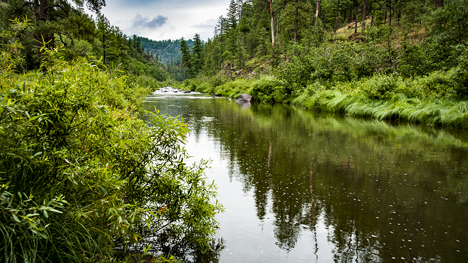
You’ll reach a fork at Mile 4.5; go left to stay on FR 26. Then, at Mile 9.7, turn right onto Forest Road 24, which crosses another meadow before diving back into the pines. Three miles past that intersection is Buffalo Crossing, a bridge over the East Fork of the Black River. You can park here, dip your toes in the water and enjoy the surrounding greenery. Just past the bridge, turn left onto Forest Road 25, which will take you the rest of the way.
The route reaches another riparian area at Mile 14.1, when it crosses the river’s West Fork. After a series of ponderosa-lined meadows and creek crossings, you’ll begin to get a look into the steep-walled canyon through which the Black River flows. The road offers a great view, but keep an eye out for Forest Road 416, on the left, around Mile 24.5. This rugged road is not suitable for passenger cars, but you can park and make the 1-mile hike to the canyon’s rim for an even better perspective.
Bighorn sheep and peregrine falcons are frequent visitors to the canyon, and if you’re lucky, you might see a black bear or an endangered Mexican gray wolf. Keep an eye out as you continue on FR 25 and descend into the canyon. Finally, at Mile 27.3, you’ll reach Wildcat Crossing, which traverses the Black River itself. Depending on the season, you could see people camping along the river’s banks or splashing in its cool water. It’s the high point of the drive. But also the low point. It’s at the bottom of a canyon, after all.
The remaining 14.5-mile stretch of FR 25 was more heavily impacted by the Wallow Fire, but it offers additional views of the canyon as you climb out. And its young aspens, springing up to fill the void left by the blaze, are sure to attract elk. So, if you’re still looking for animals, keep those binoculars handy. You never know what’s around the next bend in the road.
Note: Mileages are approximate.
Length: 41.8 miles one way (from U.S. Route 191)
Directions: From Alpine, go south on U.S. Route 191 for 14 miles to Forest Road 26. Turn right (west) onto FR 26 and continue 9.7 miles to Forest Road 24. Turn right onto FR 24 and continue 3.2 miles to Forest Road 25. Turn left onto FR 25 and continue 28.9 miles to U.S. 191 south of the starting point.
Vehicle requirements: None in good weather.
Warning: Back-road travel can be hazardous, so be aware of weather and road conditions. Carry plenty of water. Don’t travel alone, and let someone know where you are going and when you plan to return.
Information: Alpine Ranger District, 928-339-5000 or www.fs.usda.gov/asnf