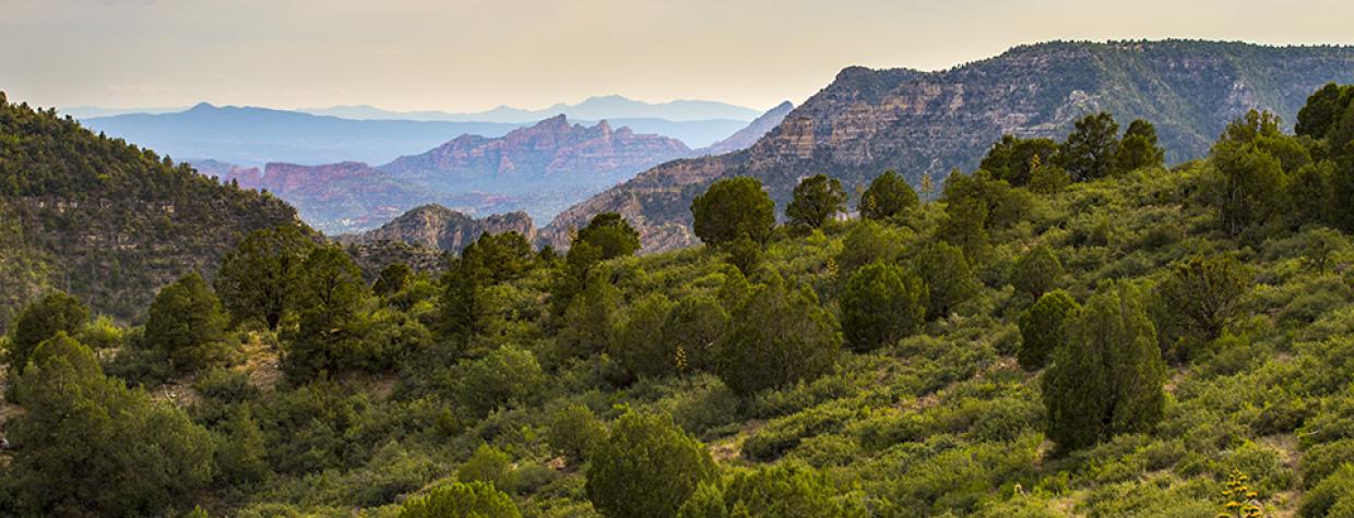
Sycamore Canyon, Flagstaff
The phrase “old cabin in the woods” typically conjures something idyllic. The kind of place where Robert Frost might have holed up with a typewriter. Winter Cabin is not that. At its best, it was rudimentary, just a shelter that checked the box on the lowest level of Maslow’s hierarchy of needs. Today, it’s the namesake of a hike that winds through the Sycamore Canyon Wilderness. The cabin is still intact, somewhat, but the payoff is the panorama you’ll have all to yourself, once you get out of the woods. First, though, you’ll have to get to the woods.
The main road to the trailhead is Forest Road 538, the same rugged road that leads to the Secret Mountain Trail. Even in dry weather, the ruts can be a deterrent. Throw in some snow or rain and they become murky moats just waiting to ruin your day. However, if you use your head and a low gear, you should be fine.
From the small, dirt parking area at the trailhead, the route immediately drops into the wilderness, which protects 58,441 acres in the state’s second-largest canyon. It’s a beautiful woodland of Gambel oaks and ponderosa pines. Mixed in, at ground level, are dollops of exposed rock and a curious number of fallen trees. After about 15 minutes, the trail levels off a little and passes a hefty alligator juniper on the left. To the right is a deep wash, one of many in the forest. Of course, where there’s water, there’s wildlife, including black bears, mountain lions, mule deer and ringtails. Deer are your best bet. Deer and birds — birds provide the soundtrack along this stretch.
A few minutes later, the trail descends again as the trees get bigger. Or thicker, anyway. The oaks are short and stout, like offensive linemen. Before long, you’ll arrive at an intersection with the Hog Hill Trail, which climbs to the northeast, toward Casner Tank. Keep left, count to a hundred, and you’ll arrive at Winter Cabin. To the right is a short spur that leads to Winter Cabin Spring. Check it out.
Back on the main trail, which is behind the cabin, you’ll quickly come to an intersection with the Kelsey Trail. There are several trails in the area. Kelsey climbs to the northwest, where it connects with the Dorsey Trail and becomes the Kelsey-Dorsey Loop. Keep left at the junction and continue downhill. In the vicinity is a massive gator, and just past it you’ll get your first glimpse of the open space surrounding the big canyon. There are mountains on the horizon and junipers all around. Your instincts will suggest that you’re headed toward the open space, but instead, the route veers left and follows a high ridge that looks down into a lush, green canyon. Just beyond the ridge, the trail breaks free of the forest and creeps onto a slope of tangled shrubs and thorny bushes. It’s rocky, too, so keep your eyes (and ears) peeled for rattlesnakes.
As you work your way southwest, look left. Somewhere out there is Turkey Butte Lookout, a fire tower, and in between is a beautiful landscape that not many get to see. And that’s just the beginning. The best view is another 10 minutes downhill. That’s where, in the distance, you’ll first see the red rocks of an unnamed ridge that extends south from the northwest rim of Sycamore Canyon. That pano-rama sticks around as you approach a side route to Ott Lake, which is a small pond, usually dry, about a quarter-mile to the right.
Although the trail continues for a few more miles to Sycamore Creek, this listing ends at the turnoff to the “lake.” Like the cabin for which it’s named, the Winter Cabin Trail can get a little rough as it descends onto Buck Ridge and down to the bottom, especially if the trail crews haven’t been around in a while. If you’re feeling adventurous, give it a shot. Otherwise, sit back and enjoy the view. You’ll likely have it all to yourself.
Length: 5 miles round-trip (to Ott Lake)
Difficulty: Moderate
Elevation: 6,850 to 5,997 feet
Trailhead GPS: N 35˚01.404', W 111˚55.418'
Directions: From the intersection of Milton Road and Historic Route 66 in Flagstaff, go west on Route 66 for 1.9 miles to Forest Road 231 (Woody Mountain Road). Turn left onto FR 231 and continue 13.8 miles to Forest Road 538. Turn right onto FR 538 and continue 8.8 miles to Forest Road 538H. Turn right onto FR 538H and continue 0.5 miles to the trailhead.
Vehicle Requirements: A high-clearance vehicle is required.
Dogs Allowed: Yes (on a leash)
Horses Allowed: Yes, but the trail is not suitable for horses beyond Ott Lake.
USGS Map: Sycamore Point
Information: Flagstaff Ranger District, 928-526-0866 or www.fs.usda.gov/coconino

