
Prescott National Forest, Jerome
In the same way that a 2005 Pine Ridge cabernet sauvignon pairs nicely with filet mignon, this scenic hike in Central Arizona complements a day trip to Jerome. Or vice versa. The pairing isn’t necessary, of course, but the trailhead is just up the road, and the hike itself is quick and easy. So, even if you like to mosey along and make a lot of photographs, you could still hit the trail mid-morning and be back in Jerome in time for lunch.
No matter how you end the day, the trail begins just west of the Summit Picnic Area at Mingus Pass. For the first mile or so, the route follows an old jeep road surrounded by alligator junipers, piñon and ponderosa pines, Gambel oaks and a forest floor covered with pine cones. It’s pleasant, and the trail is easy to follow.
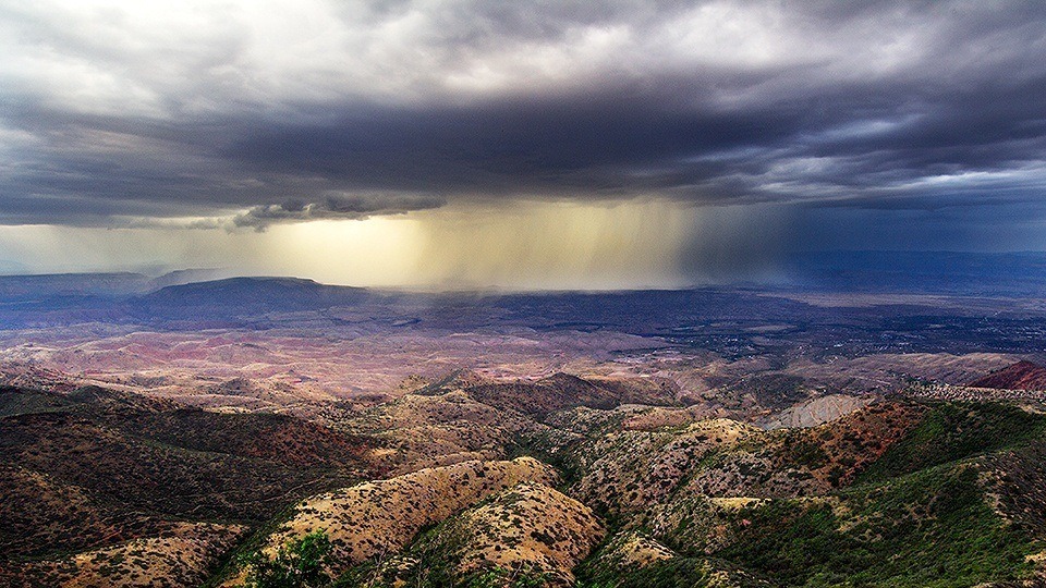
After a few minutes, the trees open up and offer a glimpse of what you’ll be seeing on and off throughout the hike: spectacular views of the Verde Valley, Sedona, Sycamore Canyon, the Mogollon Rim and the San Francisco Peaks. A few minutes later, you’ll look down on State Route 89A, which is the winding road you followed uphill from Jerome. The views are impressive, and they get even better when you arrive at a narrow, treeless saddle that lets you see in several directions — to the southwest are Chino Valley and the Juniper Mountains.
As you cross the saddle, the trail climbs slightly, and then steeply, as it winds back into the woods. After a brief respite of level terrain, the route drops downhill to another small saddle. In addition to the other landmarks to the north, you’ll also see Kendrick Peak. Enjoy the views, but don’t forget to look down, too. Most of this stretch has a northern exposure, so there might be some lingering snow and ice in the spring. Watch your step.
Continuing downhill, you’ll see a faint trail that comes in from the right. Around the same time, you’ll start climbing again. Then, after 45 minutes of overall hiking, you’ll arrive at the boundary of the Woodchute Wilderness. The wilderness area gets its name from the mountain, which got its name from a large wooden chute that was built to shuttle ponderosa logs down the north slope to a narrow-gauge railroad that once served Jerome — the trees were used for tunnels in the underground mines.
Of the many wilderness areas in Arizona, Woodchute is among the smallest. In all, it protects only 5,887 acres, but within that space, you might see black bears, elk, mule deer, white-tailed deer, mountain lions, bobcats, rock squirrels, gray foxes, golden eagles and bald eagles. You’ll see meadows, too. The most impressive forms a lush boundary around Woodchute Tank, which can be accessed along the Rick Tank Cutoff Trail — you’ll see an intersection with that trail just minutes into the wilderness.
From the junction, the Woodchute Trail continues through a beautiful forest — this is the best part of the hike — and then begins a steep climb (about 400 feet in elevation) to the mountaintop. It’s a slow ascent, without a lot of switchbacks. However, after about 10 or 15 minutes of plodding, you’ll arrive on a mesa (of sorts) that’s marked by a grove of young ponderosas. The trekking is easy as you amble west to an unmarked intersection.
If you have the time, and the stamina, the Woodchute Trail continues for a few more miles to a trailhead off of Forest Road 318A. Backpackers tend to carry on; however, day hikers usually veer right where the trail splits and continue another 200 yards to the north rim of the mountain. The views from the edge are even better than the views along the way. Make a few photos, and then make your way back to Jerome, where you can reinstall the calories you burned off on the trail. Somewhere in town, no doubt, there’s a decent steak. You might not find a Pine Ridge cab to go with it, but Caduceus Cellars (Maynard James Keenan’s winery) has a tasting room on Main Street. And, like the views along the trail, it’s impressive.
Length: 7.2 miles round-trip
Difficulty: Moderate
Elevation: 7,145 to 7,488 feet
Trailhead GPS: N 34˚42.938', W 112˚09.610'
Directions: From the fire department in Jerome, go south on State Route 89A for 7.6 miles to Forest Road 106 (unmarked), which is located across from the Summit Picnic Area at Mingus Pass. Turn right onto FR 106 and continue 0.3 miles Forest Road 106D. Turn left onto FR 106D and continue 0.7 miles to the trailhead. (Note: You will pass a parking area after 0.1 miles on FR 106D. This is not the trailhead parking area. The trailhead is 0.6 miles farther down the road.)
Vehicle Requirements: None
Dogs Allowed: Yes
Horses Allowed: Yes
USGS Maps: Hickey Mountain, Munds Draw
Information: Verde Ranger District, 928-567-4121 or www.fs.usda.gov/prescott