
Apache-Sitgreaves National Forests, White Mountains
If East Baldy and West Baldy are Lennon and McCartney, then Baldy Crossover is George Harrison. It’s the quiet trail — the trail that lives in the shadow of the White Mountains’ marquee hikes. While the first two offer a distant summit and the subsequent notch in the belt, the Mount Baldy Crossover Trail is less ornamental. No big vistas. No ancient ruins. No unlikely waterfalls. But it woos you, nonetheless, with its alpine nature and its standing offer of solitude. It’s the epitome of a gorgeous walk in the woods.
Unlike most hikes, this one doesn’t have a traditional trailhead. Instead, you have to access it from either the East Baldy Trail or the West Baldy Trail. The east side makes for a shorter overall route; however, the approach from the west is more scenic. What’s more, you’ll want as many miles as you can get in the White Mountains — the climate is cool and wet, and the summertime temperatures are usually in the 70s.
From the trailhead, the West Baldy begins with a slight uphill climb through some pines and aspens before heading downhill through a series of wide meadows. After about 15 minutes, the West Fork of the Little Colorado River makes its first appearance. The river, which is dotted with beaver dams, parallels the trail at this point. Five minutes later, you’ll enter the Mount Baldy Wilderness. Looking around, you’ll understand why this area was granted the ultimate protection. In all, 6,814 acres have been declared off-limits to “human habitation.”
Just beyond the wilderness boundary, after about a mile of hiking, the West Baldy Trail intersects the Crossover Trail. From the junction, it’s 3.56 miles to East Baldy.
Almost immediately, the Crossover Trail jumps the Little Colorado, leaves the meadow and enters a thick forest of corkbark firs, ponderosa pines, white firs and Engelmann spruce. The route also begins a gradual uphill with the help of some moderate switchbacks. As you wind through the woods, don’t be surprised if you run into Julie, Jeff or one of the other wildlife experts at the Arizona Game and Fish Department. In recent years, Mexican wolves have been traced to this area. While encounters are rare, wolves (and other large mammals) can be dangerous if startled, or if they feel you’re a threat to their young or their food. Sing, whistle, whatever ... it’s a good idea to make some noise.
No doubt, seeing a wolf would be thrilling, but it’s probably not going to happen. However, you might see black bears, elk and mule deer. And you’ll definitely see a massive, old-growth fir after about 10 minutes on the trail. After another 10 minutes, you’ll hit the high point (9,580 feet) of the hike. Ferns and a few aspens start showing up, too.
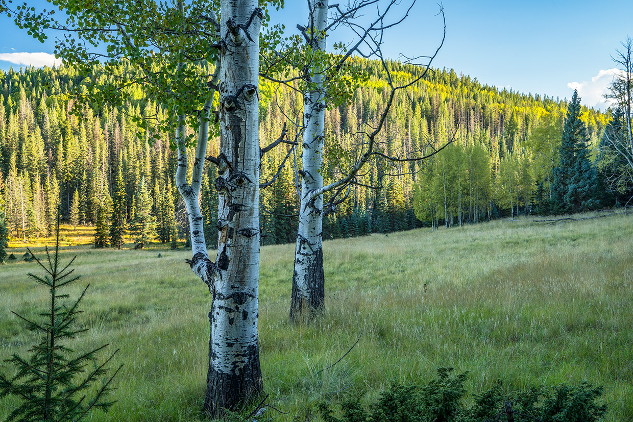
The rest of the route is a moderate descent that winds past an impressive, two-trunk Douglas fir and some large boulders. Beyond the rocks and trees, and to the right, you’ll get a glimpse of one of the many meadows along the trail. A few minutes later, you’ll be standing in the meadow, thinking: If I were a homesteader, this is where I’d sink some roots.
Continuing on, the trail crosses the long meadow, which is about 75 yards wide and maybe a half-mile long, and re-enters the woods. There’s a slight uphill, and then it’s downhill again to another meadow that’s split by a small stream. From there, the pattern repeats itself — forest, meadow, forest, meadow — until, after more than an hour of hiking on the Crossover Trail, you’ll end up in a nice grove of aspens.
After the grove, the trail passes through a gate and intersects the East Baldy Trail. The trailhead is about a quarter-mile to the east, near the Gabaldon Campground. With a car-shuttle system, you could be done at this point. It’s not a hardship, though, to retrace your steps back to the other side. Although it’s overshadowed by its celebrated neighbors, the Mount Baldy Crossover Trail is every bit as scenic. And it’s quiet, too, without the pressure of long distances and steep switchbacks. There’s something in the way it woos you. You’ll see.
Length: 9 miles round-trip
Difficulty: Moderate
Elevation: 9,287 to 9,580 feet
Trailhead GPS: N 33˚57.888', W 109˚30.071'
Directions: From Eagar, go west on State Route 260 for 18.7 miles to State Route 273. Turn left (south) onto SR 273 and continue 8.6 miles to the trailhead at Sheeps Crossing.
Vehicle Requirements: None
Dogs Allowed: Yes
Horses Allowed: Yes
USGS Maps: Mount Baldy, Big Lake North
Information: Springerville Ranger District, 928-333-6200 or www.fs.usda.gov/asnf