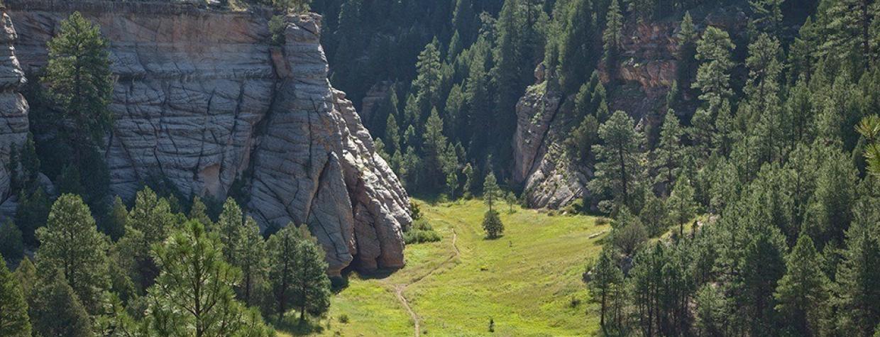
Coconino National Forest, Flagstaff
If you do a Google search for “how long is the Arizona Trail,” you won’t find an exact number. Not without some digging. Most reliable sources mark it at “800-plus” miles. Even the Arizona Trail Association rounds it off to 800. That’s because there are two “alternate” routes along the trail. One at Pusch Ridge in the Santa Catalina Mountains. And one in Flagstaff. They were built — in the spirit of the trail — as a way of avoiding city traffic and “maximizing the experience of Arizona’s landscape.” The bypasses can throw off the math. In addition, the trail is continually being groomed, which affects the overall distance. So, if you’re counting, the AZT is about 800 miles long. Give or take.
The Walnut Canyon Trail (an unofficial name that we’ve assigned) is a segment of the “Flagstaff bypass,” and it begins at a well-marked trailhead along Old Walnut Canyon Road. What you’ll see when you get there is a healthy, open forest of ponderosa pines. The trail is a mix of rock and dirt, and the floor is covered with too many pine cones to count.
About five minutes into the woods, Humphreys Peak makes its first appearance. Look to the northwest. Then, about a minute later, the AZT intersects the Campbell Mesa Trail. The terrain at this point is mostly level. Twenty minutes later, however, the trail switches downhill into a small side canyon, where the trees get thick and the forest gets dark. The bottom is shady and cool, and the fresh smell of the pines is intense. So are the sounds of the birds.
From the bottom, the trail climbs up the other side and eventually intersects a short spur trail that runs 0.2 miles to a scenic viewpoint, where you’ll get a beautiful look into Walnut Canyon. The canyon, which is 20 miles long, 400 feet deep and a quarter-mile wide, was carved by Walnut Creek over a period of 60 million years, and within its winding walls are an abundant mix of plants and animals — you’ll see signs of mule deer all day. Just east of the viewpoint is Walnut Canyon National Monument, where, from around 1100 to 1250, ancient Sinaguans constructed the cliff dwellings that are now protected by the national monument. If you don’t make the detour on the way out, be sure to hit it coming back.
Back on the main trail, enjoy the views of Humphreys Peak and settle in. The terrain remains about the same for the next 25 minutes, at which point you’ll intersect another spur (0.7 miles) to another scenic viewpoint. Although the forest is made up of mostly ponderosas, there are some Gambel oaks, too, and this is where they really start showing up.
Continuing southwest, you’ll come to a short side trail that leads to Forest Road 301. It’s accompanied by a massive, old-growth ponderosa. The tree is lying dead on the ground, but it makes its presence known. So do the misanthropic Steller’s jays, which never seem to stop yelling at the uninvited interlopers.
Turn left at the big tree. A few minutes later, the trail dips toward another side canyon but never goes in. Instead, it skirts the edge and starts a gradual climb. As you inch your way up, you’ll start glimpsing Walnut Canyon through the trees to your left. Then, all of a sudden, there it is. A big opening with even bigger views. It’s a quick look, however, as the trail immediately peels away from the rim.
For the next 20 minutes, you’ll wind through the woods and arrive at another short spur to a forest road. Just beyond it, the AZT makes a turn toward Marshall Lake. Instead of making the turn, stay left for about 200 yards to Fisher Point, which is the turnaround point and the payoff for this hike. Plan on spending some quality time there. The point is one of the highlights of the Arizona Trail, which, if you’re counting, continues south for another 580 miles. Give or take.
Length: 13.4 miles round-trip, not including spur trails to scenic viewpoints
Difficulty: Moderate
Elevation: 6,735 to 7,033 feet
Trailhead GPS: N 35˚10.816', W 111˚31.928'
Directions: From Interstate 17 in Flagstaff, go east on Interstate 40 for 5.5 miles to Country Club Drive (Exit 201). Turn right onto Country Club Drive and continue 0.8 miles to Old Walnut Canyon Road (Forest Road 303). Turn left onto Old Walnut Canyon Road and continue 3.5 miles to the trailhead parking on the right. (Note: All but the first 0.4 miles of Old Walnut Canyon Road are dirt, and it can be rugged in places.)
Vehicle Requirements: A high-clearance vehicle is recommended.
Dogs Allowed: Yes
Horses Allowed: Yes
USGS Map: Flagstaff East
Information: Flagstaff Ranger District, 928-526-0866 or www.fs.usda.gov/coconino

