
Coronado National Memorial, near Benson
Coronado National Memorial isn’t the smallest national park in the state, but compared with some of the others — Organ Pipe, Petrified Forest, Grand Canyon — it’s definitely on the smaller side. What it lacks in acreage, however, it makes up for in history. And it begins with the name: Coronado.
The location of the park, Joseph P. Sanchez writes in his book Coronado National Memorial, “was predicated on a route determined by historians to be near the place where explorers of the Coronado expedition (1540-42) entered present-day United States from Mexico.” Thus, the park. The history, though, goes deeper than that. According to Sanchez, the area was also a “focal point where Spanish and Mexican period miners and ranchers, Native Americans, early Anglo-American mining entrepreneurs and homesteaders crossed paths.”
Although its history is colorful, the park itself is quiet, with just over 100,000 visitors a year. Most of those folks are drive-throughs. And some are hikers.
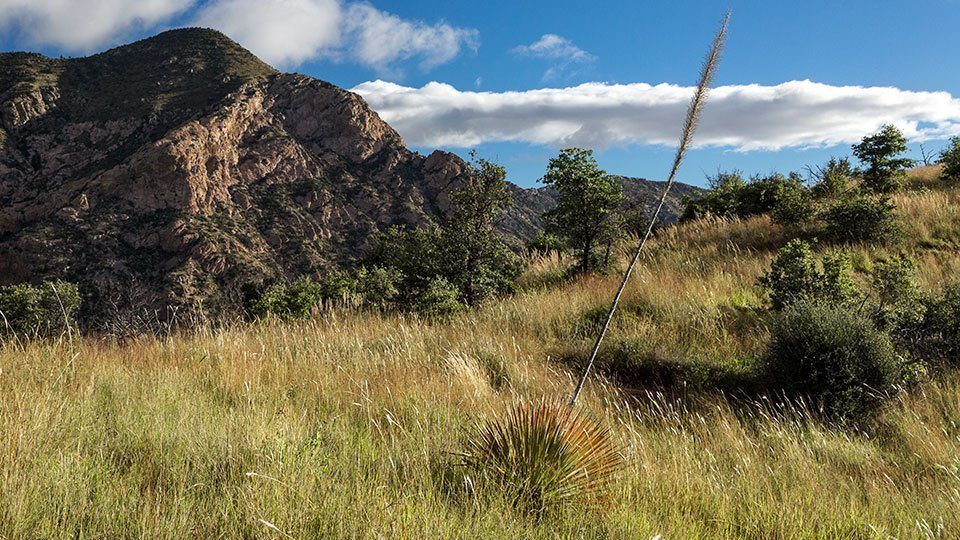
Of the five trails in the park, Joe’s Canyon is arguably the best. It begins near the visitors center, along a well-maintained track of dirt and rock. The climb starts with your first step, and within a few more, you’ll see Montezuma Peak to your right — at 7,676 feet, it’s the highest point in the park. About 10 minutes later, the trail veers slightly left, and up ahead, you’ll see a saddle-like ridge that separates the east and west ends of the trail. In the space between, you’ll pass chollas, manzanitas and waves of grass punctuated by wildflowers.
Just beyond the turn, the trail crosses a narrow wash that feeds a string of hardy Arizona white oaks. That’s followed by a series of long zigs and zags. The track here is rocky, and as you approach the ridge, you’ll skirt the base of a steep wall. Look for Mexican jays, which are rare in the U.S., and Lucifer hummingbirds, an elusive Mexican species that shows up in the summer. The park has coatimundis, too, but the chances of seeing any are slim.
After 30 minutes of overall hiking, you’ll arrive at the ridge. From there, the climb continues, but it’s more gradual as the trail moves past an impressive alligator juniper, crosses a wash and arrives at a high point. Look south. The spectacular views will make you wonder: Is that really Mexico? It’s so green. It looks more like Ecuador. Indeed, it’s hardly the stereotype that misrepresents the terrain along the border.
Moving on, you’ll get a glimpse of the narrow road that winds through the park and come to an intersection with the Yaqui Ridge Trail, which descends steeply for 1 mile to the U.S.-Mexico border. You’ll know you’re there when you reach International Boundary Marker 102. The old post marks the starting point of the Arizona Trail. If you have the time, it’s a worthwhile detour.
Back at the intersection, the trail continues northwest toward Montezuma Pass. Looking around, you’ll get a good sense of the botanical diversity of the park. The low valleys are dotted with fairyduster shrubs and honey mesquite trees. Higher up are the open oak woodlands that shelter silk tassel, sumac and mountain mahogany. Agaves, yuccas and sotols grow on the rocky hillsides. And in every direction are the grama grasses that come alive with the summer rains. It’s so green.
The final push to Montezuma Pass takes about 15 minutes. From there, it’s another 600 yards to Coronado Peak, which, at 6,864 feet, is the highest point on the trail. It’s also the turnaround point for this hike. However, unless there’s lightning in the sky, you’ll want to linger. The peak is perhaps the best place to think about the man for whom the park is named. And, frankly, that’s as close as you’ll ever get to Francisco Vázquez de Coronado. Unlike other historic parks, this one is without artifacts or visible remains. So, instead, you contemplate history. You squint your eyes and try to imagine Coronado and his legion of men making their way to Arizona. Or, if that doesn’t interest you, you can simply enjoy the view. The vistas from the peak are unsurpassed.
Length: 6.2 miles round-trip
Difficulty: Moderate
Elevation: 5,231 to 6,864 feet
Trailhead GPS: N 31˚20.761', W 110˚15.218'
Directions: From Benson, go south on State Route 90 for 31.7 miles to Hatfield Street in Sierra Vista. Turn left to stay on SR 90, which later becomes State Route 92, and continue 13.5 miles to State Route 83 (South Coronado Memorial Road). Turn right onto SR 83 and continue 4.7 miles to the Coronado National Memorial visitors center.
Vehicle Requirements: None
Dogs Allowed: No
Horses Allowed: No
USGS Map: Montezuma Pass
Information: Coronado National Memorial, 520-366-5515 or www.nps.gov/coro