
Unless you’re Rob Krar, extreme trail running is ill-advised. For Krar, an elite endurance athlete who lives in Flagstaff, it’s a way of life — he once ran from rim to rim to rim (41.2 miles) at the Grand Canyon in 6 hours, 21 minutes and 47 seconds. For average hikers, though, it’s a bad idea. The human body isn’t generally equipped to tackle rugged terrain at breakneck speeds — you’d be better off blasting your kneecaps with a Louisville Slugger. That said, there are always exceptions. And the Woods Canyon Trail, the southernmost route in the Sedona area, is one of them.
The hike begins at the Red Rock Ranger Station, which is located along State Route 179 about halfway between Interstate 17 and uptown Sedona. Not only is it an easy-to-find launchpad for the hike, but the station also offers a great introduction to the area with educational displays about geology, human history and the seven biotic communities found in the surrounding landscape. The restrooms are clean, too. And that’s not a thing to take for granted.
From the south end of the parking lot, the well-graded and easy-to-follow trail drops down and heads east. After a few minutes, it arrives at a log that serves as a connecting point to the other side of Dry Beaver Creek, which may or may not have water in it. Despite the moisture level of the creek, the landscape will likely include Herefords, whose orange-red hides match the red dirt of the initial stretch of trail. A few minutes later, you’ll come to a gate, beyond which is an old jeep road. By the time you’ve closed the barrier, the sounds of SR 179 will have disappeared and the striking mesas ahead will be grabbing your attention, along with the wide-open trail — Rob Krar or not, it’s on this stretch that you’ll really feel like running.
About 20 minutes later (less time if you decide to run), after having crossed a few small washes, you’ll come to a trail register and a larger wash that’s home to some beautiful Arizona sycamores. As always, use caution when entering wash areas, especially on cloudy days.
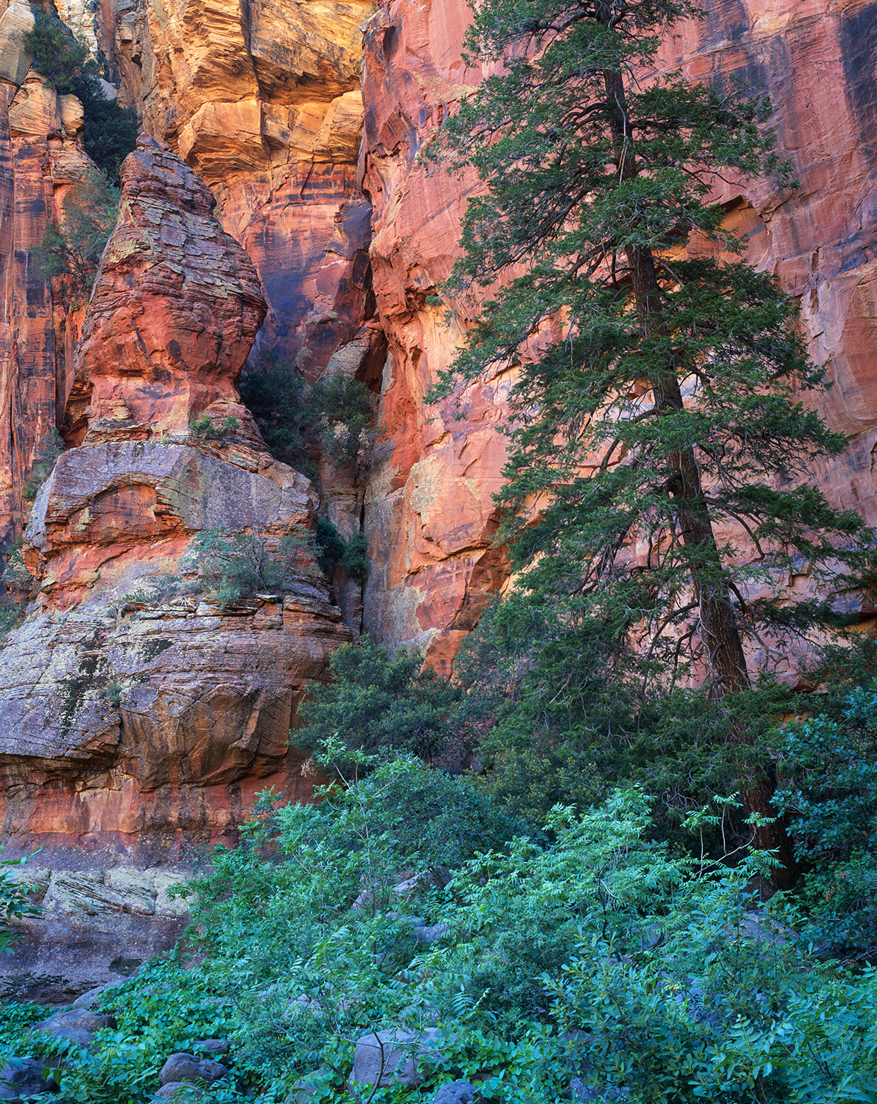
Moving along, the trail hugs the wash for a few hundred yards before passing through a cattle gate and a barbed-wire fence. Up ahead, you’ll see an intersection. The Horse Mesa and Hot Loop trails go left, and the Woods Canyon Trail veers right. Five minutes later, you’ll cross into the Munds Mountain Wilderness, which protects 18,109 acres, and catch your first glimpse of the beautiful red rocks. Unlike some of the more famous trails to the northwest, this trail isn’t dominated by the picturesque geology that epitomizes Sedona. Instead, the highlight is a beautiful riparian area that includes sagebrush and desert grasses at the lower elevations, followed by scrub oaks, manzanitas, piñon pines and junipers as you climb. Then, after about an hour, the Arizona cypresses and ponderosa pines start showing up.
As beautiful as the trees are, the best part of the trail actually begins about a quarter-mile farther, where Rattlesnake Canyon merges with Woods Canyon. At this point, the trail dips into the enormous, boulder-strewn wash of Dry Beaver Creek, where you’ll come to the first of two good-sized pools. Your best photos of the day will be made from atop one of the Frigidaire-sized rocks in this area. Although the scenery is spectacular, keeping tabs on the trail can be a little tricky. Stay left along the wash and you’ll see the trail within a few minutes.
From there, the route climbs gradually to a point, about 100 feet above the creek, where the hike’s most prominent red rocks come into view. It moves up and down again before arriving at what the locals call “the big pool” — it can be up to 300 feet long when the weather cooperates. The pool marks the end of the trail. For the average person, it makes for a decent day hike. However, if you’re feeling adventurous and you have some extra time, you can extend the hike by boulder-hopping through the thickets of Woods Canyon all the way to Interstate 17. It won’t put you on par with Rob Krar, but it will elevate your stature beyond that of an average hiker.
Trail Guide
Length: 9.8 miles round-trip
Difficulty: Easy
Trailhead GPS: N 34˚45.371', W 111˚45.793'
Elevation: 3,905 to 4,165 feet
Directions: From Sedona, go south on State Route 179 for approximately 8.5 miles to the Red Rock Ranger Station. The trailhead is at the south end of the parking lot.
Vehicle Requirements: None
Dogs Allowed: Yes (on a leash)
Horses Allowed: Yes
USGS Maps: Munds Mountain, Sedona
Information: Red Rock Ranger District, 928-203-2900 or fs.usda.gov/coconino