

Prescott National Forest
Conventional wisdom suggests that any trail located a stone’s throw from a federally designated scenic road is probably worth a look. There might be exceptions, but the Yaeger Canyon Loop isn’t one of them. In fact, if the measure of an excellent hike is a combination of scenery, degree of difficulty and accessibility, this 6-mile route ranks way up there.
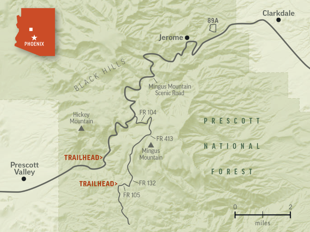
There are two trailheads. One is in the woods, surrounded by picture-perfect campsites. The other is conveniently located along the east side of Mingus Mountain Scenic Road, which was designated in 1992 and runs for 12 miles from Prescott Valley to Jerome. There’s plenty of parking at both locations. And, like most loops, you can hike this route in either direction. The locals suggest counterclockwise from the scenic road — to get the big climb out of the way early.
From the parking area, the trail drops into and out of a wash, and begins a loop that’s made up of three trails: Little Yeager Canyon (No. 553), Yeager Cabin (No. 111) and Yeager Canyon (No. 28). The first leg is Little Yeager Canyon, a well-worn single track that follows a series of switchbacks up the south-facing slope of Mingus Mountain.
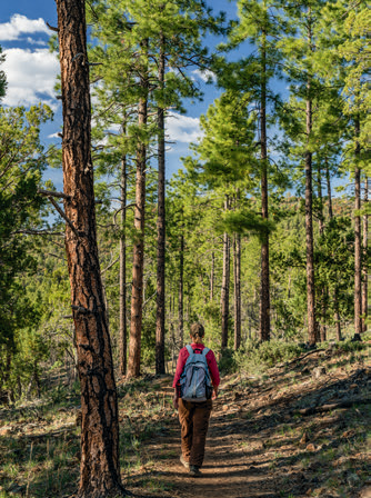
After crossing a cattle guard, the gradual ascent begins. No warmup. About 10 minutes in, the trail moves into the trees — small oaks, ponderosas and alligator junipers. If you turn around and look to the northwest, you’ll see Hickey Mountain — one of the highest peaks in the Black Hills.
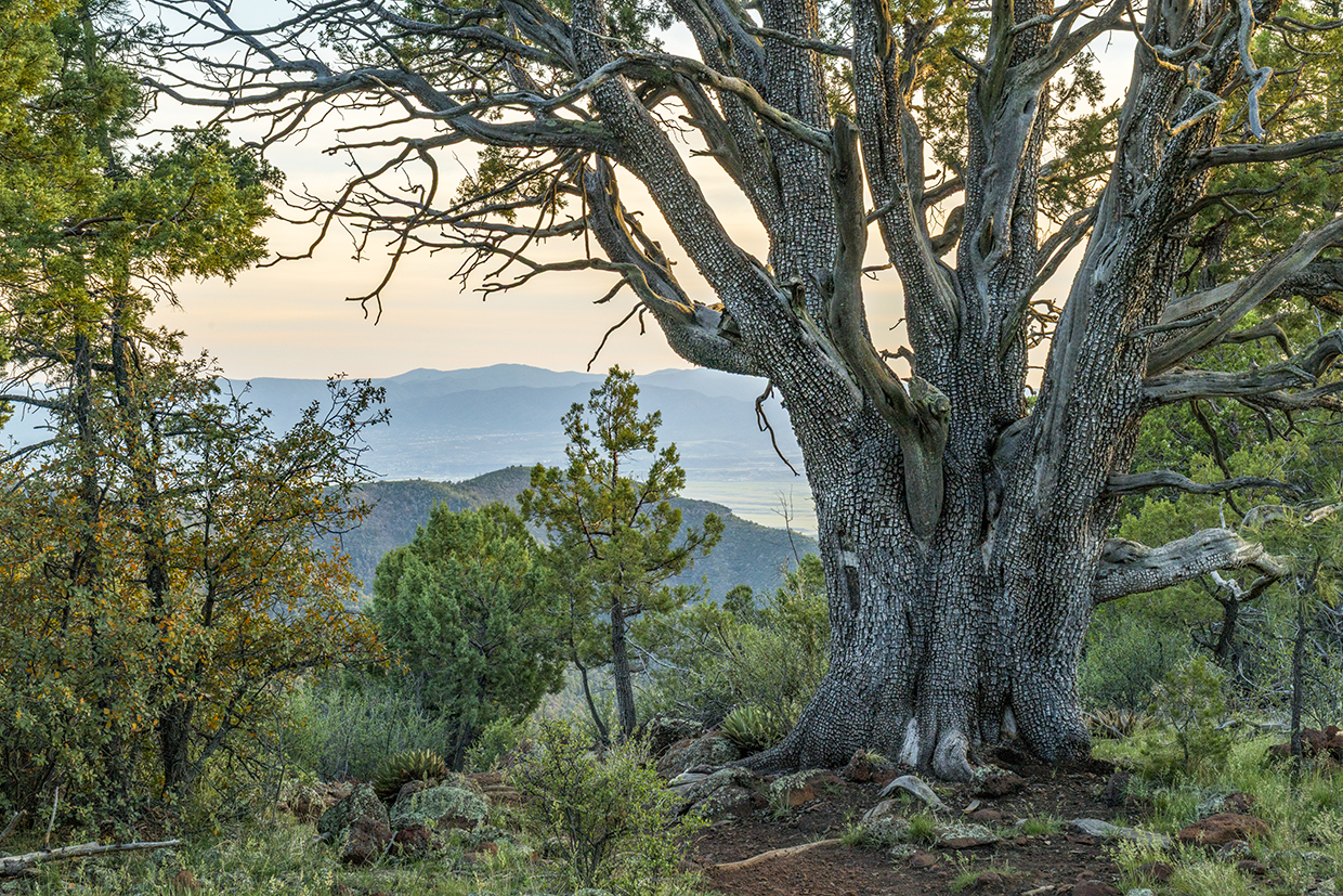
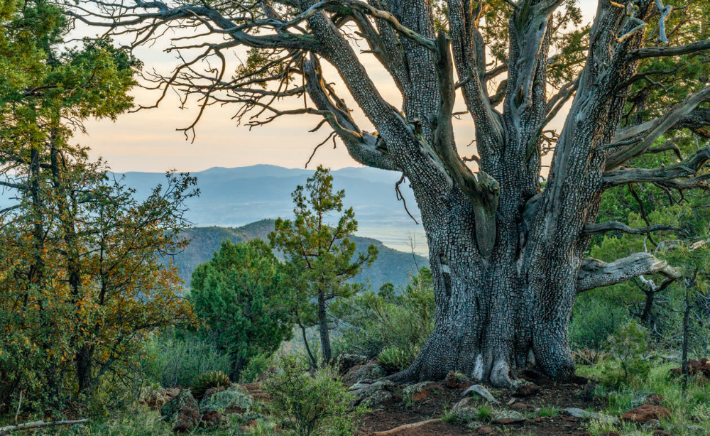
The canopy comes and goes for the next half-mile. After that, the forest takes over and the trail arrives at a short spur that leads to a lookout point. Take a peek, resume the climb, and watch your step. The trail gets rocky as it approaches the first big gator. Five minutes later, there’s an even bigger gator. It’s not as big as the monsters on Granite Mountain, but it makes a statement.
From there, the trail climbs to a small saddle (6,855 feet) and shifts downhill for a few hundred yards to an intersection with Forest Road 105, which marks the end of Little Yeager. There's no sign to point the way, but if you veer left and follow the road for about five minutes, you'll come to the other trailhead. To the left is a barbed-wire fence with a yellow sign that reads: “Please! Close the Gate.” That gate marks the beginning of the Yeager Cabin Trail.
The old cabin is long gone, but in the early 1900s, it was a shelter for Harlow and Louis Yaeger (spelled differently than the trails), a couple of well-known brothers who ran sheep in the area. Tragically, on May 9, 1911, Louis was murdered south of the canyon by Alexander Gallegos. According to The Coconino Sun, Yaeger, “one of Arizona's most prominent sheepmen, and popular with all, irrespective of class, was a victim of the murder-mania of a sheepherder in whose drink-crazed mind raged the devil of revenge.” A few weeks later, on July 28, Gallegos was sent to the gallows in Florence.
Today, Yaeger Canyon, named for Louis, is a lush riparian area thick with hardwoods. In the summer, they provide a respite from the sun. In the fall, a canopy of color. And in November, if you're lucky, a dusting of snow. There's wildlife, too, including mule deer, black bears, pumas and all kinds of birds. Look and listen for yellow-rumped warblers, rock wrens, verdins, western wood-pewees and Hutton's vireos.
The Cabin Trail — the best section of the loop — winds through this wonderland. It takes about a half-hour to get from one end to the other. In between you'll enjoy the epitome of “a walk in the woods,” cross a wash, hit a couple of sharp switchbacks, pass Young Seep Spring and arrive at the high point of the loop (7,187 feet). It's there you'll connect with the Yeager Canyon Trail.
Like a bobsled run built long ago, the last leg is a winding, bumpy descent, all downhill, back to the trailhead. Your knees won't like it, but the views to the south, east and west are spectacular. It's what you'd expect a stone's throw from a scenic road.
ADDITIONAL READING: For more hikes, pick up a copy of Arizona Highways Hiking Guide, which features 52 of the state's best trails — one for each weekend of the year, sorted by seasons. To order a copy, visit www.shoparizonahighways.com/hikingguide
Trail Guide
Length: 6.25-mile loop
Difficulty: Moderate
Trailhead GPS: N 34°40.773', W 112°10.348'
Elevation: 6,029 to 7,187 feet
Directions: There are two trailheads. For the scenic option, go south from Jerome on State Route 89A for 7.6 miles to Forest Road 104 at Mingus Pass (elevation: 7,023 feet). Turn left onto FR 104 and go 1.3 miles to Forest Road 413. Turn right onto FR 413 and go 1.4 miles to Forest Road 132. Turn right onto FR 132 and go 0.4 miles to Forest Road 105. Turn right onto FR 105 and go 0.4 miles to the trailhead on the right. For the convenient option, go south from Mingus Pass on State Route 89A for 3.2 miles to a pullout on the east side of the highway.
Vehicle Requirements: None
Dogs Allowed: Yes (on a leash)
Horses Allowed: Yes
USGS Map: Hickey Mountain
Information: Verde Ranger District, 928-567-4121 or www.fs.usda.gov/prescott
LEAVE-NO-TRACE PRINCIPLES:
• Plan ahead and be prepared.
• Travel and camp on durable surfaces.
• Dispose of waste properly and pack out all of your trash.
• Leave what you find.
• Respect wildlife.
• Minimize campfire impact.
• Be considerate of others.