
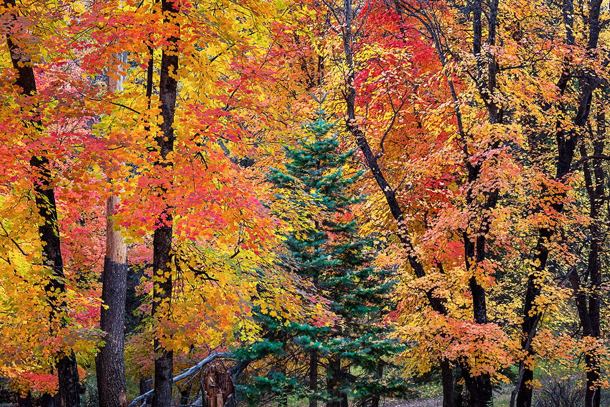
Aspens and maples. When it comes to fall color in Arizona, it seems like those two tree species get most of the attention. They put on spectacular autumn displays, but so do oaks, which grow in abundance amid the ponderosa pines atop the Mogollon Rim of Central Arizona. These trees’ yellow and orange leaves make the drive along Dane Ridge a lovely experience in October, but the abundant evergreens make it a pleasant, accessible trek through the woods at other times of year, too.
The drive begins just northeast of the Coconino National Forest’s Mogollon Rim Ranger District station, which is on State Route 87 northeast of Strawberry. Head east on Forest Road 95, a wide, smooth gravel path that passes healthy stands of ponderosas interspersed with a few oaks and junipers. The road gets more washboarded around Mile 3, then descends as it twists into an area where the oaks are more visible. Around Mile 5, you’ll get a nice view of a pine-covered ridge on the left, but for the most part, this drive is about what’s right along the roadway.
Continuing your descent, you’ll soon arrive at a one-lane bridge over East Clear Creek, which nourishes a verdant riparian area below pine-studded canyon walls. Past the bridge, turn left to follow Forest Road 96 over another narrow bridge and into Barbershop Canyon, where you’ll get excellent views of the canyon bottom on the right side of the road. The trees close in on both sides as FR 96 climbs toward the canyon’s rim, and by the time you reach a “Y” intersection with Forest Road 321, you’ll be back in a dense landscape of ponderosas
and oaks.
Bear right at the “Y” to take FR 321, which heads south as it follows Dane Ridge into a truly beautiful section of forest. The initial stretch is more of what you’ve been seeing, and that’s a good thing: Tall, thick ponderosas dominate, but large oaks also make their presence felt. The oaks then disappear for a couple of miles before re-emerging along Mile 12.5. You also might spot a few primitive campsites in this area. If you’re spending the night, be sure to use existing sites instead of creating your own.
Soon, other evergreens join the ponderosas along the road, and the deciduous trees get more diverse, too. There are maples in this area, and they combine with the oaks for a memorable show in autumn. There aren’t many aspens right along FR 321, but there’s at least one, and it’s on the left at Mile 14. A mile past that lonely aspen is an access point for the Barbershop Trail, a moderate hike that’s an excellent way to explore Rim Country.
The final stretch of FR 321 is a reprise of the ponderosas and oaks that have provided most of the scenery on this drive. But there’s one more reward in store at the end, when the road dead-ends at Forest Road 300, also known as the Rim Road. Here, you’ll get an expansive panorama of the terrain south of the Mogollon Rim, and you might spot some fall color amid the ponderosas far below. From the intersection, head left to Woods Canyon Lake and State Route 260, or go right to rejoin SR 87 south of your starting point.
tour guide
Note: Mileages are approximate.
Length: 18.2 miles one way (from State Route 87)
Directions: From State Route 87 just northeast of the Mogollon Rim Ranger District office, go east on Forest Road 95 for 6.3 miles to Forest Road 96. Turn left onto FR 96 and continue 1.9 miles to a “Y” intersection. Bear right, onto Forest Road 321, and continue 10 miles to Forest Road 300 (the Rim Road).
Vehicle requirements: A high-clearance vehicle, such as an SUV or truck, is recommended, but the route is passable in most vehicles in good weather.
Warning: Back-road travel can be hazardous, so be aware of weather and road conditions. Carry plenty of water. Don’t travel alone, and let someone know where you are going and when you plan to return.
Information: Mogollon Rim Ranger District, 928-477-2255 or fs.usda.gov/coconino