
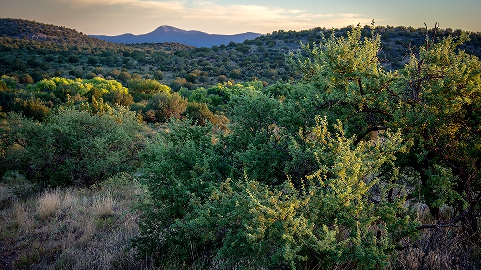
Coconino National Forest, Verde Valley
For most travelers, Interstate 17’s Exit 298 means the red rocks, aura readers and turquoise jewelers of Sedona. That’s what you’ll encounter if you head northwest from the freeway on State Route 179. To the southeast, though, you’ll find Forest Road 618, a leisurely back road that winds through Arizona prehistory and spectacular scenery on the way south toward Camp Verde.
From Sedona, head toward the freeway on SR 179, but instead of getting on I-17, keep going straight to head southeast on FR 618. Before long, you’ll reach Forest Road 119, which leads south to Montezuma Well, a National Park Service site. If you have a little extra time and a high-clearance vehicle, a visit to the ancient cliff dwellings surrounding this Arizona oddity is a fascinating detour. Otherwise, keep going straight.
Prickly pear cactuses dot the grassland as you continue southeast. You’ll cross Wet Beaver Creek on the first of several one-lane bridges, then come to the Beaver Creek Day Use Area, a popular picnicking and birding destination. Nearby is the trailhead for the Bell Trail, the only developed hiking route into the Wet Beaver Wilderness to the east. Just beyond the day use area, the pavement ends, and you’ll see the V-Bar-V Heritage Site on the right side of the road.
The site is home to the Verde Valley’s largest known collection of petroglyphs — more than 1,000 drawings, most of which were made by the ancient Sinagua people between A.D. 900 and A.D. 1350. It’s also one of the best-preserved sites in the Southwest: It used to be part of the V-Bar-V Ranch, which helped protect the rock art before selling it to the Coconino National Forest in 1994. It’s open Fridays through Mondays from 9:30 a.m. to 3 p.m.
FR 618, now a fairly well-maintained dirt road, curves to the south. This stretch is popular with runners, so if you see any, give them ample space as you pass. To the east are the national forest’s rounded buttes and rolling hills. Near the southern end of the road is Forest Road 215 (Bull Pen Road), which leads east to the boundary of the West Clear Creek Wilderness and the West Clear Creek Trailhead. The road is narrow, rough and steep in places, but if you can manage it, you’ll be rewarded with views of one of the Southwest’s most remote and beautiful waterways.
From FR 215, it’s just 2 miles farther south to State Route 260 near the sleepy town of Camp Verde, which straddles the Verde River. Eight miles to the northwest is I-17, on which you can head back to Exit 298 with a new appreciation for a road less traveled, but no less worthwhile.
Note: Mileages are approximate.
Length: 36 miles one way (from Sedona)
Directions: From Sedona, go south on State Route 179, which turns into Forest Road 618, for 28 miles to State Route 260. Turn right (west) onto SR 260 and continue
8 miles to Interstate 17 in Camp Verde.
Vehicle requirements: None in good weather for FR 618. A high-clearance, four-wheel-drive vehicle is recommended for side trips on forest roads 119 and 215.
Special considerations: A fee ($14 per vehicle, $10 after 1 p.m.) is required to park at the Beaver Creek Day Use Area. A $5 Red Rock Pass, available at many locations in Sedona, is required to visit the V-Bar-V Heritage Site.
Warning: Back-road travel can be hazardous, so be aware of weather and road conditions. Carry plenty of water. Don’t travel alone, and let someone know where you are going and when you plan to return.
Information: Red Rock Ranger District, 928-203-2900 or www.fs.usda.gov/coconino