
Apache-Sitgreaves National Forests, Alpine
"It’s not how you start; it’s how you finish.” That’s the mantra of gym teachers and campaign consultants everywhere, but it also can apply to scenic drives. Take the Blue Range Loop, a 49-mile jaunt that starts and ends in the idyllic White Mountains town of Alpine. The first leg of the loop is dotted with reminders of the worst wildfire in Arizona’s recorded history. But beyond that are pristine forest and riparian areas, plus expansive views of one of the most remote and unspoiled places in the Southwest.
From Alpine, head south on U.S. Route 191, also known as the Coronado Trail Scenic Byway, into the Apache-Sitgreaves National Forests. You’ll pass through stands of trees reduced to matchstick status by the Wallow Fire, which scorched more than half a million acres in the summer of 2011. Thankfully, Alpine and the other towns in the area were spared. And thankfully, the Wallow reminders don’t last long.
After 14 miles, you’ll head east on Red Hill Road, where you’ll see a sign warning you of primitive road conditions in the fire’s aftermath. Although the road is bumpy in spots, it’s nothing to worry about in good weather. Red Hill Road eventually curves to the southeast as it skirts the Blue Range Primitive Area — the last such area in the U.S.
About 18 miles in, a panorama of the mountainous, evergreen-covered primitive area opens up. Shortly thereafter, the road begins to wind downhill, past a group of red-rock hoodoos. The stunning views to the south continue as Red Hill Road approaches a crossing for the perennial Blue River.
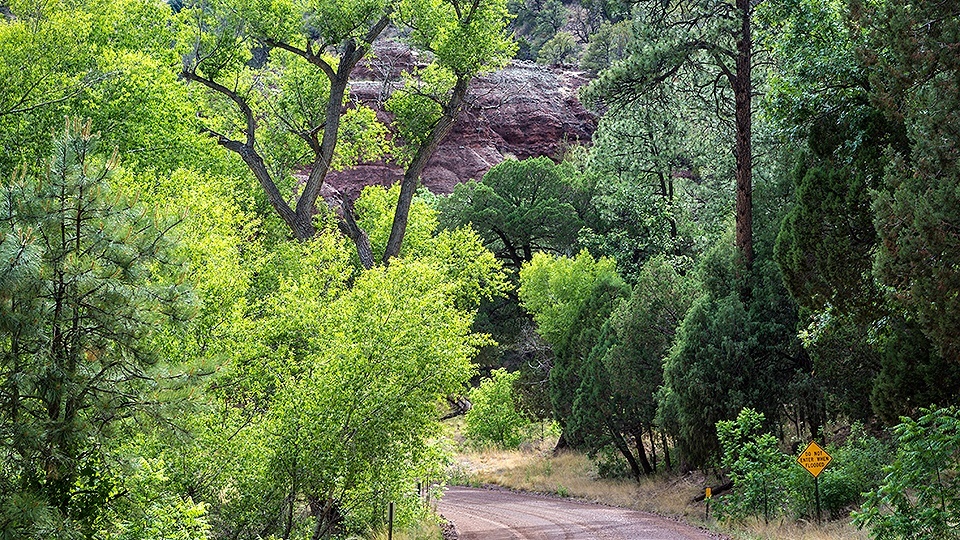
In summer, the river usually is only a trickle here, but a depth gauge to the left of the crossing will help you determine whether it’s safe to cross. Now on Blue River Road, you’ll continue through unspoiled meadows, riparian habitats and more red-rock buttes, which look as if they were airlifted from Sedona by a big helicopter.
At Mile 27 of the drive, you’ll pass a school and library for the tiny community of Blue. Other than that, there aren’t many signs of civilization along the road, which crosses the river several times, via one-lane bridges, as it winds north. Keep an eye out for endangered Mexican wolves, which have been reintroduced in the area. You’ll briefly cross over the New Mexico border, but you likely won’t know it until a sign informs you that you’re re-entering Greenlee County.
As you approach the end of Blue River Road, you’ll climb a few switchbacks before getting a nice view of 10,912-foot Escudilla Mountain, the state’s 12th-highest peak, to the north. From there, it’s just another few miles west on U.S. Route 180 to get back to Alpine, the home of Bear Wallow Café. Stop in for a slice of blueberry pie — it’s hard to find a better finish than that.
Note: Mileages are approximate.
Length: 49-mile loop
Directions: From the junction of U.S. routes 180 and 191 in Alpine, go south on U.S. 191 for 14 miles to Red Hill Road (Forest Road 567). Turn left (east) onto Red Hill Road and continue 12.2 miles to Blue River Road (Forest Road 281). Turn left onto Blue River Road, which briefly crosses into New Mexico, and continue 19.3 miles to U.S. 180. Turn left onto U.S. 180 and continue 3.5 miles back to Alpine.
Vehicle Requirements: A high-clearance, four-wheel-drive vehicle is required. Don’t attempt the drive when rain is expected.
Warning: Back-road travel can be hazardous, so be aware of weather and road conditions. Carry plenty of water. Don’t travel alone, and let someone know where you are going and when you plan to return.
Information: Alpine Ranger District, 928-339-5000 or www.fs.usda.gov/asnf