
Kaibab National Forest, Tusayan
Unless you’re a time traveler or a re-enactor, your experience with stagecoaches is probably limited to films such as 3:10 to Yuma. But before trains came along, stagecoaches were a popular method of travel in the American West, and the history of Territorial Arizona is full of them. You’ll find a bit of that history at the end of this 19.4-mile drive south of the Grand Canyon, but the scenery along the way is worth the trip, too.
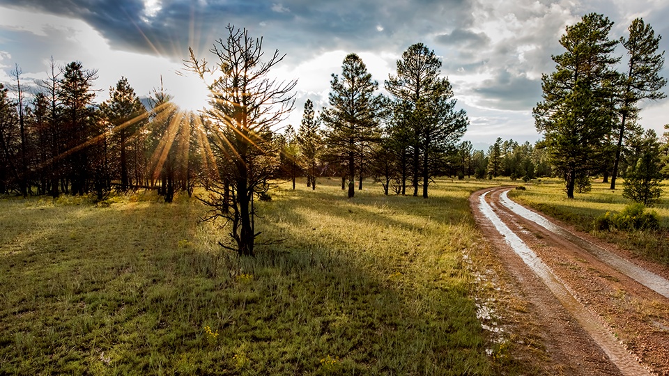
From State Route 64, head east on Forest Road 320, a smooth and well-maintained dirt road. To the north is Red Butte, which rises to about 7,300 feet and is capped by basalt — a remnant of a lava flow that covered the area millions of years ago. About 1.5 miles in, you’ll see a turnoff for Forest Road 340, which leads to the Red Butte Trail. The moderate, 2.5-mile (round-trip) hike is a worthwhile side trip that ends at the butte’s summit, where a lookout tower is staffed during fire season.
Continuing east, FR 320 curves through grasslands and chaparral, offering an excellent view of the distant San Francisco Peaks’ northern slope. You might see pockets of snow there, even in summer. Along the road, keep an eye out for deer, elk and coyotes. You also might encounter free-ranging cattle, so take it easy on the accelerator as you pass them.
About 8 miles in, you’ll start seeing ponderosa pines, which mix with the chaparral vegetation as you navigate a series of sharp curves. The ponderosas take over a few miles later, and you’ll be deep into the forest by the time you turn right onto Forest Road 301.
Up to this point, you’ll probably be wondering why this drive requires a high-clearance vehicle. FR 301 is your answer. Though it’s not an unpleasant road to navigate, parts of it are deep-rutted and rocky. In particular, take it easy when you cross a cattle guard at Mile 16.5 — it’s a bit more of a bump than you might expect. Before long, you’ll come to a clearing where several forest roads intersect. Keep going straight, and a half-mile later, you’ll reach the historical marker for Moqui Stage Station.
As the marker explains, this site was one of three stops on an 1890s stagecoach route from Flagstaff to the Grand Canyon. The trip took 12 hours and cost $20, which sounds like a bargain until you consider inflation (it’s the equivalent of about $500 today). The site also marks the start of a segment of the Arizona Trail, which crosses the state from north to south. So even if you haven’t seen another vehicle on the drive, there’s a chance you’ll see one here. But it probably won’t be a stagecoach.
Note: Mileages are approximate.
Length: 19.4 miles one way
Directions: From State Route 64 south of Tusayan, go east on Forest Road 320 for 16 miles to Forest Road 301. Turn right (south) onto FR 301 and continue 3.4 miles to the Moqui Stage Station historical marker, on the left.
Vehicle requirements: A high-clearance vehicle is required, but four-wheel-drive is not necessary in good weather.
Warning: Back-road travel can be hazardous, so be aware of weather and road conditions. Carry plenty of water. Don’t travel alone, and let someone know where you are going and when you plan to return.
Information: Tusayan Ranger District, 928-638-2443 or www.fs.usda.gov/kaibab