
Climbing Camelback Mountain can be frustrating. Parking is an ordeal, too many hikers wear too much cologne, and the single-file line can feel like a TSA queue at Sky Harbor. If you go on a weekday, though, especially late morning or early afternoon, things are usually different. You’ll never experience the solitude of the Widforss Trail or Old Baldy, but at least you won’t be dealing with the weekend onslaught of imprudent trailgaters.
Weekend or weekday, this superhighway is one you should do at least once. It leads to the highest point in metropolitan Phoenix, it’s a landmark that can be seen from the window seats of approaching 737s, and it’s one of the capital city’s official points of pride. It’s also a great workout that’ll have even the best-conditioned hikers huffing and puffing by the end. It’s only 1.2 miles to the top, but in that short scramble, the trail climbs more than 1,200 feet.
Like so many mountains, there’s more than one way to the top of Camelback. In this case, there are two: the Cholla Trail, which approaches from the east (and is currently closed), and the Echo Canyon Trail (aka the Summit Trail), which approaches from the west. The Echo side is most popular, and if you’re only going up once, it’s the route to take.
From the trailhead, which is located at Echo Canyon Recreation Area, the hike immediately begins an uphill climb that won’t let up until you’re on your way back down. After a long series of man-made steps, the trail winds around an enormous boulder, about the size of a Dairy Queen, that is used by novice rock climbers as a training tool. About 15 minutes later, you’ll come to a small saddle that offers a look at Paradise Valley below and the Praying Monk above. The Monk is a well-known local landmark and another popular hangout for rock climbers.
From the saddle, the trail continues south to another series of man-made steps, which are followed by a set of handrails that help guide hikers up a steep series of boulders. This stretch tends to get clogged with hikers slowly making their way. Be patient, and be careful. There’s a final set of handrails before the trail tops out on the nape of the camel’s neck and winds to a narrow gully. From this point forward, there’s no actual trail. You simply make your way over and around the many boulders that dominate the terrain all the way to the summit.
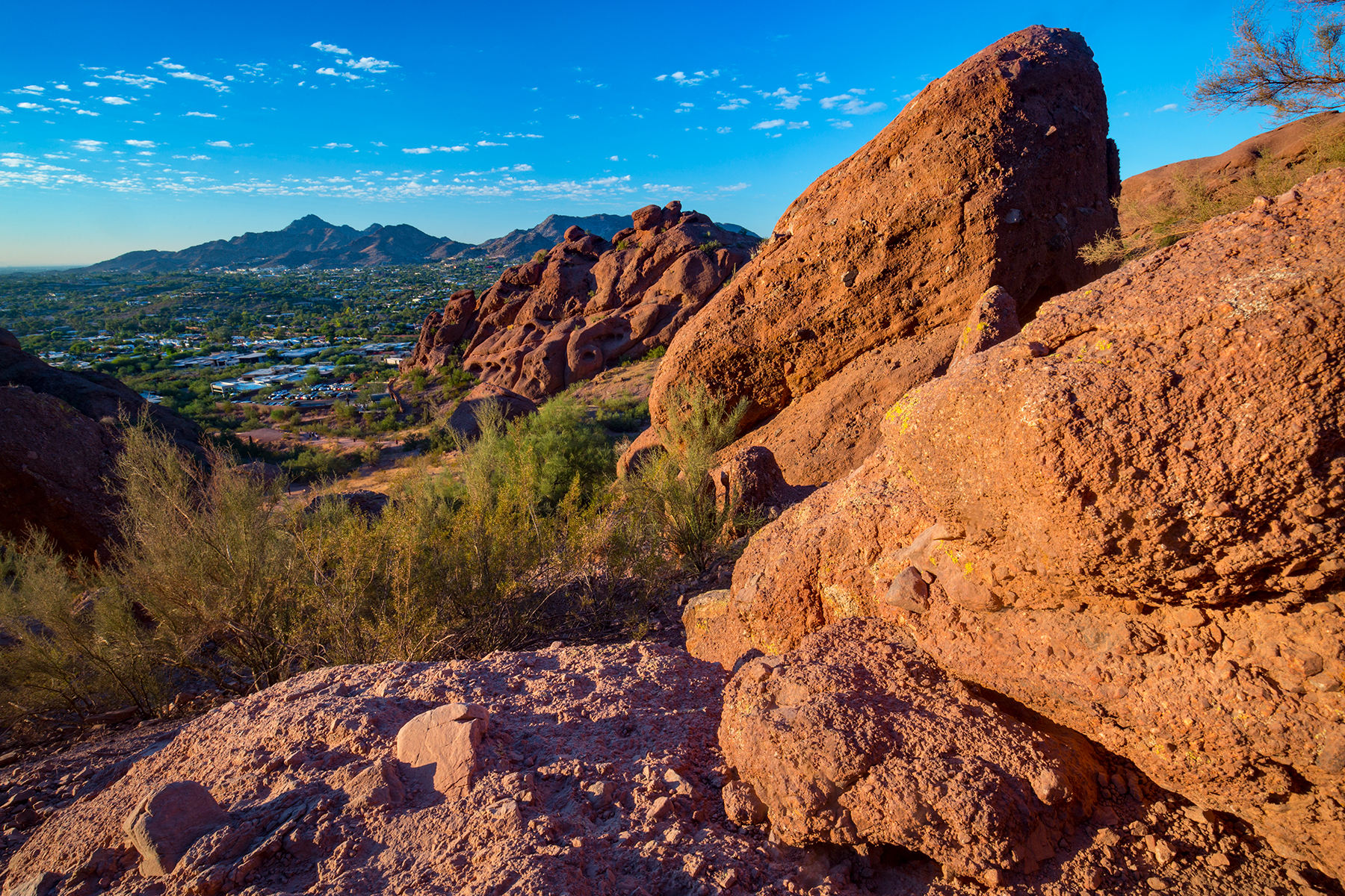
At the crown of the gully, views to the south open up — you can see downtown Phoenix and beyond. This is a good place to catch your breath and gear up for the hike’s most strenuous stretch, which is another field of boulders, similar to what you’ll have conquered in the gully. This gantlet, however, is much longer and much more difficult. Not only will you be trying to catch your breath, you’ll also be dodging the downhill hikers who are gingerly skipping from rock to rock, hoping to maintain their footing. In terms of balance, going up is easier than coming down, but you won’t appreciate that while you’re trudging upward.
Eventually, you’ll come to another saddle. The third in all. You’ll think you’re at the top, but you’re not. This is what’s known as Camelback’s false peak. The true summit is a few minutes away. When you get there, you’ll be surrounded by fellow hikers — because the summit is relatively flat and comfortably wide, people tend to hang out up there for a while, catching their breath, snapping selfies and taking in the 360-degree panorama. It’s a just reward after enduring the parking lot, the cologne and the trailgaters.
Trail Guide
Length: 2.4 miles round-trip
Difficulty: Strenuous
Elevation: 1,476 to 2,704 feet
Trailhead GPS: N 33˚31.287', W 111˚58.417'
Directions: From Central Phoenix, go north on 44th Street to its intersection with Tatum Boulevard and McDonald Drive. Turn right onto McDonald Drive, continue one block to the roundabout and turn right into the parking lot. The lot is open from sunrise to sunset, and parking is extremely limited.
Vehicle Requirements: None
Dogs Allowed: Yes (on a leash), but not when the temperature exceeds 100 degrees.
Horses Allowed: No
USGS Map: Paradise Valley
Information: Phoenix Parks and Recreation Department, 602-495-5458 or phoenix.gov/parks/trails