
Ponderosa pines are among the old-timers in Arizona — their eminence is measured in centuries, not centimeters. Most live anywhere from 200 to 500 years, but scientists at Northern Arizona University have determined that the top number can go as high as 800. Douglas-firs are in the same club. Sadly, so many of the state’s old trees were lost to felling saws in the late 1800s. But not all of them. That’s why old-growth forests such as the one surrounding the Mormon Mountain Trail are so special.
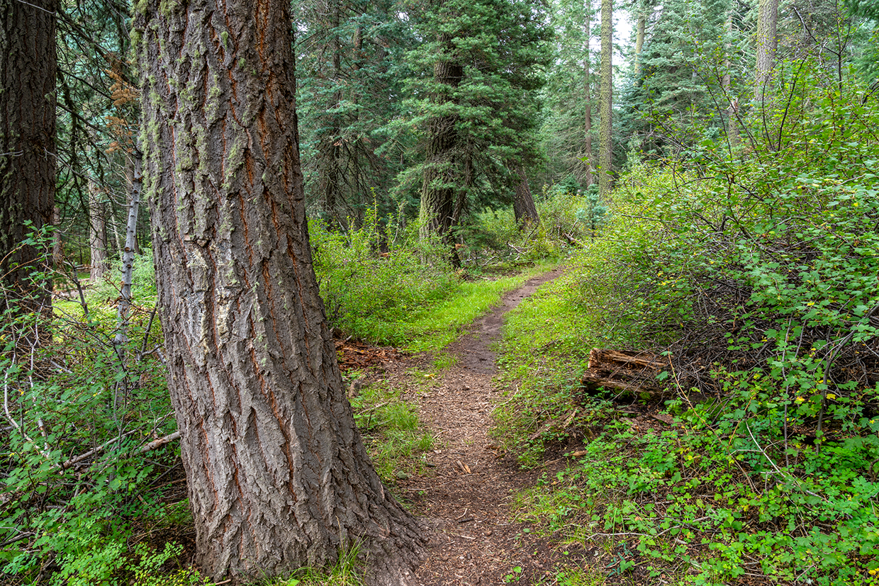
Like all old and well-established forests, this one is made up of big trees, snags (large, standing dead trees), downed logs, clumps of younger trees, seedlings and small clearings. The snags in particular are vital to the survival of the forest, because they provide habitat for birds and other small creatures, which then become lunch and dinner for the resident hawks, eagles, bears, coyotes and foxes. It’s all part of a sophisticated ecosystem, and you’ll get a firsthand look at that on this hike.
The trail begins at Dairy Springs Campground. There’s some history there: Between 1876 and 1878, Mormon settlers established a farm near what now is the trailhead. Beginning with a herd of 115 cows, a number that would eventually double, the dairy produced large quantities of butter and cheese that were sent to the towns of Brigham City, Sunset and St. Joseph (now Joseph City). The dairy closed in 1886, when Hyrum Judd, the supervisor, moved his family to a Mormon colony in Mexico.
All of that is hard to imagine today. Instead of bellowing cattle, the area is pin-drop quiet. And the only whiff you’ll get is the pine scent of the north woods. This is a trail for those in search of solitude.
For the first few minutes, the rocky single track overlaps a self-guided nature trail connected to the campground. There are two intersections with the loop. Veer left each time. Soon after the second, you’ll come to a gate, beyond which is an intersection with the Arizona Trail, which runs for more than 800 miles up and down the state from Mexico to Utah — it’s 28.4 miles from this point to Flagstaff.
As you move beyond the AZT, you’ll start seeing some oaks and other hardwoods mixed in with the pines and firs. A few minutes later, the trail levels off a little, but only briefly. Most of what’s ahead is a steady trudge that will get your attention.
After about 15 or 20 minutes, the forest opens up briefly, offering a glimpse of Mormon Lake, as well as the grassy flats and forest-covered hills that surround it. Depending on the time of year and what the weather’s been like, the lake may or may not have water in it. Either way, you’ll get your bearings. You’ll also see signs of elk, which seem to appreciate the easy-to-follow trail that was built with only one switchback. It’s an only child, but it shifts the course of the route from south to north and steers its passengers to a small clearing that introduces the most beautiful section of the trail.
This is where you’ll start seeing some of those old-timers. If you’re not familiar with the aging process of ponderosas, you can get a sense of how old they are by looking at their bark. For the first 120 to 150 years, ponderosa bark is blackish. As it gets older, the bark changes to a yellowish-red color and forms the flat “plates” that you’re probably familiar with. This is where the tree’s nickname, “yellow belly,” comes from.
Just beyond the clearing, at an elevation of 8,440 feet, the first two noticeable aspens appear off to the right. From there, the trail drops and the number of aspens goes up. The short descent leads to a large meadow where elk tend to gather like insurance agents around a water cooler. At this point, you can either turn around and head back (it’s 2.5 miles to the trailhead) or veer left for a few hundred yards to Forest Road 648, which leads to the top of the mountain.
At the road, turn right, and where it ends, you’ll see some cell towers to the north. That area is off-limits, but the summit is to the left. If you have the energy, make your way through the trees to the top. The views up there are worth it. Plus, any excuse to spend some extra time among the old-timers.
trail guide
Length: 6.4 miles round-trip
Difficulty: Moderate
Elevation: 7,218 to 8,459 feet
Trailhead GPS: N 34˚57.298', W 111˚29.258'
Directions: From Flagstaff, go south on Forest Highway 3 (Lake Mary Road) for 20 miles to West Side Mormon Lake Road (Forest Road 90). Turn right onto West Side Mormon Lake Road and continue 3.7 miles to the entrance to Dairy Springs Campground. Turn right into the campground and continue 0.6 miles to the trailhead. All roads are paved except the last 0.6 miles.
Vehicle Requirements: None
Dogs Allowed: Yes, on a leash
Horses Allowed: Yes
USGS Maps: Mormon Lake, Mormon Mountain
Information: Flagstaff Ranger District, 928-526-0866 or fs.usda.gov/coconino