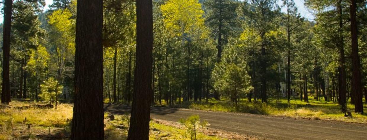
Apache-Sitgreaves National Forests, White Mountains
A crisp fall morning is the perfect time for this back-roads drive in the White Mountains.
The 44.3-mile loop from McNary to Vernon begins and ends on White Mountain Apache Tribe land near Pinetop-Lakeside. It winds in and out of the Sitgreaves National Forest, through stands of pine and spruce interspersed with groves of aspen that make a spectacular fall display. A historic campground and a small, quiet lake make pleasant diversions along the way.
From Pinetop-Lakeside, we head east along State Route 260 about 8 miles to McNary. We pass the Apache Baptist Church, with its three plain white crosses, and turn left on Cady Avenue (County Road 3140). This becomes Vernon-McNary Road.
McNary was originally called Cluff Cienega, after a Mormon bishop who harvested hay for Fort Apache here in the late 19th century. Later renamed Cooley, it then became McNary after the McNary Lumber Co. bought the land in the 1920s. Today, McNary is a community of about 500 on tribal land.
The pavement ends in about a half-mile, and the road winds gently along a well-graded gravel route into the Sitgreaves National Forest. At 7 miles, we turn right at Forest Road 20 and drive the quarter-mile to Los Burros Campground.
Los Burros is a small, simple campground with a single picnic table and fire pit at each campsite, but the setting is beautiful. The campground sits at the edge of a grassy meadow, near the picturesque remains of a home, a barn and wooden corrals.
The buildings, with red board-and-bat siding and stone foundations, were built in 1909. A ranger once lived here and rode a horse each day to Lake Mountain Lookout. The windows and doors of the house are boarded up, but viewing holes offer glimpses of the decaying interior.
The 13-mile Los Burros Trail begins at the campground and winds through a shady ponderosa-pine forest, and it includes a side trip to Lake Mountain Lookout. Mule deer and elk, as well as the occasional black bear, are often seen along the trail.
Back on Vernon-McNary Road, we head north. As we approach Vernon, the pines give way to juniper-dotted grasslands, and we begin to see homes scattered on the hillsides. Vernon was settled in the 1890s as a sawmill town. The area is now a growing bedroom community.
Finding no shops or restaurants in Vernon, we retrace our steps back down Vernon-McNary Road. Just past the Vernon cemetery, we turn left onto County Road 3261. It becomes Forest Road 61 as it re-enters the national forest, where pines reclaim the landscape. Many of the roads here are unmarked, so we are grateful that our GPS works, guiding us toward County Road 61 and Harris Lake.
After about 9 miles, we take a sharp left and drive the quarter-mile to a road on the right that leads down along the lake. The lake is very small, looking more like a wetland. But it’s enough to attract wildlife, including a couple of reintroduced Mexican gray wolves that have been reported here. The lake is on private property, enclosed by a fence. But there is a meadow at the side of the road, which makes an agreeable place to picnic.
Backtracking our way along CR 61, we pick up Forest Road 96. This stretch is deeply rutted and rocky in places. But the forest is thicker and wilder here, with taller pines and more aspens. Some aspens appear quite old, with thick, scarred trunks.
In 8 miles, we’re back to Vernon-McNary Road, where we turn left and drive back to McNary.
Note: Mileages are approximate.
Length: 44.3-mile loop
Directions: From McNary, go north on Cady Avenue (County Road 3140), which becomes Vernon-McNary Road (Forest Road 224), for 7 miles to Forest Road 20, which leads to Los Burros Campground. Back on Vernon-McNary Road, continue another 10 miles to Vernon (the road will become CR 3140 again). Return south on Vernon-McNary Road. About 0.2 miles past the Vernon cemetery, turn left onto County Road 3261, which becomes Forest Road 61, and continue 2.4 miles to a “Y” intersection. Bear right onto Forest Road 404 (unmarked) and continue 1.2 miles to County Road 61 (also unmarked). Turn right onto CR 61 and continue 5 miles to a sharp left that leads to Harris Lake. Back on CR 61, backtrack north 1.5 miles to Forest Road 96. Turn left onto FR 96 and continue 8 miles back to Vernon-McNary Road. Turn left onto Vernon-McNary Road and continue 9 miles to State Route 260 at McNary.
Vehicle requirements: A high-clearance vehicle is required. Four-wheel-drive is recommended, particularly in wet conditions.
Information: Lakeside Ranger District, 928-368-2100 or www.fs.usda.gov/asnf
Travelers in Arizona can visit www.az511.gov or dial 511 to get information on road closures, construction, delays, weather and more.

