
Tonto National Forest, Pleasant Valley Ranger District
The first thing you need to know about this National Scenic Byway — officially known as the Desert to Tall Pines Scenic Road, but informally known as the Young Highway — is that it isn’t a drive you can do before lunchtime. This 74-mile back road, from State Route 260 near Payson to State Route 188 north of Globe, winds through ponderosa pines and grasslands before shifting abruptly to the saguaros of Arizona’s high desert. Large sections of the road are unpaved or lack guardrails, so patience — along with a light foot on the accelerator — is a must. Pack a picnic lunch, and take your time. The scenery, particularly toward the end, is worth it.
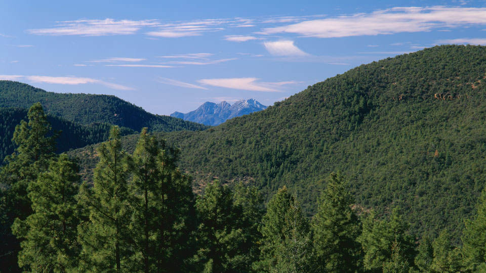
Heading south on Forest Road 512, past an aspen grove, you’ll come to the first of two areas hit by recent wildfires. Despite the devastation, you’ll see that saplings are springing up to replace the burned ponderosas. A little farther south, as you crest a hill at Mile 14, you’ll get a nice look at the Mogollon Rim on your right. It’s the first of many breathtaking views. Several pullouts line this narrow road, so stop frequently and enjoy the panoramas — particularly at Mile 19 — that show the stark contrast between the wildfire-scorched trees on the left and the dense forest on the right.
From there, you’ll descend into Young, an isolated community that didn’t even have outside electricity until the mid-1960s. Fewer than 700 people call Young home, and a drive through it is like traveling back in time. It’s a good place to stop and eat your picnic lunch (the town doesn't have any restaurants).
South of Young, the road climbs again, and a vista point at Mile 31 provides another view of the Mogollon Rim, along with the town below. The canopy then begins to open up as small trees and bushes replace the taller pines, and on a clear day, the blue sky, combined with the silence of this isolated area, is spectacular.
At Mile 41, McFadden Peak (7,135 feet above sea level) dominates the view as you begin the descent into the desert. You’ll pass several lush riparian areas, and the streams offer excellent opportunities to see birds, deer and other wildlife. But the real payoff is an incredible panorama of Roosevelt Lake, with its surrounding red cliffs and mountains to the south. The jaw-dropping views continue for several miles, but be careful not to let them lead you off the road — there are numerous sharp turns as you lose altitude.
Before long, you’ll find yourself among the saguaros and prickly pear cactuses that are the Sonoran Desert’s trademarks. Once you’ve dropped into the desert, it’s just a short drive to a one-lane bridge over the Salt River, and another short trip from there to the drive’s conclusion at State Route 188. After the leisurely pace that’s necessary on the Young Highway, the trip back home will feel like light speed by comparison.
Note: Mileages are approximate.
Length: 74 miles one way
Directions: From Payson, go east on State Route 260 for 32 miles to Forest Road 512. Turn right onto FR 512, which turns into State Route 288 (Young Highway), and continue 74 miles to State Route 188 near Globe.
Vehicle requirements: A standard SUV is recommended. While the road is passable with a sedan in good weather, some mountainous sections receive little sunlight and might remain muddy or icy for several days after a storm.
Information: Pleasant Valley Ranger District, 928-462-4300 or www.fs.usda.gov/tonto
Travelers in Arizona can visit www.az511.gov or dial 511 to get information on road closures, construction, delays, weather and more.