Payson Ranger District, Tonto National Forest
Some scenic drives require a certain amount of commitment. Whether it’s time, vehicle requirements or sheer guts, you often have to give a little in order to get Arizona’s spectacular views in return. Fortunately, the drive to Mount Ord is the exception. No sacrifice is required. In fact, this drive is more about bang than buck, so to speak. The views are breathtaking, the trip itself is quick and the fist-clenching moments are few and far between. Really, this drive is ideal for out-of-town visitors on the go — or in-laws in need of entertainment.
From Fountain Hills, take State Route 87 (the Beeline Highway) northeast toward Payson. Turn right (east) at the clearly marked turnoff for Mount Ord, Forest Road 626, near Milepost 223. The road goes from pavement to graded dirt in a matter of seconds. Although it’s well maintained, there are a few bumps in this road, and a standard SUV is your best bet. In inclement weather, a high-clearance vehicle is an absolute must.
Heading uphill, it isn’t long before you’ll be treated to gorgeous views of the Mazatzal Mountains. Tight switchbacks and no guardrail give thrill-seekers a temporary rush as the road climbs steadily — steeply in some parts.
At Mile 1.6, there’s room to pull over and enjoy the beauty. Despite how easily accessible FR 626 is, it’s remarkably quiet. There’s only the hum of Mother Nature in the air. In less than a mile, the landscape — dotted with scrub oaks, piñon pines and agaves — dramatically shifts, and you’ll be lost in a forest of pine trees.
As the road continues to climb, a real “wow” moment occurs near the 3-mile mark. A dramatic, panoramic view of the Mogollon Rim reveals itself, and from this vantage point, you can clearly see the sheer cliff face that is the southernmost edge of the Colorado Plateau. It’s an impressive sight that will leave even the most impatient passenger in awe.
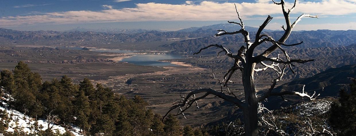
Continuing on, the road eventually hugs the back of the mountainside, where you’ll be treated to another amazing view: Roosevelt Lake, which looks like a glittering shard of glass from this elevation. The end of the road comes at Mile 6.1. A metal gate blocks the road to the very top of Mount Ord, where several communication towers are located. Only authorized vehicles are allowed to continue on. Return the way you came. The drive back to State Route 87 moves quicker than the climb up, so proceed with caution — you never know who or what is right around the next switchback. As you reach the highway, take a moment to gloat, especially if you’re playing tour guide for the day.
Note: Mileages are approximate.
Length: 12.2 miles round-trip (Forest Road 626)
Directions: From Fountain Hills, drive north on State Route 87 for 33 miles to Milepost 223. Turn right onto Forest Road 626 and continue for 6 miles.
Vehicle requirements: A high-clearance vehicle is recommended.
Warning: Back-road travel can be hazardous, so be aware of weather and road conditions. Carry plenty of water. Don’t travel alone, and let someone know where you are going and when you plan to return.
Information: Payson Ranger District, 928-474-7900, www.fs.usda.gov/tonto

