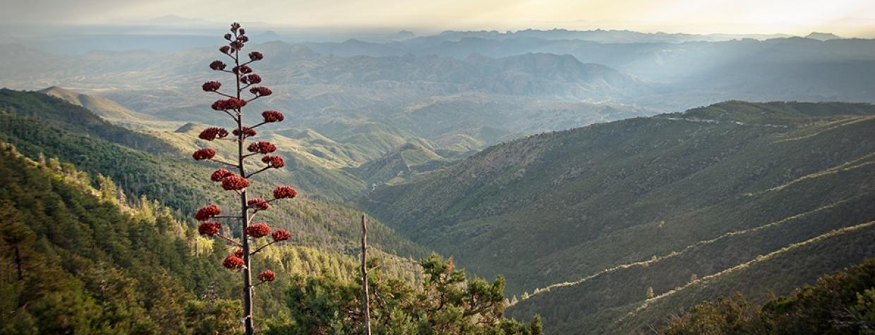
If there’s one thing we’ve learned in recent years, it’s that we all could stand to be a little more polite to each other. On the route to the summit of the Globe area’s Pinal Peak, that’s a necessity. This narrow mountain road presents a few challenges and a need for driving etiquette, but a pleasant trek with remarkable views at the top is the reward.
Reset your car’s trip odometer on U.S. Route 60 in Globe, then head south on Russell Road. After a couple of turns in town — including one at Rose Mofford Way, named for Arizona’s 18th governor and Globe’s most famous native — you’ll wind through a residential area and get a view of the Pinal Mountains, the pine-covered range into which you’re headed, straight ahead. The road then enters a quiet canyon filled with chaparral vegetation, such as scrub oaks and junipers, before becoming Forest Road 55 when it enters the Tonto National Forest at Mile 3.3.
A few miles of twisting climbs later, turn right onto Forest Road 651, where smooth pavement gives way to washboarded dirt that’s deeply rutted in places. On the mountain slopes along the road, you’ll notice scattered Arizona sycamores, identified by their spindly limbs and mottled white bark, among the vegetation. Soon, piñon pines join them on the roadsides, and by Mile 8.7, you’ll pass through your first grove of ponderosa pines. Within a half-mile, they’re everywhere, shading the road and dropping cones for Abert’s squirrels, which often can be spotted in these mountains, to munch on.
It’s around here that etiquette comes into play, because the road often is wide enough for only a single car. Technically, a car going uphill has the right of way, because it’s easier to reverse in a downhill-traveling car. But not every driver plays by those rules, so make a note of the roadside pullouts you pass, in case you encounter an unyielding driver and have to return to one of them. And keep an eye out for downhill traffic heading your way — which isn’t always easy, given the many sharp bends in the road.
Around Mile 10, the ponderosas close in, with sycamores occasionally providing an interesting contrast. Just past Sulphide Del Rey Campground, formerly the site of a mining camp, you’ll come to an intersection with Forest Road 580, which leads to Madera Peak on the northwest side of the Pinals. Instead, bear left to continue on FR 651, where you’ll quickly get an incredible panorama of the mountain ranges to the southwest.
In this area, you’ll see a lot of agaves and prickly pear cactuses, the product of the south-facing slope the road traverses. Before long, though, you’re back in the ponderosas and smaller evergreens, and you’ll want to drive carefully, as snow and ice can linger into spring at this altitude. After a curve to the north — offering another panorama, this time of mountain ranges to the west and northwest — you’ll enter the Pinal Mountain Recreation Area, which includes a pair of campgrounds, at Mile 16.4.
A mile farther, and you’ll reach a “Y” intersection. Bear right and continue a quarter-mile to the communications towers at the summit of Pinal Peak. The scenery from the main road is just fine, but for the best view to the south, hike or drive up to the highest tower. From there, you’ll see the rugged Dripping Springs Mountains to the southwest, the isolated Picachos farther out and even the Santa Catalinas to the distant south. It’s a view that’ll make you linger awhile, but once you head down, remember what you learned about the right of way. A little politeness goes a long way on a narrow mountain road.
Note: Mileages are approximate.
Length: 17.7 miles one way (from U.S. Route 60)
Directions: From the intersection of U.S. Route 60 and State Route 188 in Globe, go south on Russell Road for 0.3 miles to an intersection with Golden Hill Road. Turn right to stay on Russell Road and continue 0.2 miles to an intersection with Rose Mofford Way. Turn left to stay on Russell Road, which later becomes Forest Road 55, and continue 5.7 miles to Forest Road 651. Turn right onto FR 651 and continue 11.2 miles to a “Y” intersection. Bear right, following the “Pinal Peak” sign, and continue 0.3 miles to the summit of Pinal Peak.
Vehicle requirements: A high-clearance vehicle, such as an SUV or truck, is required, but four-wheel-drive is not necessary in good weather.
Note: Back-road travel can be hazardous, so be aware of weather and road conditions. Carry plenty of water. Don’t travel alone, and let someone know where you are going and when you plan to return.
Information: Globe Ranger District, 928-402-6200 or fs.usda.gov/tonto

