Coconino National Forest, Flagstaff
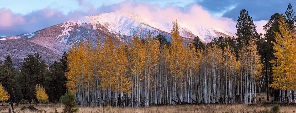
By the first or second weekend in October, aspen stands on the San Francisco Peaks are golden and glorious. But the problem for people seeking to get their annual leaf-peeping fix is that popular spots high on the mountains can feel as congested as a shopping mall’s parking lot on Christmas Eve. If you want to enjoy one of the best fall color displays in Arizona without the crowds, skip Arizona Snowbowl and head to the north side of the Peaks, where the aspens are plentiful but the leaf-peepers are few and far between.
Driving northwest from Flagstaff on U.S. Route 180, continue past Snowbowl Road and Arizona Nordic Village to the second turnoff for Forest Road 151, and hang a right. As you make your way up FR 151, you’ll quickly see what you’ve come for: the towering Peaks, dead ahead, with their steep slopes draped in cascades of gold. On your left, the vibrant yellow leaves of young aspen stands pop against black remnants of the 1996 Hochderffer Fire.
After 1.6 miles, you’ll reach a fork where FR 151 bends to the right and Forest Road 418 to the left. Follow FR 418 as it meanders through the aspens, with the scree-covered (and sometimes snowcapped) slopes of 12,633-foot Humphreys Peak commanding the southern horizon. The rolling White Horse Hills unfold to the north. A little more than a mile from the intersection, on both sides of the road, are lush aspen stands ideal for photo ops or just wandering in awe beneath the golden canopies.
As you climb up rocky FR 418, you’re skirting the boundary of the Kachina Peaks Wilderness and some of the most remote stretches of this long-dormant volcano. If you’re looking for a place to pitch a tent, head down four-wheel-drive Forest Road 9219V to claim an isolated pullout that looks onto an aspen-encircled meadow. About 3 miles after turning onto FR 418, you’ll reach the intersection with Forest Road 9123J and a spectacular panorama (and ideal picnic spot) that encompasses the crown jewels of Northern Arizona. To your left and straight ahead, grass-covered cinder hills might be dappled in shadows beneath cotton-ball clouds. On the northwestern horizon, a glim-mering stripe of white limestone marks the Grand Canyon’s North Rim, serving as a yin to the Peaks’ yang. To the northeast, golden meadows fall away into the Painted Desert’s sea of color and space.
Continuing on FR 418, the rocky road gives way to smooth gravel as you descend through rolling foothills and continue east, toward the Painted Desert. Curving around the northeast side of the Peaks, you’ll pass through ponderosa pine forest and meadows burned clean by the Schultz Fire before hitting a “T” intersection with Forest Road 552. Turning right will take you up to Lockett Meadow and the Inner Basin Trailhead. The leaf-peeping crowds are so thick there on weekends that parking is often impossible. But you’ve already found your gold. Turn left, and before long, you’ll hit the blacktop of U.S. Route 89 for the drive back to Flagstaff.
Note: Mileages are approximate.
Length: 49.3-mile loop (from Flagstaff)
Directions: From downtown Flagstaff, go northwest on U.S. Route 180 for 19 miles to Forest Road 151. Turn right onto FR 151 and continue 1.6 miles to Forest Road 418. Turn left onto FR 418 and continue 11.1 miles to Forest Road 552. Turn left onto FR 552 and continue 1.6 miles to U.S. Route 89. Turn right onto U.S. Route 89 and continue 16 miles back to Flagstaff.
Vehicle requirements: A high-clearance vehicle is recommended, but four-wheel-drive is not necessary in good weather.
Warning: Back-road travel can be hazardous, so be aware of weather and road conditions. Carry plenty of water. Don’t travel alone, and let someone know where you are going and when you plan to return.
Information: Flagstaff Ranger District, 928-526-0866 or www.fs.usda.gov/coconino

