
Oatman to Bullhead City
When you’re standing amid chollas and yuccas in the Arizona mining town of Oatman, it’s hard to fathom that you’re just a 14-mile drive from the cool water of the Colorado River. (It’s hard to fathom anything, really, other than: What are all these burros doing here?) But it’s true: Silver Creek Road, which leads from Oatman to Bullhead City, takes you from arid Mojave Desert to the banks of the Colorado, with plenty to see along the way.
Before you leave Oatman — named for Olive Oatman, whose face was tattooed after she was captured and enslaved by Mohaves in the mid-1800s — a word about those burros. These days, they’re the town’s biggest tourist attraction, but their ancestors lived less glamorous lives as beasts of burden in the area’s mines. When the mines went bust, the prospectors turned the burros loose, and now they graze on desert flora and handouts from visitors.
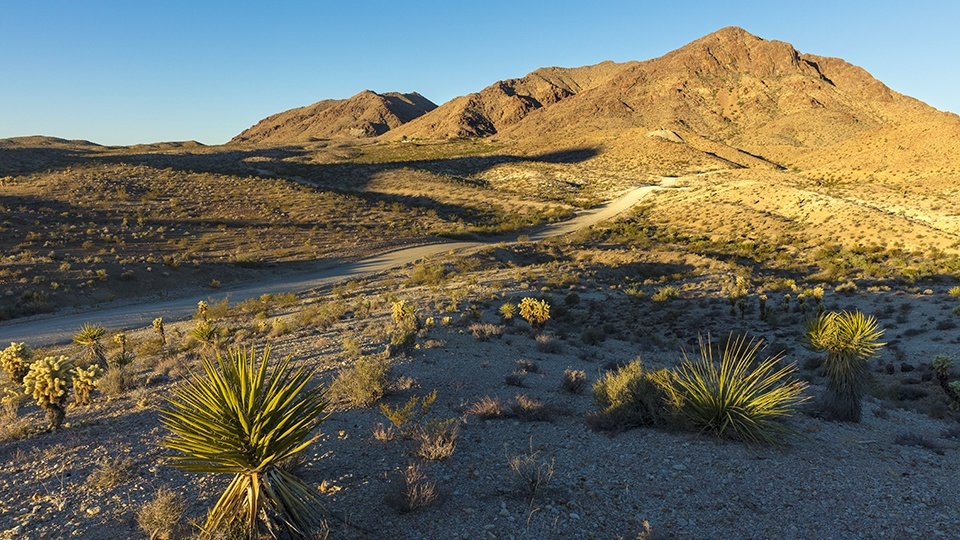
Once you and the burros have had your fill of each other, head north on the Oatman-Topock Highway, a section of Historic Route 66. After a mile, you’ll turn left onto Silver Creek Road, a rolling dirt road that’s rough in spots but passable in any car with a careful driver. Teddy bear chollas and yuccas dominate the scenery along the road, which quickly curves to the north. On the right side, to the east, are the multicolored volcanic buttes of the Mount Nutt Wilderness, which protects 28,000 acres of the Black Mountains. If you have a pair of binoculars, you might be able to see the desert bighorn sheep that live in the wilderness area.
Silver Creek Road then turns to the west, and at Mile 2.8, you’ll get a view of Hardy Mountain, a 3,143-foot summit, dead ahead. The peak likely is named for William Harrison Hardy, an early settler of the area that later became Bullhead City. A mile and a half later, northeast of the mountain, you’ll pass the entrance to one of several mining claims in the area — some of which are still active.
As you continue, you’ll get glimpses of the mountains across the Colorado River, including Spirit Mountain in Nevada. But don’t let that distract you from the sights along the road, including Cathedral Rock, which is on the left at Mile 5.5. Arizona is home to several Cathedral Rocks — the most famous is in Sedona — but this one is as eye-catching as any of them, its volcanic spire pointing sharply skyward from the desert landscape.
Be sure to stop at the pullout at Mile 7.3 for a panoramic view of the Lower Colorado River Valley to the west. From there, the road rolls for a few more miles down to an intersection with Bullhead Parkway and a return to pavement in Bullhead City. Keep going past the stoplight for 2.5 miles to State Route 95, the stopping point for this drive.
If you’d like to dip your toes in the river, head north on SR 95 for a mile and a half to Bullhead City Community Park, which has a public beach and a boat launch area. If you’re looking to strike it rich, you can cross the river into Laughlin, Nevada. Or you could try your hand at a mining claim along Silver Creek Road.
Note: Mileages are approximate.
Length: 14 miles one way
Directions: From Oatman, go north on the Oatman-Topock Highway (Historic Route 66) for 1 mile to Silver Creek Road. Turn left onto Silver Creek Road and continue 13 miles to State Route 95 in Bullhead City.
Vehicle requirements: A high-clearance vehicle is recommended, but the road is passable in a standard sedan in good weather.
Warning: Back-road travel can be hazardous, so be aware of weather and road conditions. Carry plenty of water. Don’t travel alone, and let someone know where you are going and when you plan to return.
Information: Oatman Chamber of Commerce, www.oatmangoldroad.org; Kingman Field Office, 928-718-3700 or www.blm.gov/arizona