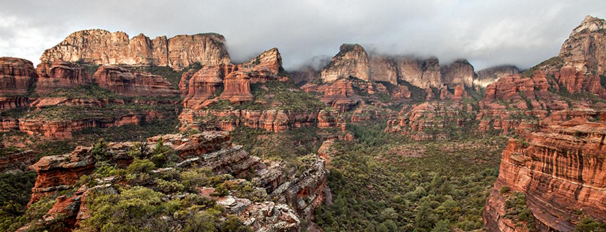
Red Rock-Secret Mountain Wilderness, Sedona
Let’s say you have a friend who lives in the rural Midwest. Let’s call him Tommy Fisher. And let’s say that Tommy is convinced that there’s no other place on the planet that’s as beautiful as the woodland that surrounds his hometown. Despite your insistence that Arizona is pretty nice, too, he just rolls his eyes. Year after year. Then, one day, against all expectation, he ventures West to see for himself. You want to convince him that you’re right — that Arizona is at least as scenic as where he's from. So you think to yourself, Hmmm ... what trail should I take him to? Well, if Tommy Fisher is an avid hiker, the options are numerous. But let’s say that he can’t hike too far or too hard. If that’s the case, you might want to take Tommy into Boynton Canyon. It’s pretty easy. And pretty nice.
The trail begins in the vicinity of so many other great trails in Sedona — Bear Mountain, Brins Mesa, Long Canyon. From the trailhead, the route follows a red-dirt path that reflects the color of the surrounding Coconino sandstone. The track is hard-packed, like melted crayons. Two minutes in, you’ll come to an intersection with Deadman’s Pass and the Mescal Trail. Veer left. A few minutes later, there’s a sign that marks the boundary of the Red Rock-Secret Mountain Wilderness. Usually, wilderness areas are more remote and harder to get to. Mount Trumbull is a good example. This one, though, with its 48,314 acres, is just one iced venti Americano from the congestion of the Sedona strip. Even closer is the five-star resort that borders the wilderness in the early part of the hike.
That’s the most common complaint about the Boynton Canyon Trail. That the resort is right there, with its pricey guest rooms and Ayurvedic spa treatments. The contrast is impossible to overlook, but the resort has been a good neighbor for many, many years, and it’s not going anywhere. You might as well shake it off and move on. What’s ahead is worth the temporary distraction.
Just beyond the wilderness sign is another intersection. Again, veer left as the trail passes the spa and winds through a grove of oaks, piñons, junipers and manzanitas. You might hear Native flute music as you move along, but that eventually fades as you get beyond the resort and deeper into the canyon, where alligator junipers show their age. The trail at this point heads northwest and parallels a wash. About 10 minutes later, it shifts course to the west-southwest. With that turn, the forest gets thicker and welcomes a few ponderosa pines to the mix. The woods look familiar, like something you’d see near Prescott or Payson. That is, until you get a glimpse of the 800-foot cliffs through the trees. It’s a reminder that this hike isn’t just another hike.
The homestretch gets a little steeper and rockier, and touches the feet of some impressive pillars and rock walls. The scattered Douglas firs are aged exclamation points of olive green. Then, after about an hour of overall hiking, the trail dead-ends at another rock wall, one that helps hold up Bear Mountain. The elevation here is 5,220 feet, which is the high point of the hike. The views, however, aren’t long panoramas. Instead, they’re compressed. That’s because the trail ends in what feels like an open-air cathedral. Others might call it a vortex.
If you’re not familiar, a vortex is defined “as a place where the Earth is exceptionally alive and healthy, its natural beauty reflected in the elements of land, light, air and water.” Additionally, “it’s a place with increased energy that magnifies or amplifies whatever you bring into it.”
Boynton Canyon is one of several alleged vortex sites in Red Rock Country. Whether that’s New Age nonsense, ancient wisdom or none of the above, it’s probably not the kind of thing you’d want to mention to Tommy Fisher. Let the rocks and the trees convince him of the state’s beauty. If you start talking mysticism and spirituality, there’s a good chance he’ll roll his eyes and never come back.
Length: 6.16 miles round-trip
Difficulty: Easy
Elevation: 4,524 to 5,220 feet
Trailhead GPS: N 34˚54.456', W 111˚50.928'
Directions: From the roundabout intersection of state routes 179 and 89A in Sedona, go southwest on SR 89A for 3.1 miles to Dry Creek Road. Turn right onto Dry Creek Road and continue 2.7 miles to Boynton Pass Road. Turn left onto Boynton Pass Road and continue 1.5 miles to Boynton Canyon Road. Turn right onto Boynton Canyon Road and continue 0.1 miles to the trailhead on the right.
Special Consideration: A $5 day pass is required.
Vehicle Requirements: None
Dogs Allowed: Yes
Horses Allowed: Yes
USGS Map: Wilson Mountain
Information: Red Rock Ranger District, 928-203-2900 or www.fs.usda.gov/coconino

