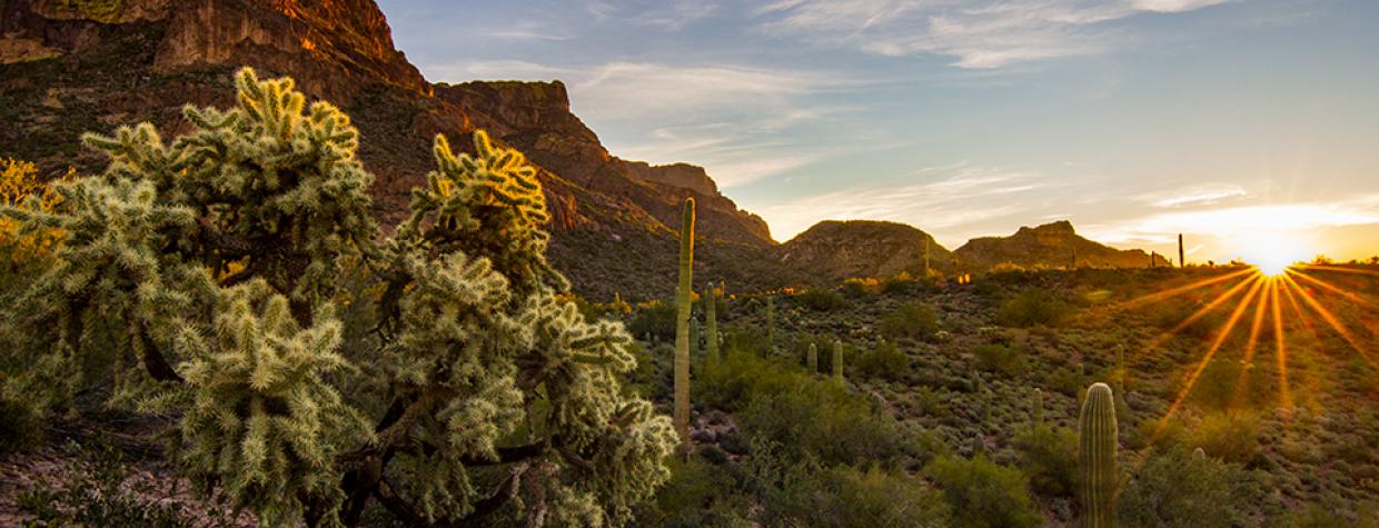
Superstition Mountains, Mesa
In the strictest sense, the word “hieroglyphic” refers only to the writing on Egyptian monuments. That’s it. That said, it’s been usurped and applied to any ancient “writings” that use pictures instead of characters. The Hittites and the Mayans are just two of the civilizations that have been misrepresented by lazy writers. This hike is another one of the victims. What you’ll see at the end of the trail are actually petroglyphs, a word that translates to “rock carvings.” There are no hieroglyphics on the Hieroglyphic Trail. Another quick lesson: Petroglyphs and pictographs are not the same thing. Pictographs are rock “paintings.” Not carvings.
The distinction will be clear when you get to the site. But first you have to find the trailhead — the approach route follows a series of narrow roads through a residential area — and then a parking spot. Under most circumstances, the lot can handle the traffic, but this time of year, when the goldpoppies, brittlebushes and globemallows are blooming, it can fill up. Early morning is usually best, but you won’t know for sure until you get there. It’s worth the risk, though.
The hike begins at the Cloudview Trailhead, which is more commonly used as a launch point for the Lost Goldmine Trail, an 11-mile (round-trip) route that crosses the south side of the Superstition Mountains. From the parking lot, you’ll pass through a gate and immediately see a sign for both trails. Two minutes later, the trails split. Veer left for the Hieroglyphic Trail. At this point, you’ll see some homes on the periphery, and also in your rearview, but straight ahead, it’s all Mother Nature.
About 10 minutes in, the trail enters the Superstition Wilderness, which was designated a Forest Reserve in 1908 and then the Superstition Primitive Area in 1939. It got its wilderness protection in 1964, and now cradles 160,236 acres, including most of those along this trail.
The track is rocky on this stretch, and there’s a slight ascent. Nothing difficult, though. This is an easy trail that winds through a typical Sonoran Desert landscape of saguaros, teddy bear chollas and barrel cactuses. And if the conditions are right, there will be wildflowers, too. All of which is set against the backdrop of the rugged Superstition Mountains, which are the result of intense volcanic activity about 25 million years ago — lava, calderas, upthrusts, alluvial fans ... this was a busy place in the mid-Tertiary Period.
Continuing north, you’ll hit a rise (elevation: 2,453 feet) and then drop into a wash created by the waters of Hieroglyphic Spring. The banks are lined with catclaws and other riparian vegetation. As the trail makes a gradual climb, it passes through a cluster of 200-year-old saguaros. Just beyond the giant cactuses, the trail enters Hieroglyphic Canyon and comes to an end.
In the springtime, you’ll likely see water holes. And if you hit it just right, you might see waterfalls, too. To see the petroglyphs, you have to bushwhack a bit and scramble over some boulders. They’ll be off to the left. Among the carvings are geometric shapes and animals, possibly deer or bighorn sheep.
For better or worse, trail crews have made it easy to get close enough to touch the ancient art. But don’t. Like all things in nature, the petroglyphs are fragile and could be permanently damaged by inappropriate behavior. Please adhere to the principles of Leave No Trace. And keep in mind that the rock art is protected by the Antiquities Act. Anyone who mars or destroys any prehistoric site can be fined and/or imprisoned. The petroglyphs (not hieroglyphics, not pictographs) have remained intact since before the 1400s. Let’s keep them that way.
Length: 3 miles round-trip
Difficulty: Easy
Elevation: 2,096 to 2,654 feet
Trailhead GPS: N 33˚23.381', W 111˚25.470'
Directions: From the intersection of State Route 88 (Idaho Road) and U.S. Route 60 near Apache Junction, go east on U.S. 60 for 5.9 miles to Kings Ranch Road. Turn left (north) onto Kings Ranch Road and continue 2.7 miles to Baseline Avenue. Turn right onto Baseline Avenue and continue 0.2 miles to Mohican Road. Turn left onto Mohican Road and continue 0.3 miles to Valley View Drive. Turn left onto Valley View Drive, which turns into White Tail Road, and continue 0.5 miles to Cloudview Avenue. Turn right onto Cloudview Avenue and continue 0.4 miles to the Cloudview Trailhead.
Vehicle Requirements: None
Dogs Allowed: Yes
Horses Allowed: Yes
USGS Map: Goldfield
Information: Mesa Ranger District, 480-610-3300 or www.fs.usda.gov/tonto

