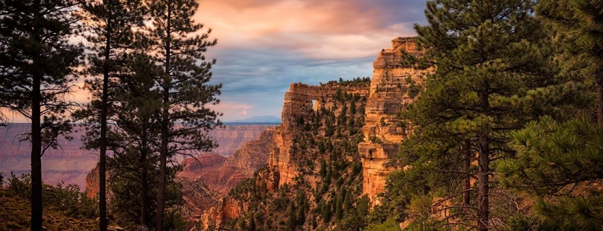
North Rim, Grand Canyon National Park
The North Rim of Grand Canyon National Park has a short season, but there’s another reason it sees about as much vehicle traffic in an average year as the South Rim sees in an average month. Actually, there are 130 reasons. That’s the difference, in miles, between North Rim and South Rim driving distance from Flagstaff. It’s hard to believe — until you look at a road map. There are no shortcuts to the North Rim. No interstates. Just a long trip up U.S. routes 89 and 89A, across Navajo Bridge, past the Vermilion Cliffs and down State Route 67. And even though it’s a gorgeous drive, by the end of it, you’d be forgiven for parking at Grand Canyon Lodge and chucking your car keys.
Don’t. Because just north of the lodge is Cape Royal Road, an easy, paved route offering incredible Canyon views that even fewer people have seen — plus a little history along the way.
From SR 67, head east on Cape Royal Road, which dates to the 1920s and was one of the National Park Service’s first major projects on the north side of the Canyon. It’s lined with aspens, ponderosa pines, spruce and firs, and in places, you’ll see the effects of forest fires, including the lightning-caused Fuller Fire, which scorched an area to the north in 2016. But those areas are brief and don’t detract from the beauty of the drive.
About 5 miles in, you’ll come to a “Y” intersection. To the left is the road to Point Imperial, the park’s highest overlook (8,803 feet). That route was heavily impacted by the 2016 blaze, but the point itself is worth a trip if you’ve got the time. For now, though, bear right to stay on Cape Royal Road. Two and a half miles later, you’ll reach an easy-to-miss sign, on the right, for Greenland Lake, an ephemeral pond formed from a sinkhole. Follow a narrow, 200-yard trail counterclockwise around the lake to reach a cabin built in the 1890s to store salt for cattle.
Now, finally, it’s time to see the Canyon, at a series of vistas — starting with Vista Encantada, about 2 miles ahead. From there, you can see Nankoweap Creek and the distant Vermilion Cliffs. Roosevelt Point, a mile and a half later, offers a look at the confluence of the Colorado and Little Colorado rivers. There are other gorgeous stops along the way, but they’re all appetizers for the main course at the end of the road. From a gravel parking lot, a short, paved walk leads to the road’s namesake, plus a side route to Angels Window, a natural arch.
Cape Royal is the North Rim’s southernmost overlook, so the panorama you’ll see there is hard to beat. Among nearby sights are Vishnu Temple and Wotans Throne. And at twilight, you can make out the lights of buildings on the South Rim. The people over there are enjoying themselves, to be sure. But you put in the mileage to get to this side of the Canyon, and at Cape Royal, surely you’ll conclude it was worth it.
Just keep a grip on those car keys. It’s a long way back.
Note: Mileages are approximate.
Length: 23 miles one way (from Grand Canyon Lodge)
Directions: From Grand Canyon Lodge on the North Rim, go north on State Route 67 (North Rim Parkway) for 3 miles to Cape Royal Road. Turn right (east) onto Cape Royal Road and continue 20 miles to the Cape Royal parking area. From there, a half-mile paved trail leads to Cape Royal.
Special consideration: National Park Service fees apply. The North Rim is open from mid-May to mid-October.
Vehicle requirements: None
Information: Grand Canyon National Park, 928-638-7888 or www.nps.gov/grca

