
Kaibab National Forest, Parks
People have been traveling across Northern Arizona for thousands of years. First they journeyed on foot, then by covered wagon, next by train and eventually via a historic two-lane road. But when you’re speeding down one of the lanes of Interstate 40, it’s easy to skip past the region’s history and take in only as much as you can glimpse at 70 mph. That’s when it’s time for a much-needed detour on the Spring Valley Loop. From hiking an ancient pathway to a watering hole, to walking in the wagon wheel ruts of a pioneer route, to following the cracked pavement of Route 66, this 29.7-mile tour revisits what made the region tick 100, or even 1,000, years ago.
From Exit 178 on I-40, head west on Historic Route 66. In a half-mile, you’ll arrive at the small community of Parks and the historic Parks in the Pines General Store, the starting point for the loop. Built in 1910, the store was one of the first gas stations in the area and also served as a post office. Locals still hang out here to shoot the breeze, just as they have for more than a century.
But save the store for later. The first stop on this tour is 3.7 miles past the store, at the region’s original hangout: Keyhole Sink. A short box canyon, which sometimes has a flowing waterfall, contains an ancient petroglyph panel created by Native Americans who moved through the area some 1,000 years ago. Park on the left side of the road, at the Oak Hill Snow Play Area. A green metal U.S. Forest Service gate across the highway marks the Keyhole Sink Trailhead, where an easy 1.3-mile path through the pines takes you to the petroglyphs.
As you continue west on Route 66, watch for a square stone monument, about 4 feet tall, on the right side of the road. This is what’s left of two 20-foot pillars that marked a segment of the National Old Trails Road, the precursor to Route 66. Built in the early 20th century, the highway once ferried Model T’s that slowly bumped their way across Northern Arizona.
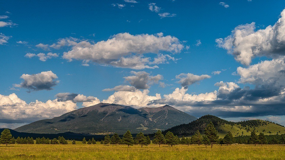
Route 66 then bends to the north and becomes Forest Road 74. After several miles, the pavement ends and the road becomes graded red gravel. The rounded peak of 9,354-foot Sitgreaves Mountain is dead ahead and surrounded by open pastureland. After approximately 7 miles on FR 74, the road intersects Spring Valley Road (Forest Road 141). Turn right, and as you contour around Sitgreaves Mountain, be on the lookout, on the right, for a camel sign 3.6 miles past the intersection. This marks a Forest Service trailhead for the historic Beale Wagon Road. If you explore that route, keep your eyes trained on the ground, where there are still wagon-wheel ruts left by the thousands of 19th century immigrants who passed this way.
On the north side of Sitgreaves Mountain, Spring Valley Road intersects Friendly Country Road. Turn right to stay on Spring Valley Road, then continue south for 10 miles to Parks. You’ve completed the loop when you arrive back at the old store. But what’s your rush? Grab a sandwich at the deli and pull up to a picnic table out front to chat with the locals before returning to the interstate. Life in the fast lane can wait.
Note: Mileages are approximate.
Length: 29.7-mile loop
Directions: From Parks, go west on Historic Route 66, which turns to the north and becomes Forest Road 74, for 13.4 miles to Spring Valley Road (Forest Road 141). Turn right onto Spring Valley Road and continue 16.3 miles back to Parks.
Vehicle Requirements: None in good weather.
Warning: Back-road travel can be hazardous, so be aware of weather and road conditions. Carry plenty of water. Don’t travel alone, and let someone know where you are going and when you plan to return.
Information: Williams Ranger District, 928-635-5600 or www.fs.usda.gov/kaibab