Apache-Sitgreaves National Forests, Mogollon Rim
Sometime in the 1800s, the story goes, a trapper and scout by the name of Chevelon found himself at a creek that ran through a narrow canyon on present-day Arizona’s Mogollon Rim. He also found some roots that looked tasty. And maybe they were, but they also were poisonous. So he died. Right there on the bank of the creek.
That’s according to Lorenzo Sitgreaves, who learned of Chevelon’s plight during his 1851 expedition. It’d probably be little consolation to the ill-fated trapper, but today, both the creek and the canyon are named for Chevelon, as is Chevelon Canyon Lake — a secluded reservoir and ideal summer destination via a leisurely 22-mile drive, and a bit of a hike, through Rim Country.
From State Route 260 east of Payson, go north, then west, on Forest Road 300 (also known as the Rim Road). Three vistas along the road provide spectacular views off the Mogollon Rim, and on a clear day, you can see the Hellsgate Wilderness, the Sierra Ancha and even the Four Peaks to the distant south. After a few miles, you’ll reach the turnoff for Woods Canyon Lake, and on a summer weekend, most of the traffic will likely be headed that way. Instead, continue on FR 300 as it curves to the north.
Here, the road turns to dirt as it winds through thick forests of ponderosa pines. You’ll see aspens, too, including a big stand of them around Mile 5.5. Keep an eye out for elk and black bears, along with Abert’s squirrels, which you might see darting across the road.
At Mile 8.3, turn right onto Forest Road 169, which passes several campsites spaced between designated wildlife areas, where camping is prohibited. Massive ponderosas line the road, which soon begins to twist and turn as it gains elevation. After 12 miles on FR 169, you’ll turn right onto Forest Road 169B, and here, you’ll realize why a high-clearance vehicle is required for this drive. The rolling, deeply rutted road will put your suspension to the test if you’re going too fast, so take it easy — the trek on this road is less than 2 miles to Chevelon Canyon Lake Campground.
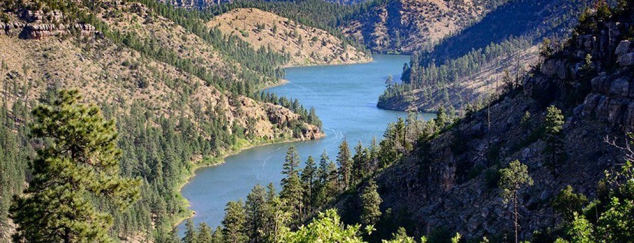
Park at one of the dispersed campsites, then walk down the old road (closed to vehicles) that leads to the lake. It’s a steady descent of less than a mile, but watch out for loose rocks along the way. After about 20 minutes, you’ll reach the north end of the lake, which the Arizona Game and Fish Department created by damming Chevelon Creek in 1965. Ponderosa pines cling to the steep walls of Chevelon Canyon, which cradles this roughly 200-acre reservoir.
Because of the hike required to reach it, Chevelon Canyon Lake draws only the most determined anglers, but those who do visit find rainbow trout (which are stocked twice a year) and brown trout (which are wild). If you’re not in the mood for fishing, just dip your toes in the lake’s cool water and enjoy the views. The hike back up to the campground is no joke, so this is also a good time to enjoy some beef jerky or a Clif Bar. But don’t eat any roots, no matter how tasty they look.
Note: Mileages are approximate.
Length: 22 miles one way (from State Route 260)
Directions: From Payson, go east on State Route 260 for 29 miles to Forest Road 300. Turn left onto FR 300 and continue 8.3 miles to Forest Road 169. Turn right onto FR 169 and continue 12 miles to Forest Road 169B. Turn right onto FR 169B and continue 1.7 miles to Chevelon Canyon Lake Campground. From there, it’s a moderate hike of about 0.8 miles to Chevelon Canyon Lake.
Vehicle requirements: A high-clearance vehicle is required.
Warning: Back-road travel can be hazardous, so be aware of weather and road conditions. Carry plenty of water. Don’t travel alone, and let someone know where you are going and when you plan to return.
Information: Black Mesa Ranger District, 928-535-7300 or www.fs.usda.gov/asnf

